• Login
  • Sign Up
Member Area
  • Login
  • Sign Up
 English
    • Afrikaans formal
    • Afrikaans informal
    • Arabic
    • Azerbaijan
    • Brazilian
    • Bulgarian
    • Catalan
    • Chinese simplified
    • Chinese traditional
    • Croatian
    • Czech
    • Danish
    • Dutch
    • English
    • Estonian
    • Finnish
    • French
    • Georgian
    • German
    • Greek
    • Hebrew
    • Hungarian
    • Icelandic
    • Indonesian
    • Italian
    • Japanese
    • Latvian
    • Lithuanian
    • Malaysian
    • Norwegian
    • Persian
    • Polish
    • Portuguese
    • Romanian
    • Russian
    • Serbian
    • Slovakian
    • Slovenian
    • Spanish
    • Swedish
    • Thai
    • Turkish
    • Ukrainian
    • Vietnamese
VideotonStock
Your Shopping Cart is empty.
  • Files

    Stock

    • Photo
    • Video

    Special offer

    • Collections
    • Packages
    • Lightboxes

    Licenses

    • Royalty free
    • Rights managed
    • Creative
    • Editorial

    Items

    • Most downloaded
    • Featured
    • Most popular
    • New
    • Free
  • Categories

    Browse categories

  • Site info

    Site info

    • About
    • Support
    • Privacy Policy
    • Privacy Policy
    • FAQ
    • Contact Us
    • Contact Us
    • Terms and Conditions
    • Buyer Agreement
    • Seller Agreement

    Customers

    • Users
    • Credits

    Photographers

    • Boby Richards   0
    • Boby Richards   0
    • Videoton1   286

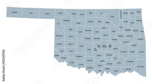
Oklahoma, U.S. state, gray political map with borders and county names. State in the South Central region of USA, subdivided into 77 counties. Native America, Land of the Red Man, and Sooner State.

    {PATH}


Download sample
File Details
Published: 2024-08-15 11:02:05.480514 Category: Travel Type: Vector Model release: Yes
Share
Contributor: Peter Hermes Furian
ID : 923307150

TitleFilesize
Vector5221x2873


Buy on VideotonStock

Keywords
oklahoma, state, county, us, silhouette, subdivision, map, division, us, region, ok, cleveland, canadian, america, america, administrative, structure, federal, landlocked, country, state, land, name, mapping, atlas, overview, cartography, geography, border, boundary, infographic, travel, destination, grey, isolated, illustration


Related items

  • Home
  • About
  • Support
  • Privacy Policy
  • News

Copyright © 2022 Videoton Media Stock