Login
Sign Up
Member Area
Login
Sign Up
English
Afrikaans formal
Afrikaans informal
Arabic
Azerbaijan
Brazilian
Bulgarian
Catalan
Chinese simplified
Chinese traditional
Croatian
Czech
Danish
Dutch
English
Estonian
Finnish
French
Georgian
German
Greek
Hebrew
Hungarian
Icelandic
Indonesian
Italian
Japanese
Latvian
Lithuanian
Malaysian
Norwegian
Persian
Polish
Portuguese
Romanian
Russian
Serbian
Slovakian
Slovenian
Spanish
Swedish
Thai
Turkish
Ukrainian
Vietnamese
Toggle navigation
VideotonStock
Your Shopping Cart is empty.
Files
Stock
Photo
Video
Special offer
Collections
Packages
Lightboxes
Licenses
Royalty free
Rights managed
Creative
Editorial
Items
Most downloaded
Featured
Most popular
New
Free
Categories
Browse categories
Site info
Site info
About
Support
Privacy Policy
Privacy Policy
FAQ
Contact Us
Contact Us
Terms and Conditions
Buyer Agreement
Seller Agreement
Customers
Users
Credits
Photographers
Boby Richards
0
Boby Richards
0
Videoton1
286
Search
Keywords:
Creator ID:
Type:
Photo
Illustration
Vector
Video
Template
3d
Categories:
Animals
Buildings and Architecture
Business
Drinks
The Environment
States of Mind
Food
Graphic Resources
Hobbies and Leisure
Industry
Landscapes
Lifestyle
People
Plants and Flowers
Culture and Religion
Science
Social Issues
Sports
Technology
Transport
Travel
News
Entertainment
Sport News
Languages:
Brazilan Portuguese - Brazil
English - Canada
French - Canada
Spanish - Mexico
English - United States
English - Belgium
French - Belgium
Dutch - Belgium
Czech - Czech Republic
English - Cyprus
Danish - Danmark
German - Germany
English - Estonia
Spanish - Spain
French - France
French - Marocco
English - Greece
English - Ireland
Italian - Italia
English - Latvia
English - Lithuania
German - Luxembourg
English - Luxembourg
French - Luxembourg
English - Hungary
English - Malta
Dutch - Nederlands
Bokmal Norwegian - Norway
German - Austria
Polish - Poland
Portuguese - Portugal
English - Romania
German - Switzerland
English - Slovenia
Slovakian - Slovakia
French - Switzerland
English - Finland
Swedish- Sweden
Italian - Switzerland
English - United Kingdom
English - Bulgaria
English - Australia
Japanese - Japan
Korean - South Korea
English - New Zealand
Russian - Russia
English - Ukrain
English - Thailand
Orientation:
All
Horizontal
Vertical
square
Color:
Model property release:
All
Yes
No
Duration Video:
All
Up to 10 seconds
Up to 20 seconds
Longer than 30 seconds
Results
(0)
Site
Getty/iStock
Bigstockphoto
Pixabay
Adobe Stock
Relevance
New
Most popular
Most downloaded
Undiscovered
12
24
36
48
96
Auto paging
Menu
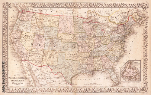
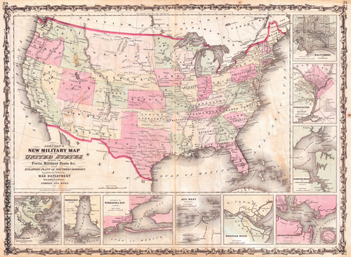
Old Map of the United States, 1867, Mitchell
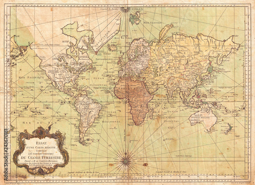
1778, Bellin Nautical Chart or Map of the World
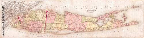
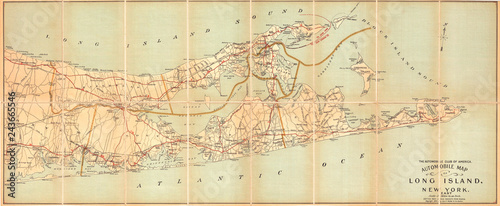
1873, Beers Wall Map of Long Island, New York
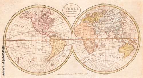
Old Map of the World, Payne 1798
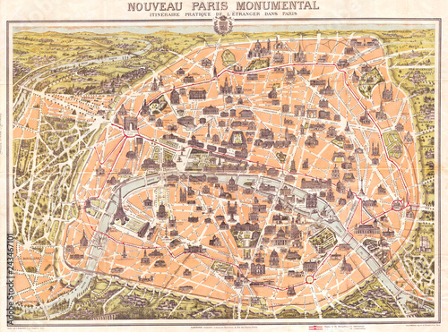
1900, Garnier Pocket Map or Plan of Paris, France, Eiffel Tower
1874, Gray Map of North Carolina
1893, U.S. Coast Survey Nautical Chart or Map of the Chesapeake Bay and Delaware Bay
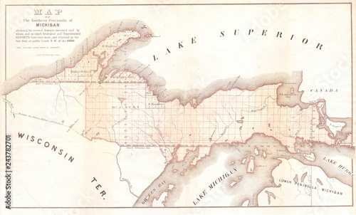
1849, Land Survey Map of Michigan Upper Peninsula
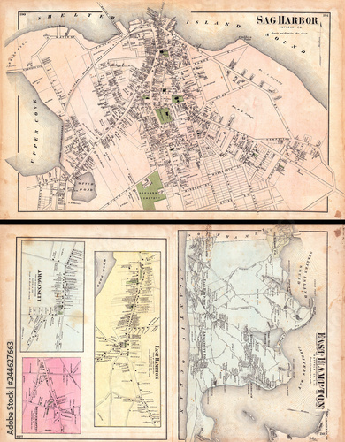
1873, Beers Map of East Hampton and Sag Harbor, Long Island, New York
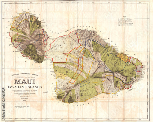
1885, De Witt Alexander Wall Map of Maui, Hawaii
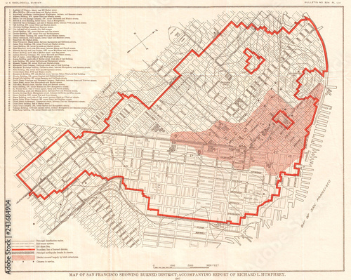
1907, Geological Survey Map of San Francisco after 1906 Earthquake
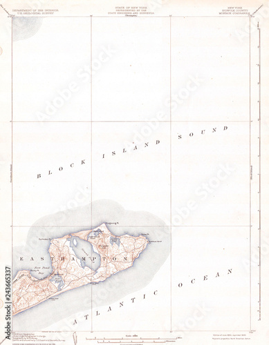
1904, U.S.G.S. Map of Long Island, New York, Montauk, Easthampton
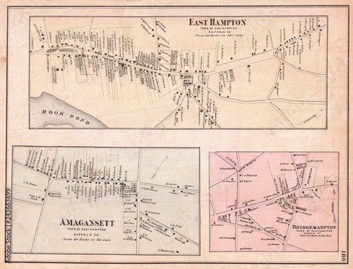
1873, Beers Map of East Hampton, Bridgehampton, and Amagansett, Long Island, New York
1827, Finley Map of North Carolina, Anthony Finley mapmaker of the United States in the 19th century
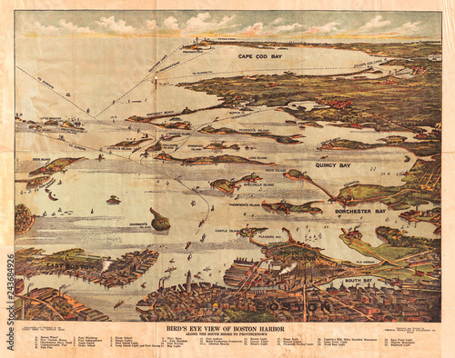
1899, View Map of Boston Harbor from Boston to Cape Cod and Provincetown
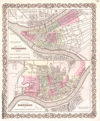
1855, Colton Plan or Map of Pittsburgh, Pennsylvania and Cincinnati, Ohio
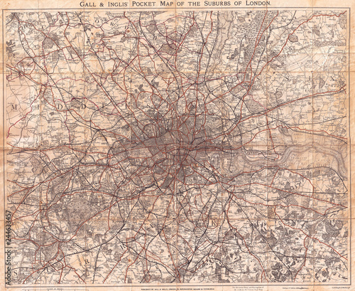
1900, Gall and Inglis, Map of London and Environs
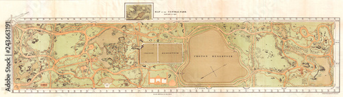
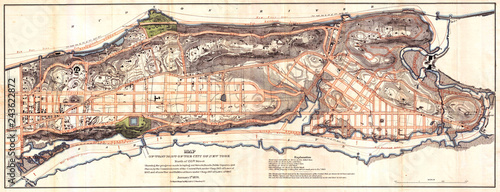
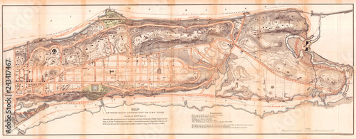
1870, Vaux and Olmstead Map of Central Park, New York City
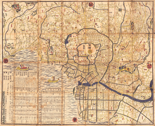
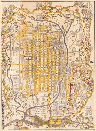
1849, Japanese Map of Edo or Tokyo, Japan
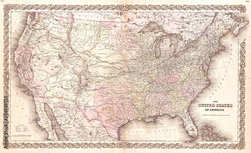
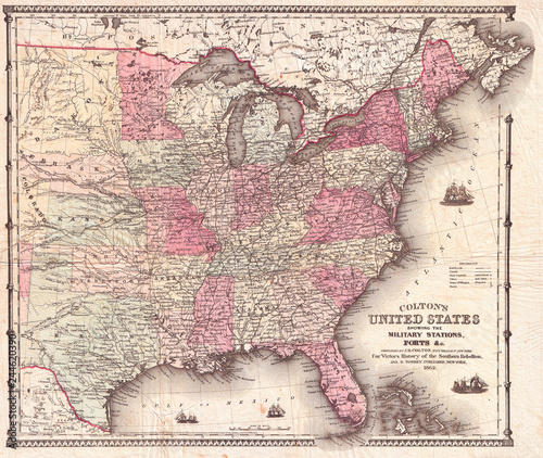
1855, Colton Map of the United States
1905, Automobile Club Map of Suffolk County, Long Island
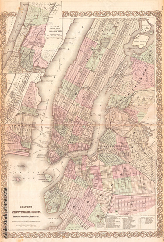
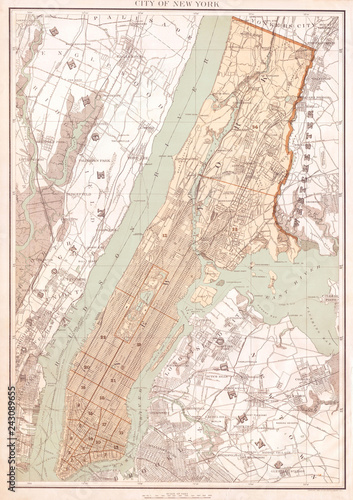
1865, Colton Map of New York City, Manhattan, Brooklyn, Long Island City
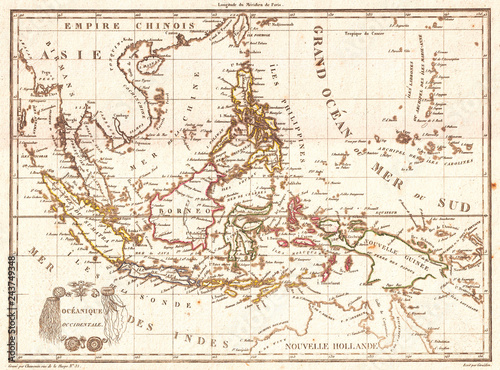
Old Map of the East Indies, Singapore, Southeast Asia, Sumatra, Borneo, Java, 1810, Tardieu
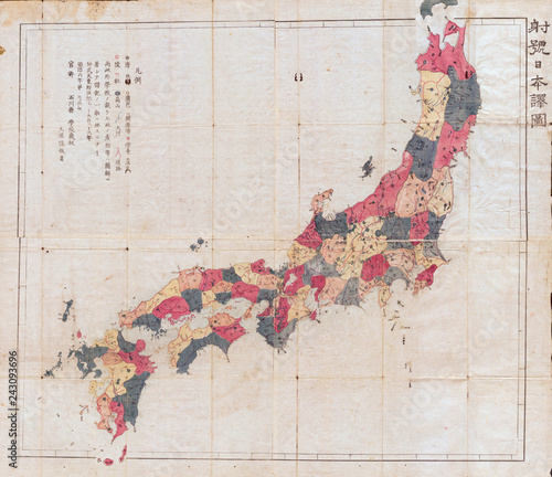
Old Map of Japan 1871, Meiji 4 Woodblock
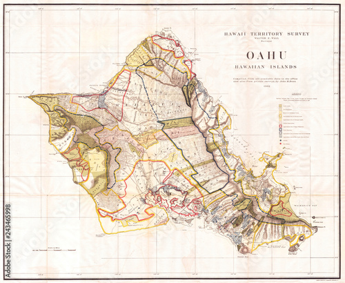
Old Map of the Island of Oahu, Hawaii, Honolulu 1902, Land Office Map
Old Map of the Island of Hawaii 1901, Land Office
1777, Brion de La Tour Map of New York and New England, Revolutionary War
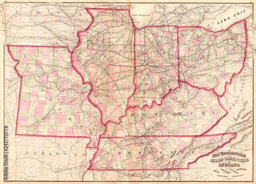
1873, Asher Adams Map of the Midwest, Ohio, Indiana, Illinois, Missouri, Kentucky
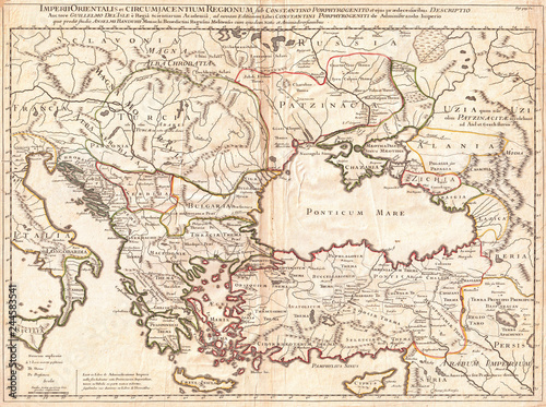
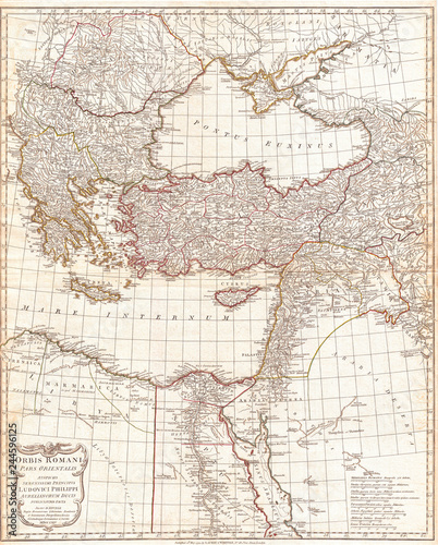
1715, De L'Isle Map of the Eastern Roman Empire under Constantine, Asia Minor, Black Sea, Balkans
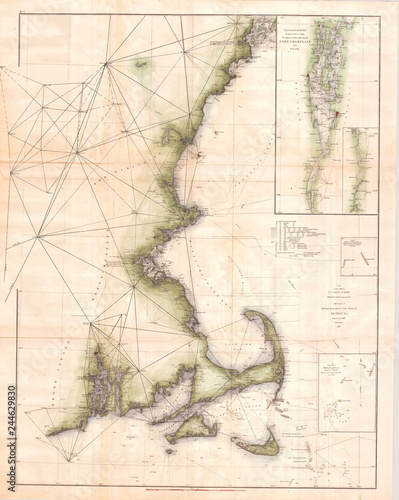
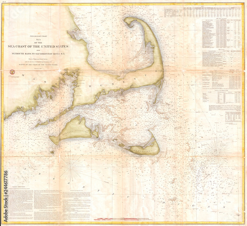
1873, U.S. Coast Survey Chart of Map of Cape Cod, Nantucket, Marthas Vineyard, and Cape Ann
1720, Homann Map of Transylvania, Romania
1747, La Feuille Map of Andalusia, Spain, Sevilla
Old Map of New York City, Queens and the Bronx, Bien 1895
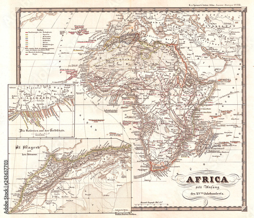
Old Map of Africa since the beginning of the 15th century 1855, Spruner
1855, U.S. Coast Survey Map of the Delta of the Mississippi River
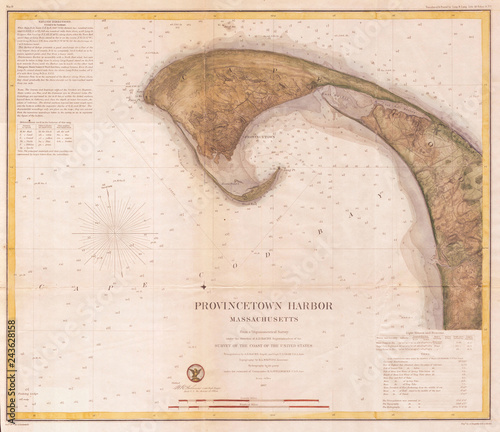
1857, U.S.C.S. Map of Provincetown Harbor, Cape Cod, Massachusetts
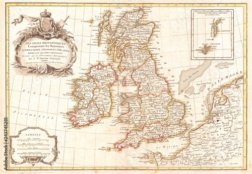
1771, Zannoni Map of the British Isles, England, Scotland, Ireland
1862, Johnson Military Map of the United States, Civil War
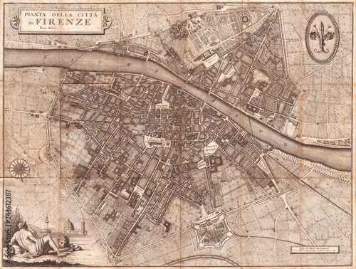
1847, Molini Pocket Map of Florence, Frienze, Italy
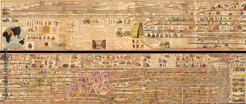
1878, Adams Monumental Illustrated Panorama of History
1873, U.S. Coast Survey Chart or Map of Long Island, New York
1830, Pigot Pocket Map of England and Wales
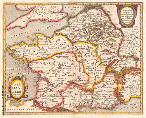
1657, Jansson Map of France or Gaul in Antiquity
1780, Raynal and Bonne Map of France, Rigobert Bonne 1727 – 1794, one of the most important cartographers of the late 18th century
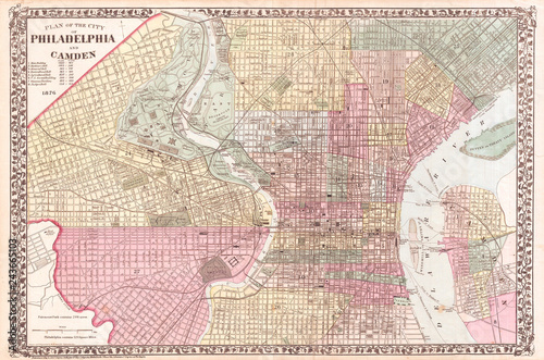
1876, Mitchell Map of Philadelphia, Pennsylvania
1906, Wood Harmon Map of New York City, Staten Island, Bronx, Brooklyn, Queens
1870, Johnson Map of Quebec, Canada
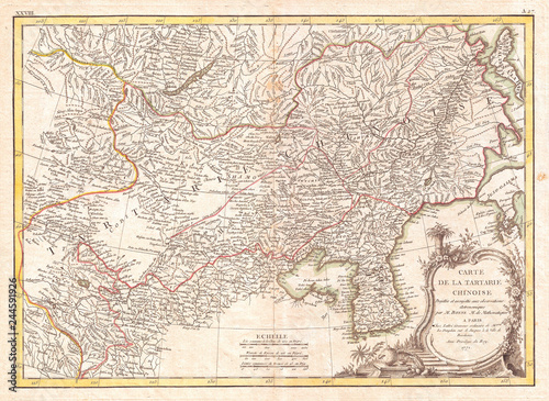
1770, Bonne Map of Chinese Tartary, Mongolia, Manchuria and Korea, Corea, Rigobert Bonne 1727 – 1794, one of the most important cartographers of the late 18th century
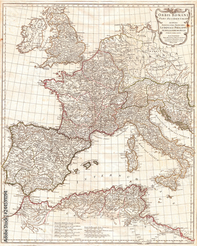
1763, Anville Map of the Western Roman Empire, including Italy
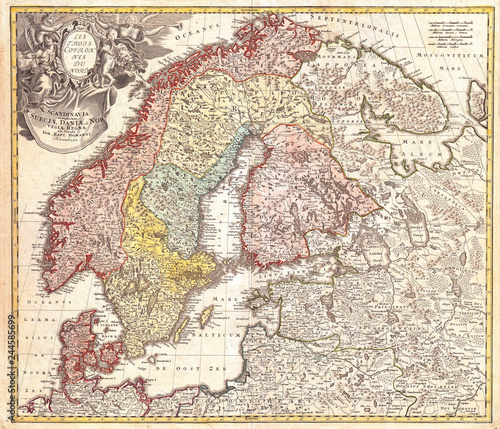
1730, Homann Map of Scandinavia, Norway, Sweden, Denmark, Finland and the Baltics
1862, Johnson Map of Iowa and Nebraska
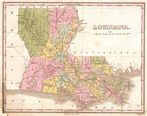
1827, Finley Map of Louisiana, Anthony Finley mapmaker of the United States in the 19th century
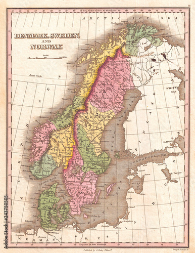
1827, Finley Map of Scandinavia, Norway, Sweden, Denmark, Anthony Finley mapmaker of the United States in the 19th century
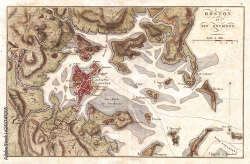
1807, Buache Map of Boston, Massachusetts
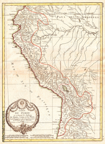
1775, Bonne Map of Peru, Ecuador, Bolivia, and the Western Amazon, Rigobert Bonne 1727 – 1794, one of the most important cartographers of the late 18th century
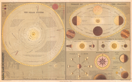
1873, A. and C. Black Map or Chart of the Solar System
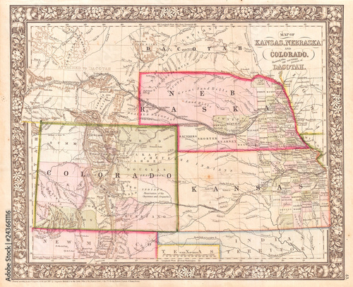
1866, Mitchell Map of Colorado, Nebraska, and Kansas
Old Polar Projection of the Globe, Antarctica, Pacific Center 1860, James
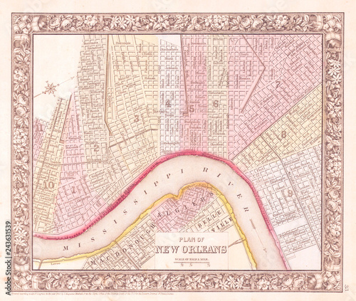
1864, Mitchell Map of New Orleans, Louisiana
1870, Knapp Map of Northern Manhattan, New York City, Harlem, Washington Heights, Inwood
1873, U.S. Coast Survey Map of the Aleutian Islands, Alaska
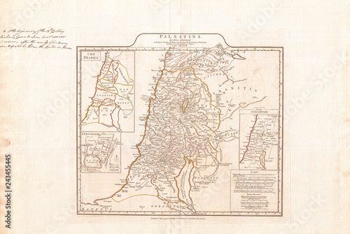
Map of Israel, Palestine or the Holy Land in Ancient Times, 1794 Anville
1853, Mitchell Map of Mississippi
1852, Levasseur Map of France
1794, Anville Map of the Eastern Roman Empire, inclues Greece
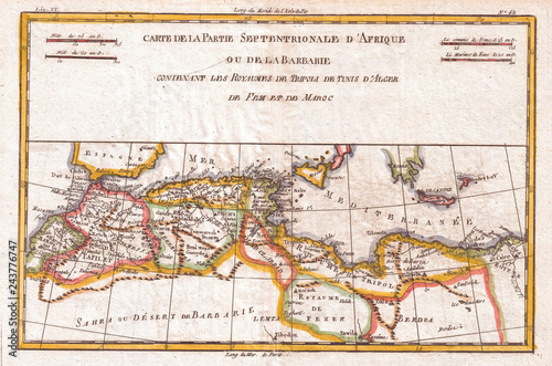
1780, Raynal and Bonne Map of the Barbary Coast of Northern Africa, Rigobert Bonne 1727 – 1794, one of the most important cartographers of the late 18th century
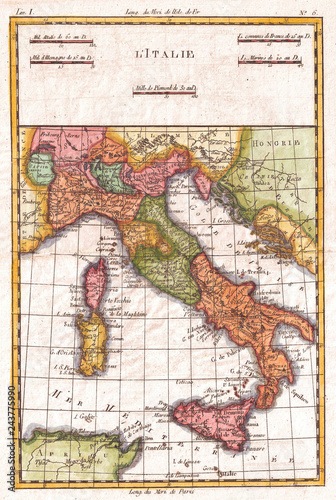
1780, Raynal and Bonne Map of Italy, Rigobert Bonne 1727 – 1794, one of the most important cartographers of the late 18th century
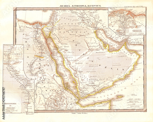
1855, Spruneri Map of Arabia, Egypt and Ethiopia or Abyssinia
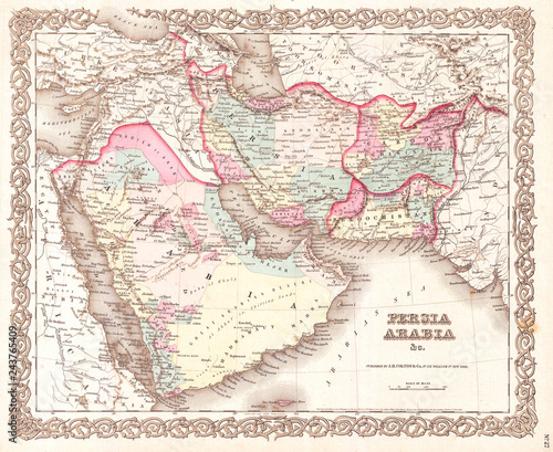
1855, Colton Map of Persia, Afghanistan, and Arabia
1857, Colton Map of New Hampshire
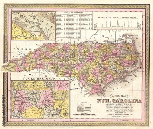
1850, Mitchell Map of North Carolina showing Gold Regions
1784, Map of the Battle of Plataea, Greece
Old Map of California, Wall Map size 1854, Land Survey
1880, Japanese Meiji Woodblock Map of Tokyo, EDO
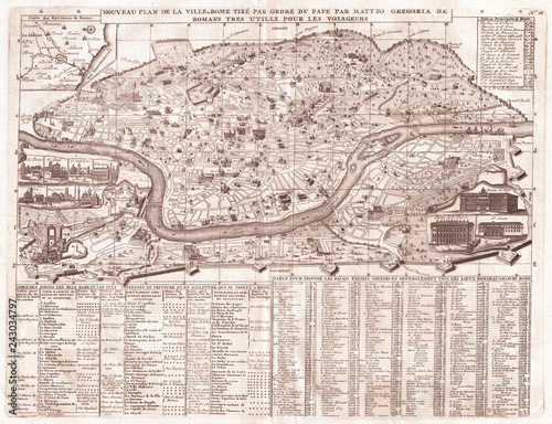
Old Map of Rome, Italy, 1721, Chatelain Plan
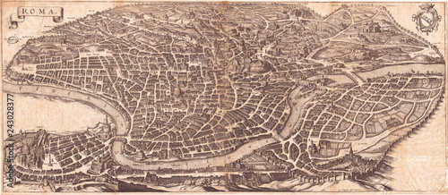
1652, Merian Panoramic View or Map of Rome, Italy
1875, Meiji 8 Japanese Wall Map of Japan
1855, Colton Map of Michigan
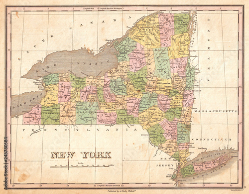
1827, Finley Map of New York State, Anthony Finley mapmaker of the United States in the 19th century
1897, Walker View of Boston Harbor
1757, Bellin Map of South Africa and the Cape of Good Hope
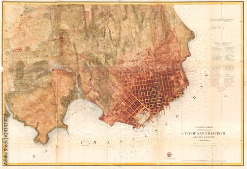
Old Map of San Francisco, Califorina, 1858, U.S. Coast Survey Chart
1858, U.S.C.S. Map or Chart of Martha's Vineyard or Muskeget Channel
1854, U.S. Coast Survey Chart or Map of the Savannah River ans Savannah, Georgia
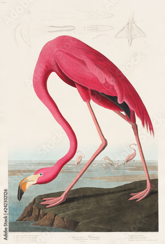
Pink Flamingo from Birds of America (1827) by John James Audubon (1785 - 1851 ), etched by Robert Havell (1793 - 1878)
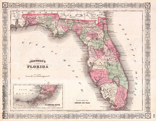
Antique Map of Florida, 1866, Johnson
1857, U.S. Coast Survey Map of Cape Cod, Nantucket, and Martha's Vineyard
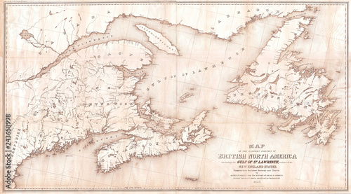
1853, Andrews Map of the Maritime Provinces, New Brunswick, Nova Scotia, Newfoundland
1696, Genroku 9, early Edo Japanese Map of Kyoto, Japan
Old Map of Northern Manhattan, New York City, Harlem, Washington Heights, Inwood, 1868, Knapp
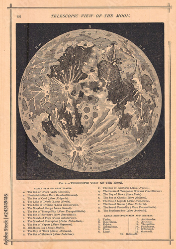
Old Map of the Moon 1886, Telescopic View
1862, Colton Pocket Map of the United States, Civil War
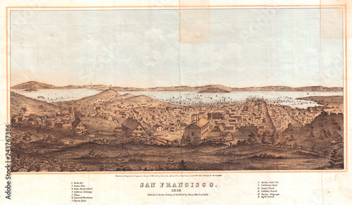
1856, Henry Bill Map and View of San Francisco, California
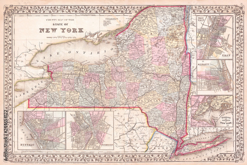
1867, Mitchell Map of New York State
1861, U.S. Coast Survey Map of New York City Bay and Harbor
1818, Pinkerton Map of Australia and New Zealand, John Pinkerton, 1758 – 1826, Scottish antiquarian, cartographer, UK
1883, German Map View of Lower Manhattan, the Brooklyn Bridge, and Brooklyn
1860, U.S. Coast Survey Map of Block Island, Buzzard Bay, Nantucket and Marthas Vineyard
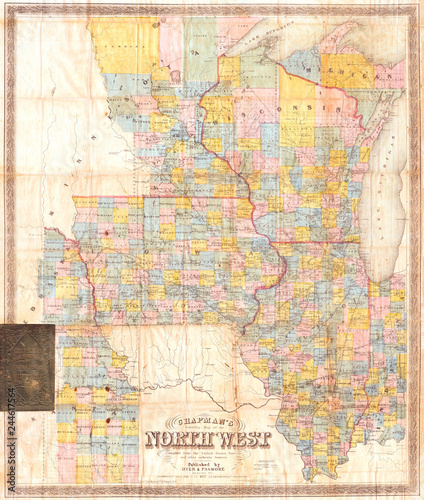
1857, Chapman Pocket Map of the North West, Illinois, Wisconsin, Iowa
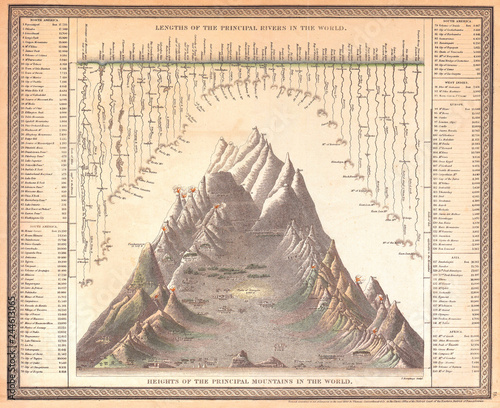
1850, Mitchell Comparitive Chart of the World's Mountains and Rivers