Login
Sign Up
Member Area
Login
Sign Up
English
Afrikaans formal
Afrikaans informal
Arabic
Azerbaijan
Brazilian
Bulgarian
Catalan
Chinese simplified
Chinese traditional
Croatian
Czech
Danish
Dutch
English
Estonian
Finnish
French
Georgian
German
Greek
Hebrew
Hungarian
Icelandic
Indonesian
Italian
Japanese
Latvian
Lithuanian
Malaysian
Norwegian
Persian
Polish
Portuguese
Romanian
Russian
Serbian
Slovakian
Slovenian
Spanish
Swedish
Thai
Turkish
Ukrainian
Vietnamese
Toggle navigation
VideotonStock
Your Shopping Cart is empty.
Files
Stock
Photo
Video
Special offer
Collections
Packages
Lightboxes
Licenses
Royalty free
Rights managed
Creative
Editorial
Items
Most downloaded
Featured
Most popular
New
Free
Categories
Browse categories
Site info
Site info
About
Support
Privacy Policy
Privacy Policy
FAQ
Contact Us
Contact Us
Terms and Conditions
Buyer Agreement
Seller Agreement
Customers
Users
Credits
Photographers
Boby Richards
0
Boby Richards
0
Videoton1
286
Search
Keywords:
Creator ID:
Type:
Photo
Illustration
Vector
Video
Template
3d
Categories:
Animals
Buildings and Architecture
Business
Drinks
The Environment
States of Mind
Food
Graphic Resources
Hobbies and Leisure
Industry
Landscapes
Lifestyle
People
Plants and Flowers
Culture and Religion
Science
Social Issues
Sports
Technology
Transport
Travel
News
Entertainment
Sport News
Languages:
Brazilan Portuguese - Brazil
English - Canada
French - Canada
Spanish - Mexico
English - United States
English - Belgium
French - Belgium
Dutch - Belgium
Czech - Czech Republic
English - Cyprus
Danish - Danmark
German - Germany
English - Estonia
Spanish - Spain
French - France
French - Marocco
English - Greece
English - Ireland
Italian - Italia
English - Latvia
English - Lithuania
German - Luxembourg
English - Luxembourg
French - Luxembourg
English - Hungary
English - Malta
Dutch - Nederlands
Bokmal Norwegian - Norway
German - Austria
Polish - Poland
Portuguese - Portugal
English - Romania
German - Switzerland
English - Slovenia
Slovakian - Slovakia
French - Switzerland
English - Finland
Swedish- Sweden
Italian - Switzerland
English - United Kingdom
English - Bulgaria
English - Australia
Japanese - Japan
Korean - South Korea
English - New Zealand
Russian - Russia
English - Ukrain
English - Thailand
Orientation:
All
Horizontal
Vertical
square
Color:
Model property release:
All
Yes
No
Duration Video:
All
Up to 10 seconds
Up to 20 seconds
Longer than 30 seconds
Results
(0)
Site
Getty/iStock
Bigstockphoto
Pixabay
Adobe Stock
Relevance
New
Most popular
Most downloaded
Undiscovered
12
24
36
48
96
Auto paging
Menu
Futuristic digital health interface with glowing medical icons, DNA, molecules, and technology symbols on a blue background. Concept of innovation in modern medicine.
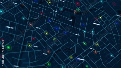
Vertical video 3D smart city map with glowing data points and geolocation markers for GPS tracking navigation urban tech and futuristic city concept
Animation Anime motion speed lines video overlay template manga style comic speed line background, Explosion flash and fast action, concentrated lines
Breaking News Template intro for TV broadcast news show program with 3D breaking news text and badge, against global spinning earth cyber and futuristic style
Technology security with padlock concept. Symbol of protection, trust, and peace of mind. Ideal for visualizing cybersecurity and safety. Digital network protect from virus and malware
3D Rendering Ai Artificial Intelligence text. CPU Central Computer Processors Cyber technology concept. Motherboard and digital chipset. Science technology Integrated communication processor
3D rendering, Transparent Clear Atom, Animation Hydrogen Molecule, New Green Energy Water Fuel Cell Future Hydrogen, scientific molecular model of a methane molecule
Abstract background Christmas with lighting, glittering, snowflake and particle dark and grain processed, falling snow with blur and depth of field effect
Video overlay template futuristic cyber and technology concept
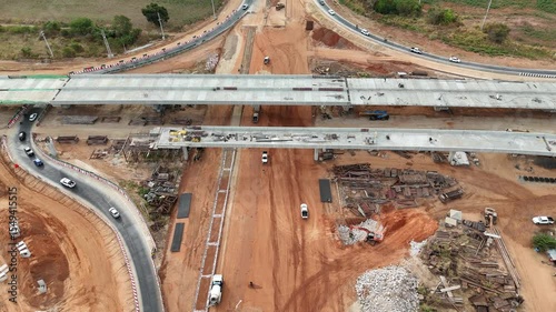
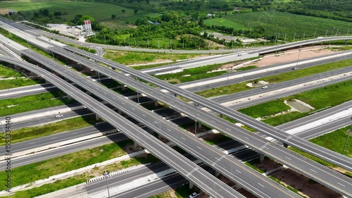
Construction site before the construction of the concrete bridge over the intersection by crane workers, tractors, and backhoes
3D Rendering Top view City map with navigator line and destination GPS Technology transportation, Futuristic user interface, HUD Head-up display. Technology and futuristic concept
Universal Technology Line and frame Video overlay Futuristic HUD Head up display interface template with basic geometry line element. Video template widescreen aspect ratio
3D rendering digital padlock with loading line element. Cyber technology futuristic security concept. Data and network protect concept
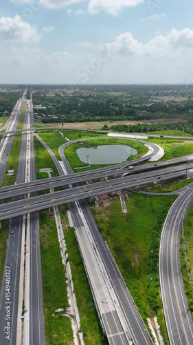
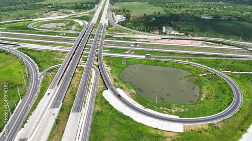
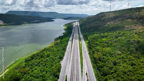
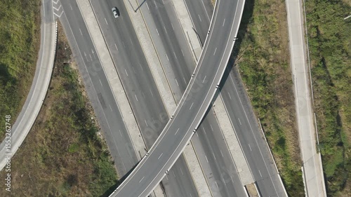
Vertical video aerial view bridge intersection between the highway numbers 290 and 304 Nakhon Ratchasima
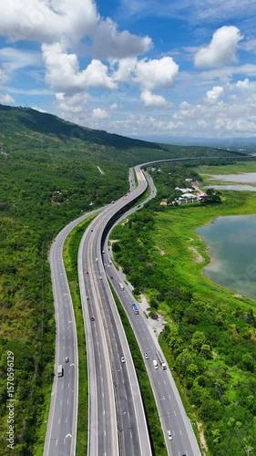
Vertical video Drone shot The M6 motorway Expressway Nakhon Ratchasima Province - Bang Pa-in Lam Ta Khong River and Mountain Drone shot of scenic landscape rural place traffic. Motorway Korat Thailand
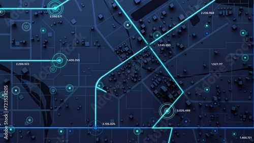
Vertical video 3D rendering a map of the community town with roads and alleys with circles indicate the destinations with random numbers for cyber technology and futuristic concept
Siberian Husky dog playing and exploring outdoors. Energetic pet enjoying natural surroundings
Drone shot The M6 motorway Expressway Nakhon Ratchasima Province - Bang Pa-in Lam Ta Khong River and Mountain Drone shot of scenic landscape rural place traffic. Motorway Korat Thailand
Drone shot The M6 motorway Expressway Nakhon Ratchasima Province - Bang Pa-in Lam Ta Khong River and Mountain Drone shot of scenic landscape rural place traffic. Motorway Korat Thailand
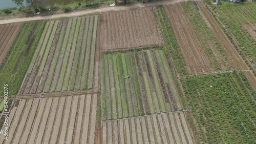
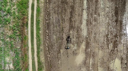
Farmers are using a small walking tractor to plow the soil
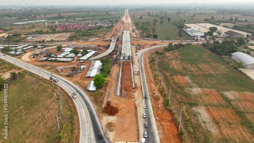
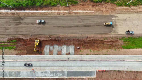
Drone shot of highway and overpass construction site with vehicles and road for infrastructure civil industry engineering and transportation concept
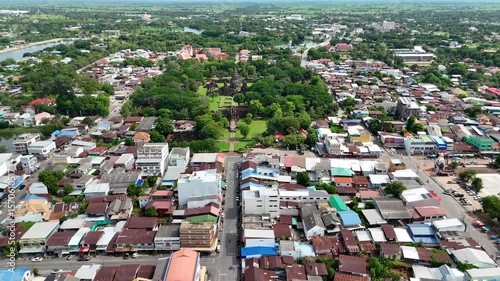
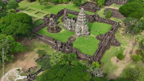
Drone footage aerial view of Phimai Historical Park, an ancient Khmer temple complex in Nakhon Ratchasima, Thailand. Famous cultural heritage and travel destination
Drone footage aerial view of Phimai Historical Park, an ancient Khmer temple complex in Nakhon Ratchasima, Thailand. Famous cultural heritage and travel destination
Drone footage aerial view of Phimai Historical Park, an ancient Khmer temple complex in Nakhon Ratchasima, Thailand. Famous cultural heritage and travel destination
Drone video a tractor is spreading cassava on a cassava drying field. Cassava flour preparation process
Drone video a tractor is spreading cassava on a cassava drying field. Cassava flour preparation process
Drone shot of highway and overpass construction site with vehicles and road for infrastructure civil industry engineering and transportation concept
Drone shot of highway and overpass construction site with vehicles and road for infrastructure civil industry engineering and transportation concept
Drone shot of highway and overpass construction site with vehicles and road for infrastructure civil industry engineering and transportation concept
Abstract background curved light streaks in vibrant gradient colors forming
Abstract background curved light streaks in vibrant gradient colors forming
Aerial view bridge intersection between the highway numbers 290 and 304 Nakhon Ratchasima
Aerial view bridge intersection between the highway numbers 290 and 304 Nakhon Ratchasima
Aerial view bridge intersection between the highway numbers 290 and 304 Nakhon Ratchasima
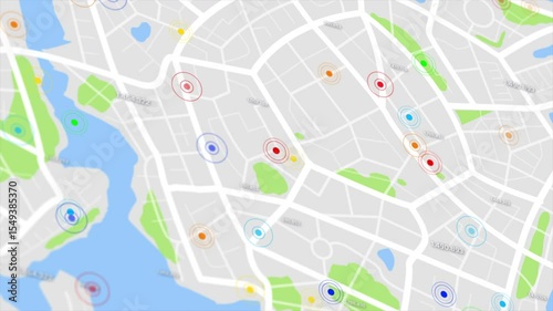
3D rendering a map of the community town with roads and alleys with circles indicate the destinations with random numbers for cyber technology and futuristic concept
Drone shot of highway and overpass construction site with vehicles and road
Aerial view of scenic landscape of agriculture farm at rural country
Video overlay template with basic geometry element ideal as a futuristic title intro or overlay
3D rendering a map of the community town with roads and alleys with circles indicate the destinations with random numbers
Vertical video plexus network background with glowing dots, connected lines, and falling digital numbers 0 and 1. Ideal for tech, blockchain, AI, and futuristic digital themes
3D Rendering Top view City map with navigator line and destination GPS Technology transportation, Futuristic user interface, HUD Head-up display. Technology and futuristic concept
Abstract background video overlay template Dynamic light flare animation with radiant glow and lens effects in a blue-purple gradient
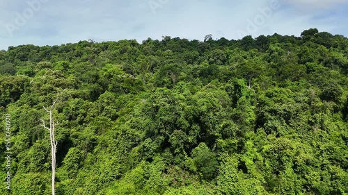
Drone footage of the Thailand forest. Aerial view of dense tropical rainforest with lush green trees under a blue sky. Natural forest landscape in Southeast Asia
Drone footage of the Thailand forest. Aerial view of dense tropical rainforest with lush green trees under a blue sky. Natural forest landscape in Southeast Asia
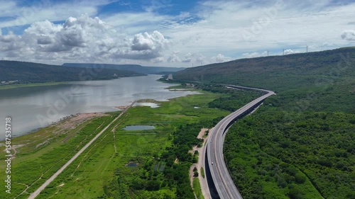
The M6 motorway Nakhon Ratchasima Province - Bang Pa-in. Lam Ta Khong River and Mountain. Drone shot of scenic landscape rural place traffic. Motorway Korat
The M6 motorway Nakhon Ratchasima Province - Bang Pa-in. Lam Ta Khong River and Mountain. Drone shot of scenic landscape rural place traffic. Motorway Korat
The M6 motorway Nakhon Ratchasima Province - Bang Pa-in. Lam Ta Khong River and Mountain. Drone shot of scenic landscape rural place traffic. Motorway Korat
The M6 motorway Nakhon Ratchasima Province - Bang Pa-in. Lam Ta Khong River and Mountain. Drone shot of scenic landscape rural place traffic. Motorway Korat
Drone footage of tractors and trucks harvest sugarcane on a farm to process it into sugar. Farming without burning
Drone footage of tractors and trucks harvest sugarcane on a farm to process it into sugar. Farming without burning
Aerial view of construction site repairing the highway
Abstract background curved light streaks in vibrant gradient colors forming a futuristic tunnel effect for motion backgrounds music visuals or tech presentations
Abstract background curved light streaks in vibrant gradient colors forming a futuristic tunnel effect for motion backgrounds music visuals or tech presentations
Aerial View of Red and White Communication Tower beside Rural Road and Farmland
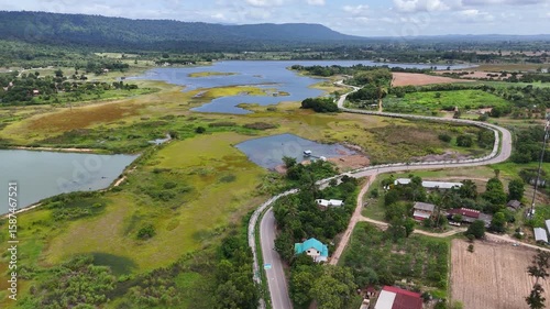
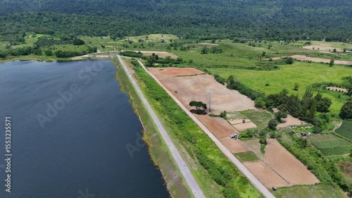
Drone footage of aerial view of Lam Phra Phloeng reservoir and surrounding farmland in Wang Nam Khiao, Nakhon ratchasima, Thailand. Scenic landscape of countryside with curved rural roads
Drone footage aerial view of Phimai Historical Park. the ancient stone temple structures from the Khmer empire. Nakhon Ratchasima, Thailand
Drone footage of tractors and trucks harvest sugarcane on a farm to process it into sugar. Farming without burning
Drone footage aerial view of Phimai Historical Park. the ancient stone temple structures from the Khmer empire. Nakhon Ratchasima, Thailand
Drone footage of tractors and trucks harvest sugarcane on a farm to process it into sugar. Farming without burning
The M6 motorway Nakhon Ratchasima Province - Bang Pa-in. Lam Ta Khong River and Mountain. Drone shot of scenic landscape rural place traffic. Motorway Korat
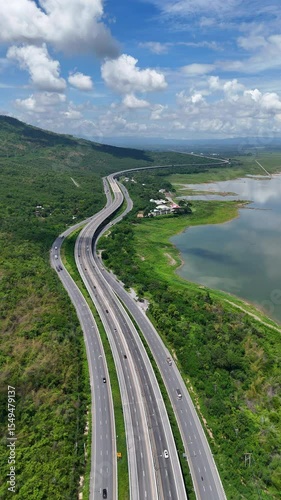
Vertical video drone footage the M6 motorway Nakhon Ratchasima Province - Bang Pa-in Lam Ta Khong River and Mountain Drone shot of scenic landscape rural place traffic. Motorway Korat Thailand
Vertical video drone footage the M6 motorway Nakhon Ratchasima Province - Bang Pa-in Lam Ta Khong River and Mountain Drone shot of scenic landscape rural place traffic. Motorway Korat Thailand
The M6 motorway Nakhon Ratchasima Province - Bang Pa-in. Lam Ta Khong River and Mountain. Drone shot of scenic landscape rural place traffic. Motorway Korat
The M6 motorway Nakhon Ratchasima Province - Bang Pa-in. Lam Ta Khong River and Mountain. Drone shot of scenic landscape rural place traffic. Motorway Korat
Vibrant rainbow abstract background with smooth gradients, waves, and fluid color transitions. Ideal for creative, modern, and artistic design projects.
The M6 motorway Nakhon Ratchasima Province - Bang Pa-in. Lam Ta Khong River and Mountain. Drone shot of scenic landscape rural place traffic. Motorway Korat
The M6 motorway Nakhon Ratchasima Province - Bang Pa-in. Lam Ta Khong River and Mountain. Drone shot of scenic landscape rural place traffic. Motorway Korat
Drone footage farmers is using a small walking tractor to plow the soil
Drone shot of highway and overpass construction site with vehicles and road for industry engineering and transportation concept
Drone footage aerial view scenic landscape of a forest fire is burning alongside a busy highway. There was a huge cloud of smoke rising. Natural disasters in the dry season
Drone footage aerial view of Phimai Historical Park. the ancient stone temple structures from the Khmer empire. Nakhon Ratchasima, Thailand
Drone footage aerial view of Phimai Historical Park. the ancient stone temple structures from the Khmer empire. Nakhon Ratchasima, Thailand
Aerial view of scenic landscape of rural countrydside traffic
Drone footage of aerial view of Lam Phra Phloeng reservoir and surrounding farmland in Wang Nam Khiao, Nakhon ratchasima, Thailand. Scenic landscape of countryside with curved rural roads
Drone footage aerial view bridge intersection between the highway numbers 290 and 304 Nakhon Ratchasima
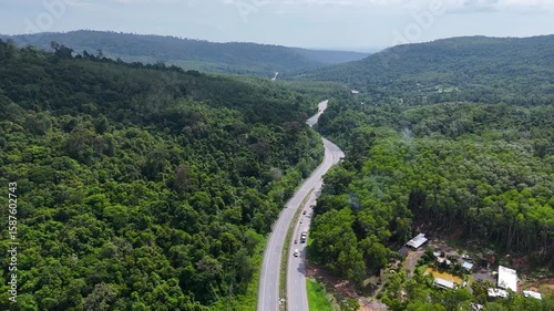
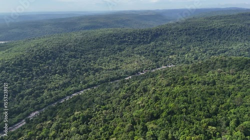
Aerial view of curvy road highway number 304 through dense forest in Thailand
Drone footage aerial view bridge intersection between the highway numbers 290 and 304 Nakhon Ratchasima
Drone footage aerial view Aerial view of the rural highway with a cross bridge
Drone footage aerial view bridge intersection between the highway numbers 290 and 304 Nakhon Ratchasima
Drone footage aerial view Aerial view of the rural highway with a cross bridge
Drone shot The M6 motorway Nakhon Ratchasima Province - Bang Pa-in Lam Ta Khong River and Mountain Drone shot of scenic landscape rural place traffic. Motorway Korat Thailand
Drone footage aerial view Aerial view of the rural highway with a cross bridge
Drone footage aerial view of Phimai Historical Park. the ancient stone temple structures from the Khmer empire. Nakhon Ratchasima, Thailand
Drone shot The M6 motorway Nakhon Ratchasima Province - Bang Pa-in Lam Ta Khong River and Mountain Drone shot of scenic landscape rural place traffic. Motorway Korat Thailand
Drone footage aerial view of Phimai Historical Park. the ancient stone temple structures from the Khmer empire. Nakhon Ratchasima, Thailand
Drone footage aerial view of Phimai Historical Park. the ancient stone temple structures from the Khmer empire. Nakhon Ratchasima, Thailand
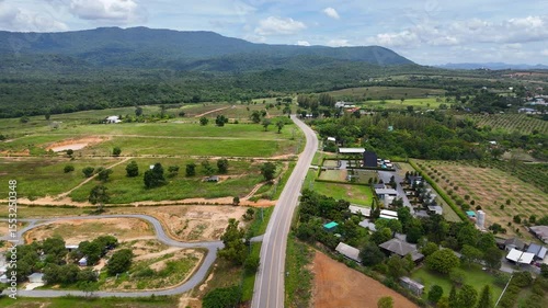
Drone footage the aerial view of a peaceful countryside road winds through green farmland and forest in Wang Nam Khiao, Thailand. A scenic aerial landscape combining rural charm with natural beauty
Drone footage of an aerial view of a red and white telecommunication tower surrounded by farmland and trees in rural. Scenic landscape of a wireless communication infrastructure in Thailand
Drone footage of the Thailand forest. Aerial view of dense tropical rainforest with lush green trees under a blue sky. Natural forest landscape in Southeast Asia
Drone footage of the Thailand forest. Aerial view of dense tropical rainforest with lush green trees under a blue sky. Natural forest landscape in Southeast Asia
Drone footage of the Thailand forest. Aerial view of dense tropical rainforest with lush green trees under a blue sky. Natural forest landscape in Southeast Asia
Drone footage of aerial view of Lam Phra Phloeng reservoir and surrounding farmland in Wang Nam Khiao, Nakhon ratchasima, Thailand. Scenic landscape of countryside with curved rural roads
Drone footage of aerial view of Lam Phra Phloeng reservoir and surrounding farmland in Wang Nam Khiao, Nakhon ratchasima, Thailand. Scenic landscape of countryside with curved rural roads
Drone footage of the aerial view of a winding road cutting through lush green forest. Scenic highway number 304 in Thailand links the Bangkok area to Nakhon Ratchasima in the northeastern region
Drone footage aerial view bridge intersection between the highway numbers 290 and 304 Nakhon Ratchasima
Slow motion drone footage aerial view bridge intersection between the highway numbers 290 and 304 Nakhon Ratchasima
3D rendering a map of the community town with roads and alleys with circles indicate the destinations with random numbers for cyber technology and futuristic concept
Vertical video the countryside highway traffic
Vertical video aerial view bridge intersection between the highway numbers 290 and 304 Nakhon Ratchasima
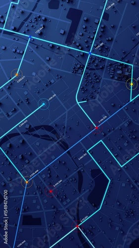
Vertical video 3D rendering a map of the community town with roads and alleys with circles indicate the destinations with random numbers for cyber technology and futuristic concept