Login
Sign Up
Member Area
Login
Sign Up
English
Afrikaans formal
Afrikaans informal
Arabic
Azerbaijan
Brazilian
Bulgarian
Catalan
Chinese simplified
Chinese traditional
Croatian
Czech
Danish
Dutch
English
Estonian
Finnish
French
Georgian
German
Greek
Hebrew
Hungarian
Icelandic
Indonesian
Italian
Japanese
Latvian
Lithuanian
Malaysian
Norwegian
Persian
Polish
Portuguese
Romanian
Russian
Serbian
Slovakian
Slovenian
Spanish
Swedish
Thai
Turkish
Ukrainian
Vietnamese
Toggle navigation
VideotonStock
Your Shopping Cart is empty.
Files
Stock
Photo
Video
Special offer
Collections
Packages
Lightboxes
Licenses
Royalty free
Rights managed
Creative
Editorial
Items
Most downloaded
Featured
Most popular
New
Free
Categories
Browse categories
Site info
Site info
About
Support
Privacy Policy
Privacy Policy
FAQ
Contact Us
Contact Us
Terms and Conditions
Buyer Agreement
Seller Agreement
Customers
Users
Credits
Photographers
Boby Richards
0
Boby Richards
0
Videoton1
286
Search
Keywords:
Creator ID:
Type:
Photo
Illustration
Vector
Video
Template
3d
Categories:
Animals
Buildings and Architecture
Business
Drinks
The Environment
States of Mind
Food
Graphic Resources
Hobbies and Leisure
Industry
Landscapes
Lifestyle
People
Plants and Flowers
Culture and Religion
Science
Social Issues
Sports
Technology
Transport
Travel
News
Entertainment
Sport News
Languages:
Brazilan Portuguese - Brazil
English - Canada
French - Canada
Spanish - Mexico
English - United States
English - Belgium
French - Belgium
Dutch - Belgium
Czech - Czech Republic
English - Cyprus
Danish - Danmark
German - Germany
English - Estonia
Spanish - Spain
French - France
French - Marocco
English - Greece
English - Ireland
Italian - Italia
English - Latvia
English - Lithuania
German - Luxembourg
English - Luxembourg
French - Luxembourg
English - Hungary
English - Malta
Dutch - Nederlands
Bokmal Norwegian - Norway
German - Austria
Polish - Poland
Portuguese - Portugal
English - Romania
German - Switzerland
English - Slovenia
Slovakian - Slovakia
French - Switzerland
English - Finland
Swedish- Sweden
Italian - Switzerland
English - United Kingdom
English - Bulgaria
English - Australia
Japanese - Japan
Korean - South Korea
English - New Zealand
Russian - Russia
English - Ukrain
English - Thailand
Orientation:
All
Horizontal
Vertical
square
Color:
Model property release:
All
Yes
No
Duration Video:
All
Up to 10 seconds
Up to 20 seconds
Longer than 30 seconds
Results
(0)
Site
Getty/iStock
Bigstockphoto
Pixabay
Adobe Stock
Relevance
New
Most popular
Most downloaded
Undiscovered
12
24
36
48
96
Auto paging
Menu
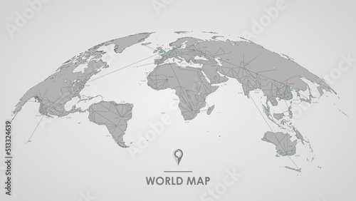
3d silhouette of a global world map, sphere with continents and islands of the world monochrome vector illustration
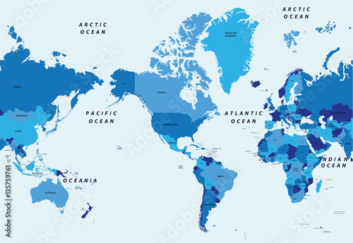
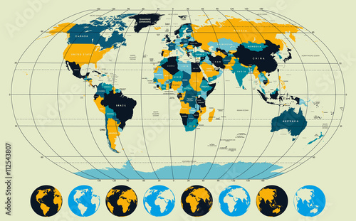
Detailed global world map, with borders and names of countries, seas and oceans, vector illustration
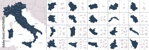
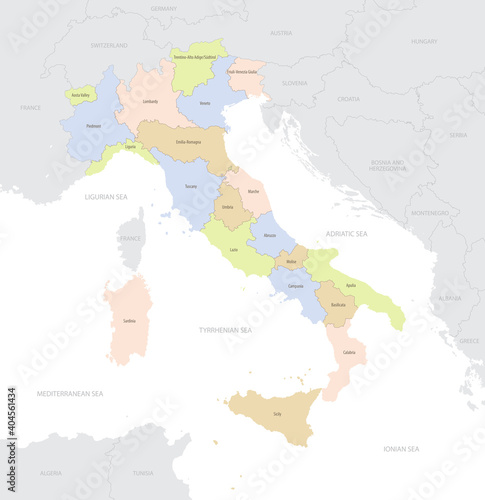
Vector color detailed map of Italy with administrative divisions of the country, each region is presented separately in-highly detailed and divided into provinces
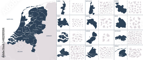
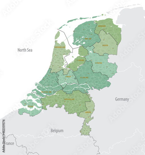
Vector color detailed map of Netherlands with the administrative divisions of the country, each Provinces is presented separately and divided into Municipalities
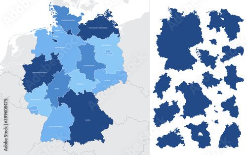
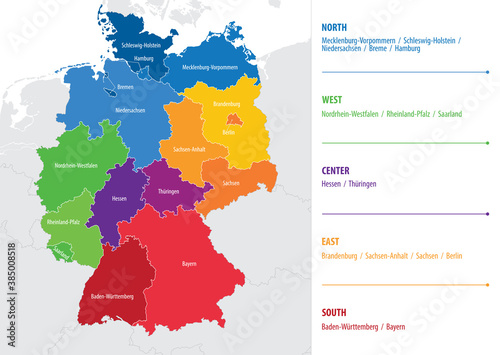
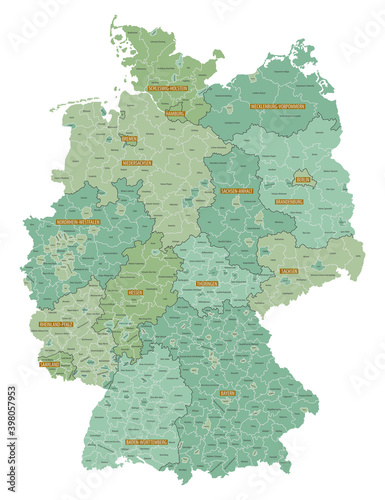
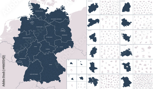
Detailed vector blue map of Germany with administrative divisions into lands and regions of the country
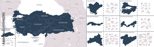
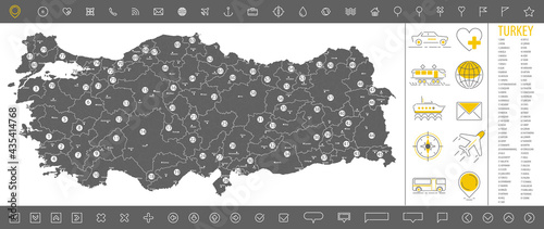
Vector color detailed map of Turkey with the administrative divisions of the country, each Districts is presented separately and divided into Provinces
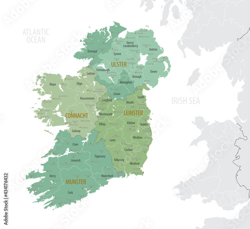
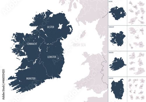
Detailed map of Ireland with administrative divisions into provinces and counties, major cities of the country, vector illustration onwhite background
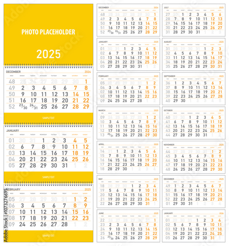
vector illustration, wall quarterly calendar 2025 with week numbers starting from Monday
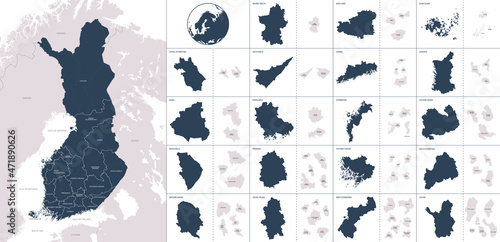
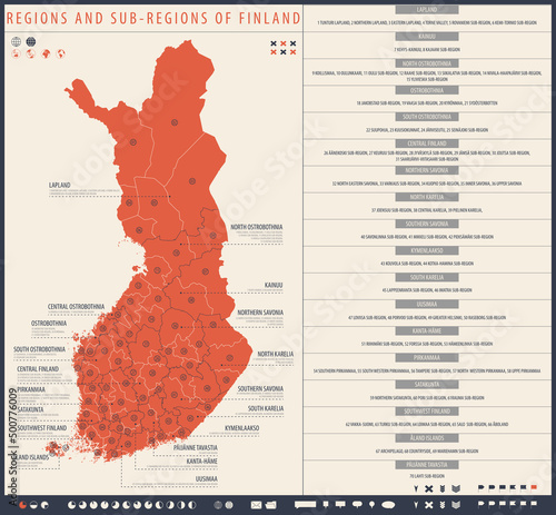
Vector color detailed map of Finland with administrative divisions of the country, each region is presented separately with high detail divided into districts and sub-regions
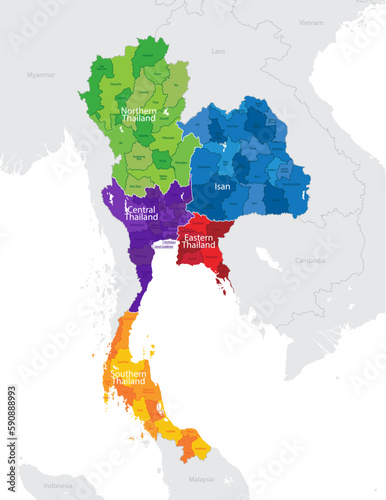
Map of the administrative division of Thailand into regions and provinces, detailed vector illustration
Detailed global world map, with borders and names of countries, seas and oceans, Continent of Europe in colors, vector illustration
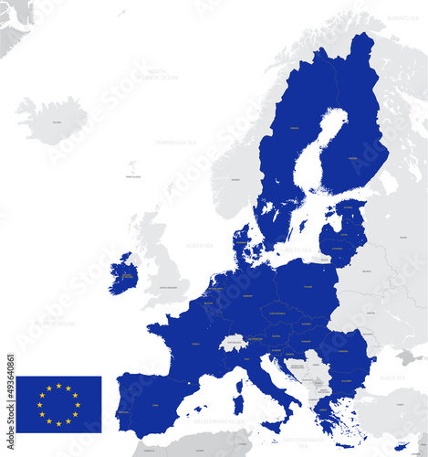
Detailed map of the European Union with flag, member states highlighted in blue
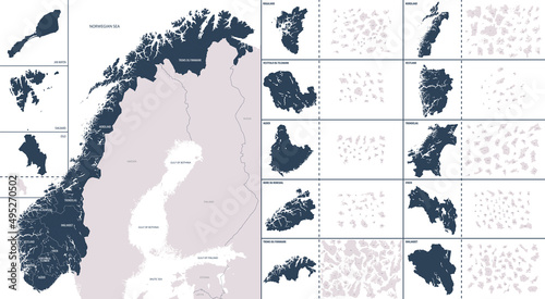
Vector color detailed map of Norway with the administrative divisions of the country, each Counties and Dependent territory is presented separately and divided into municipalities
Detailed map of Netherlands with administrative divisions into Provinces and Municipalities, major cities of country, vector illustration onwhite background
Global world telecommunication map futuristic technology, Internet networks and data exchange worldwide business, Cloud computing vector background
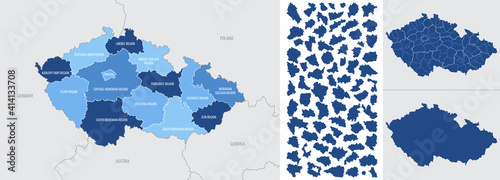
Detailed, vector, blue map of Czech Republic with administrative divisions into regions country
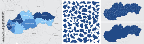
Detailed, vector, blue map of Slovakia with administrative divisions country
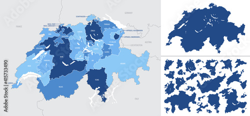
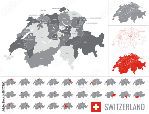
Detailed, vector, blue map of Switzerland with administrative divisions into regions country
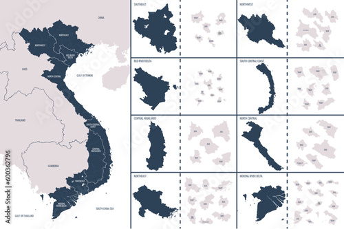
Vector color detailed map of Vietnam with administrative divisions of the country, each regions is presented separately in-highly detailed and divided into Provinces
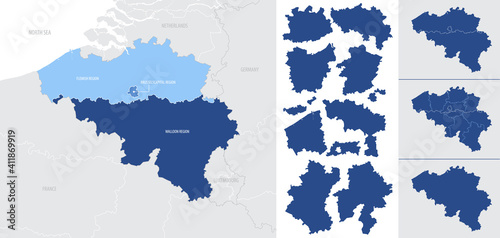
Detailed, vector, blue map of Belgium with administrative divisions into regions country
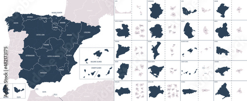
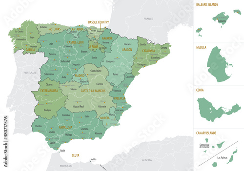
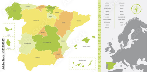
Vector color detailed map of Spain with the administrative divisions of the country, each Autonomous communities is presented separately and divided into autonomous cities and Provinces
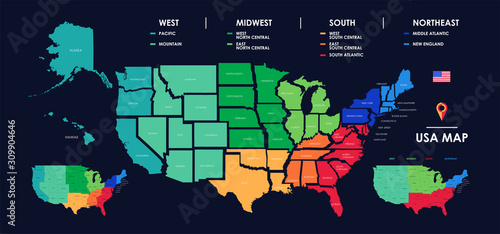
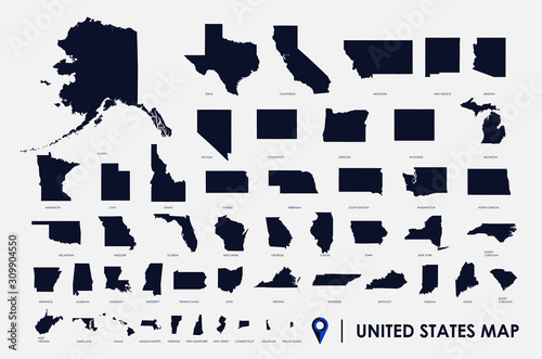
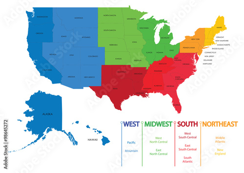
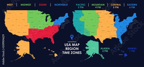
Detailed map of US regions, isolated states with names, Colorful infographics of the United States of America, vector illustration
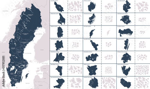
Vector color detailed map of Sweden with the administrative divisions of the country, each Regions is presented separately and divided into Municipalities
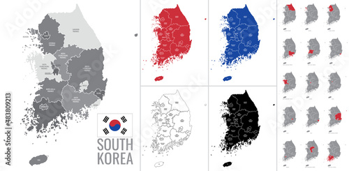
Detailed vector map of regions of South Korea with flag
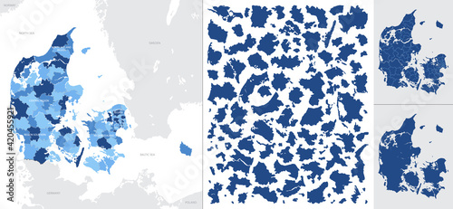
Detailed, vector, blue map of Denmark with administrative divisions into regions country
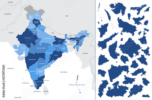
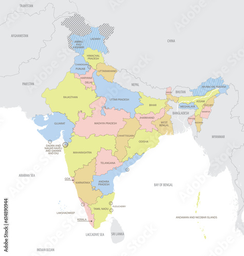
Detailed, vector, blue map of India with administrative divisions country
Vector map of regions of Germany
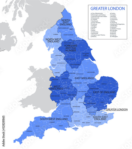
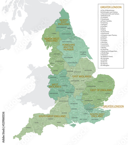
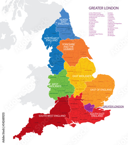
Vector, blue map of England with division into regions, counties and districts
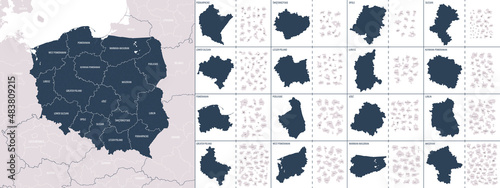
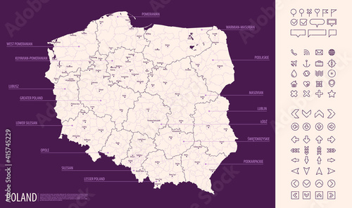
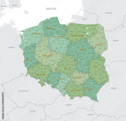
Vector color detailed map of Poland with administrative divisions of the country, each provinces (voivodeships) is presented separately in-highly detailed and divided into counties (powiats)
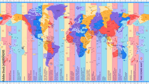
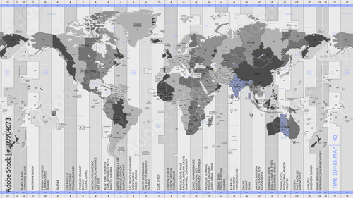
High detail world map of time zones, with big cities of the world, color vector illustration
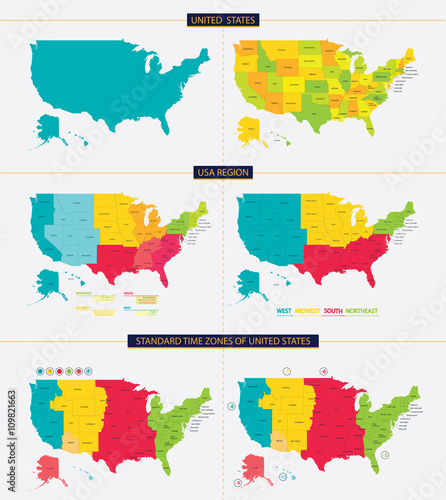
United States of America infographic, USA state maps by territory area, detailed vector illustration
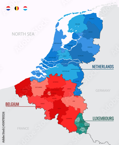
Benelux countries map on europe map, color vector illustration isolated on white background with flags and icons
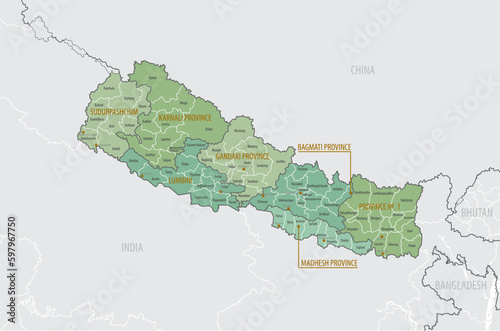
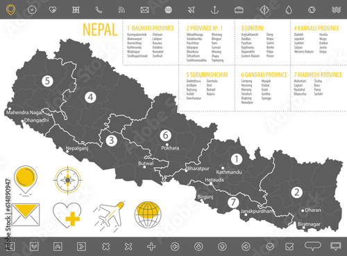
Detailed map of Nepal with administrative divisions into Provinces and Districts, major cities of the country, vector illustration onwhite background
Set of vector gold vintage decorative elements for wedding decor and book decoration
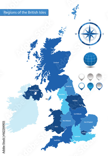
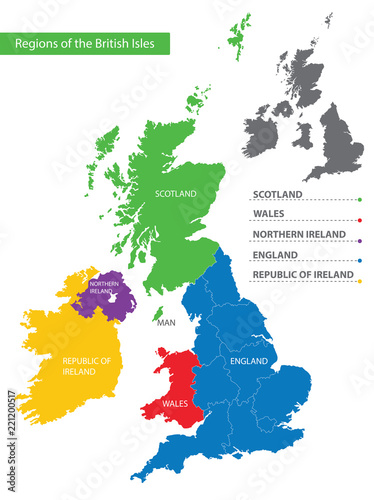
Vector map of the regions of the British Isles
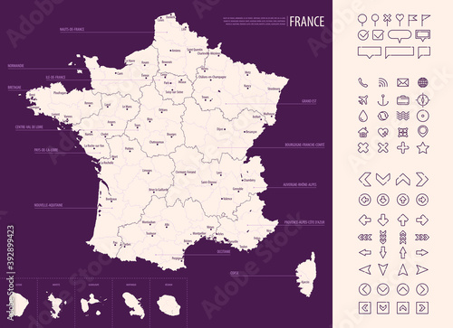
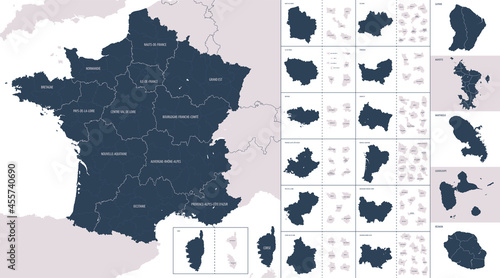
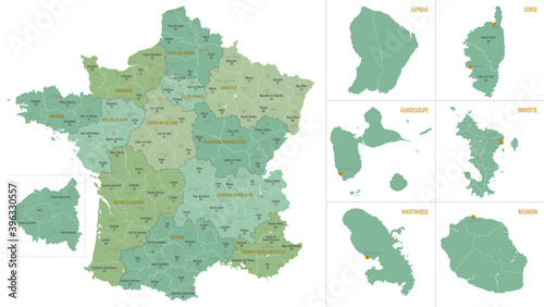
Detailed map of France with administrative divisions on a dark background, big cities of the country and icons set, vector illustration
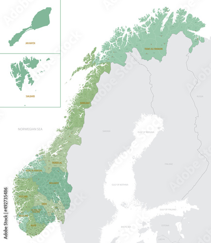
Detailed map of Norway with administrative divisions into Counties and municipalities and Dependent territory, major cities of country vector illustration onwhite background
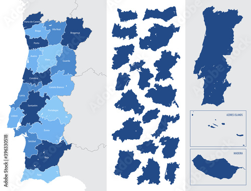
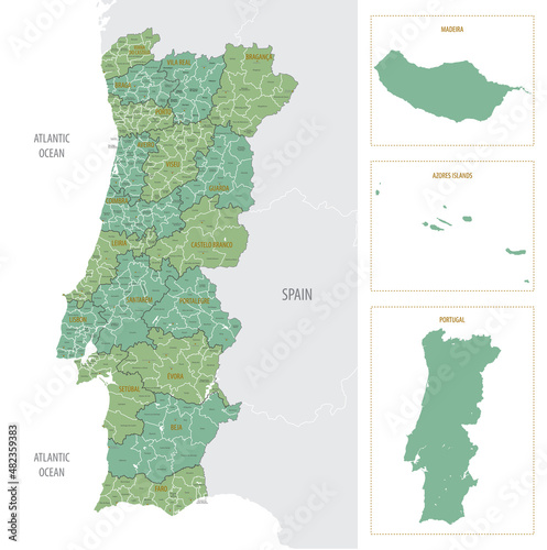
Detailed blue map of Portugal with administrative divisions, major cities on a white background, vector illustration
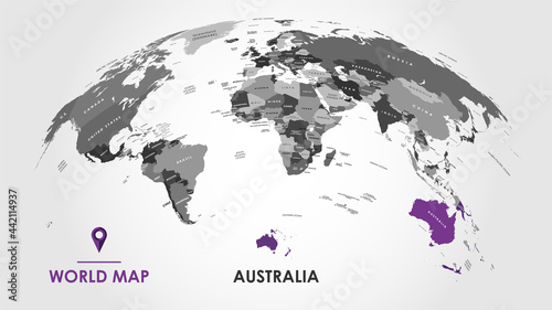
Detailed global world map, with borders and names of countries, seas and oceans, Continent of Australia in colors, vector illustration
Detailed global world map, with borders and names of countries, seas and oceans, Continent of Asia in colors, vector illustration
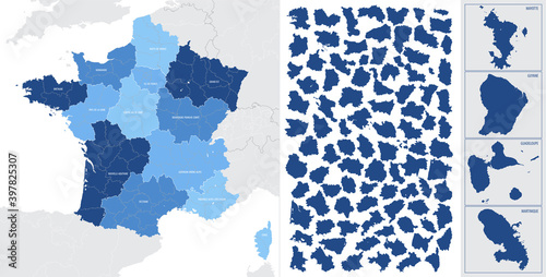
Vector color detailed map of metropolis and overseas territories of France with administrative divisions of the country, each region is presented separately in-highly detailed and divided into depart
Detailed global world map, with borders and names of countries, seas and oceans, Continent of North America in colors, vector illustration
Map of US regions. Maps USA
Detailed monochrome map of Nepal, gray country territory with geographic borders and administrative divisions on white background, travel icons set, vector illustration
Detailed map of the United Kingdom of Great Britain, Northern Ireland and Republic of Ireland with silhouettes and flags of countries
United states. Standard time zones of united states. USA region
Detailed map of Spain with administrative divisions into Autonomous communities and autonomous cities and Provinces, major cities of country, vector illustration onwhite background
Detailed, vector, blue map of France with administrative divisions into regions and departments, metropolis and overseas territories of the country
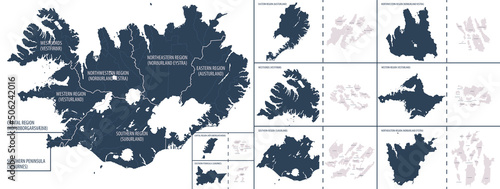
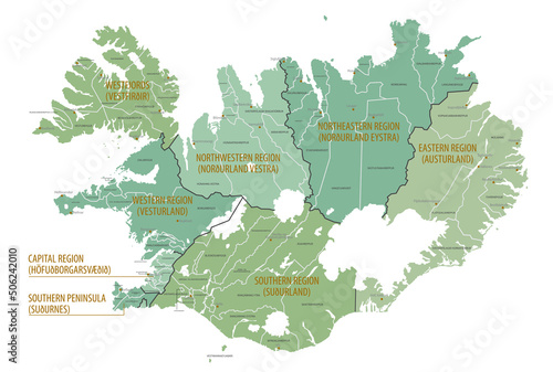
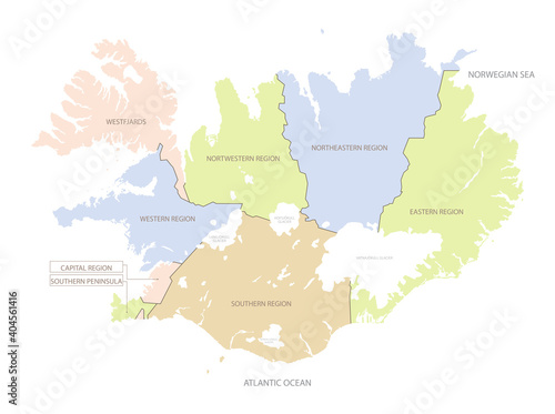
Vector color detailed map of Iceland with the administrative divisions of the country, each Regions is presented separately and divided into Municipalities
Vector color detailed map of Montenegro with the administrative divisions of the country, each regions is presented separately and divided into Municipality
Detailed vector map of Switzerland regions with flag on white background
Detailed map of US regions and time zones, Colorful infographics of the United States of America, vector illustration
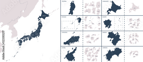
Vector detailed map Japan with the administrative divisions of the country, each region is presented separately, detailed and divided into prefectures
Collection of vector decorative elements for the design of pages
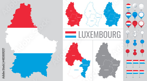
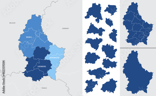
luxembourg vector map with flag, globe and icons on white background
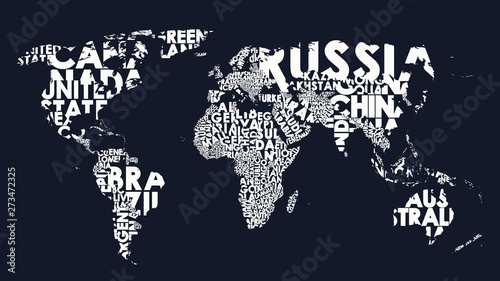
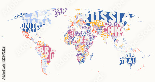
World map text composition of country names, typographical black and white vector illustration
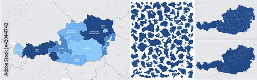
Detailed map of Austria with administrative divisions into region-states and district, major cities of the country, vector illustration onwhite background
Detailed map of England with administrative divisions into regions, counties and districts, major cities of the country, vector illustration onwhite background
Detailed vector illustration world political map centered by America
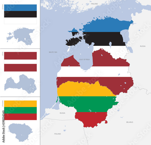
Detailed map and flags of the Baltic States with silhouettes and borders of Estonia, Latvia, Lithuania, vector illustration
Infographic map of Vietnam with administrative division into regions and Provinces
South Korea vector map with flag, globe and icons on white background
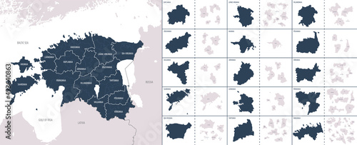
Vector color detailed map of Estonia with the administrative divisions of the country, each Counties and Parishes is presented separately and divided into Municipalities
Detailed vector blue map of luxembourg with administrative divisions into district and cantons of the country
Detailed map of federal states of Germany with administrative divisions into lands and regions of the country, vector illustration on a white background
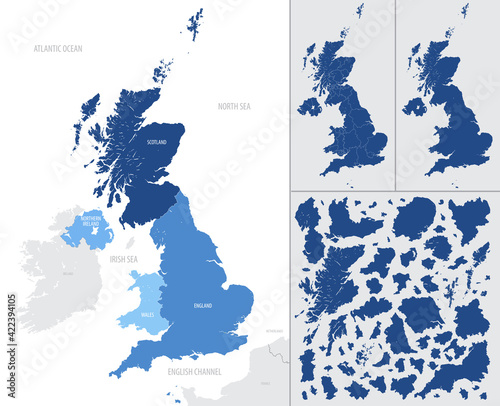
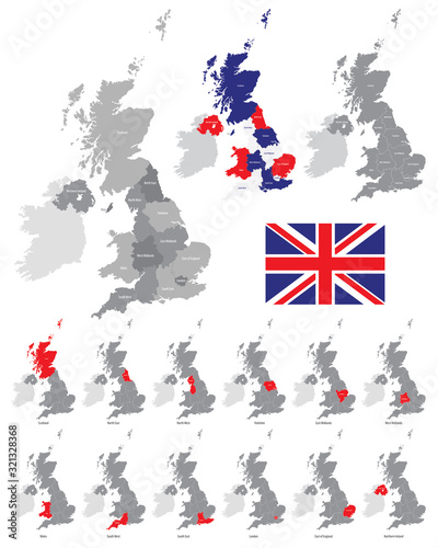
Detailed, vector, blue map of the United Kingdom with administrative divisions into countries and counties
Vector color detailed map of Ireland with administrative divisions of the country, each provinces is presented separately in-highly detailed and divided into counties
Detailed map of Poland with administrative divisions on dark background, country big cities and icons set, vector illustration
Vector set of decorative elements for borders, frames, dividers, for design
Detailed map of metropolis and overseas territories of France with administrative divisions into regions and departments, large cities of the country, vector illustration on a white background
Detailed vector map of Spain, with administrative divisions into Autonomous Communities and Islands
Detailed map of Poland with administrative divisions into 16 provinces (voivodeships) and counties (powiats), major cities of the country, vector illustration on white background
Detailed map of Iceland with administrative divisions into Regions and Municipalities, major cities of the country, vector illustration onwhite background
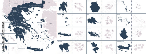
Vector color detailed map of Greece with the administrative divisions of the country, each Regions is presented separately and divided into municipalities
Infographic map of Finland with administrative division into regions and sub-regions
Location map of Italy in Europe with administrative divisions of the country, detailed vector illustration
Color detailed map of the regions and countries of the British Isles
Map of the Cyprus with regions and districts, detailed vector illustration
Detailed map of Portugal with administrative divisions into region and municipalities, major cities of country, vector illustration onwhite background
Vector color detailed map of Lithuania with administrative divisions of the country, each Counties is presented separately in-highly detailed and divided into municipalities
Vector set of gold decorative borders, frames, dividers, on a dark background
High detailed, world map with meridians and parallels
Location map of Iceland in Europe with administrative divisions of the country, detailed vector illustration
High detail monochrome world map standard time zones, with borders and country names, vector illustration
Vector color detailed map of Germany with administrative divisions of the country, each federal states is presented separately in highly detailed and divided into regions
Vector set gold vintage decorative elements for design
World map text composition, name of countries in color territories, Typographic vector illustration
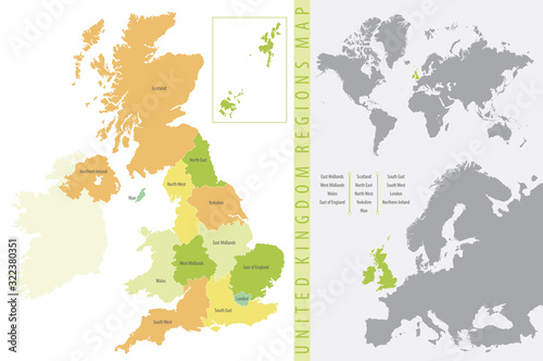
Color vector illustration, United Kingdom Regions Map
Portugal vector map with flag, globe and icons on white background
Map of the England with administrative divisions of the country into regions, detailed vector illustration
Detailed map position of France in Europe, administrative division into regions and departments
Detailed map of India with administrative divisions and borders of neighboring countries, vector illustration on white background
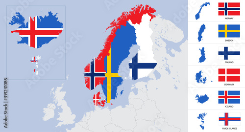
Vector detailed map and flags of Scandinavia with country silhouettes Sweden, Norway, Denmark, Finland, Iceland, Faroe islands
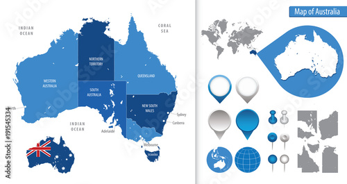
Detailed map of Australia
Set of vector vintage decorative elements for wedding decor and book decoration
Vector set of old gold decorative elements for book pages and wedding decor
Detailed monochrome map of Turkey, gray country territory with geographic borders and administrative divisions on white background, travel icons set, vector illustration
Detailed, vector, blue map of Austria with administrative divisions into regions country
Detailed map of Czech Republic with administrative divisions on dark background, country big cities and icons set, vector illustration
Detailed vector map of the regions of the British Isles, in the color of the British flag