Login
Sign Up
Member Area
Login
Sign Up
English
Afrikaans formal
Afrikaans informal
Arabic
Azerbaijan
Brazilian
Bulgarian
Catalan
Chinese simplified
Chinese traditional
Croatian
Czech
Danish
Dutch
English
Estonian
Finnish
French
Georgian
German
Greek
Hebrew
Hungarian
Icelandic
Indonesian
Italian
Japanese
Latvian
Lithuanian
Malaysian
Norwegian
Persian
Polish
Portuguese
Romanian
Russian
Serbian
Slovakian
Slovenian
Spanish
Swedish
Thai
Turkish
Ukrainian
Vietnamese
Toggle navigation
VideotonStock
Your Shopping Cart is empty.
Files
Stock
Photo
Video
Special offer
Collections
Packages
Lightboxes
Licenses
Royalty free
Rights managed
Creative
Editorial
Items
Most downloaded
Featured
Most popular
New
Free
Categories
Browse categories
Site info
Site info
About
Support
Privacy Policy
Privacy Policy
FAQ
Contact Us
Contact Us
Terms and Conditions
Buyer Agreement
Seller Agreement
Customers
Users
Credits
Photographers
Boby Richards
0
Boby Richards
0
Videoton1
286
Search
Keywords:
Creator ID:
Type:
Photo
Illustration
Vector
Video
Template
3d
Categories:
Animals
Buildings and Architecture
Business
Drinks
The Environment
States of Mind
Food
Graphic Resources
Hobbies and Leisure
Industry
Landscapes
Lifestyle
People
Plants and Flowers
Culture and Religion
Science
Social Issues
Sports
Technology
Transport
Travel
News
Entertainment
Sport News
Languages:
Brazilan Portuguese - Brazil
English - Canada
French - Canada
Spanish - Mexico
English - United States
English - Belgium
French - Belgium
Dutch - Belgium
Czech - Czech Republic
English - Cyprus
Danish - Danmark
German - Germany
English - Estonia
Spanish - Spain
French - France
French - Marocco
English - Greece
English - Ireland
Italian - Italia
English - Latvia
English - Lithuania
German - Luxembourg
English - Luxembourg
French - Luxembourg
English - Hungary
English - Malta
Dutch - Nederlands
Bokmal Norwegian - Norway
German - Austria
Polish - Poland
Portuguese - Portugal
English - Romania
German - Switzerland
English - Slovenia
Slovakian - Slovakia
French - Switzerland
English - Finland
Swedish- Sweden
Italian - Switzerland
English - United Kingdom
English - Bulgaria
English - Australia
Japanese - Japan
Korean - South Korea
English - New Zealand
Russian - Russia
English - Ukrain
English - Thailand
Orientation:
All
Horizontal
Vertical
square
Color:
Model property release:
All
Yes
No
Duration Video:
All
Up to 10 seconds
Up to 20 seconds
Longer than 30 seconds
Results
(0)
Site
Getty/iStock
Bigstockphoto
Pixabay
Adobe Stock
Relevance
New
Most popular
Most downloaded
Undiscovered
12
24
36
48
96
Auto paging
Menu
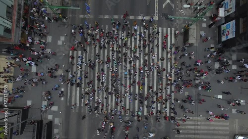
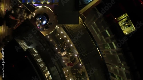
Vertical Video with aerial top view of a busy crosswalk intersection with people walking on both sides.
Vista aérea cenital de una multitud caminando sobre el cruce peatonal más transitado de México. El drone elevándose lentamente mientras la gente cruza Eje Central
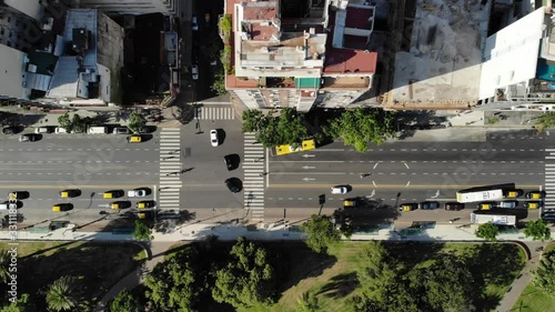
Aerial top down view of Metrobus buses crossing Insurgentes Avenue in Mexico City
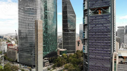
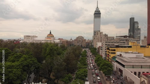
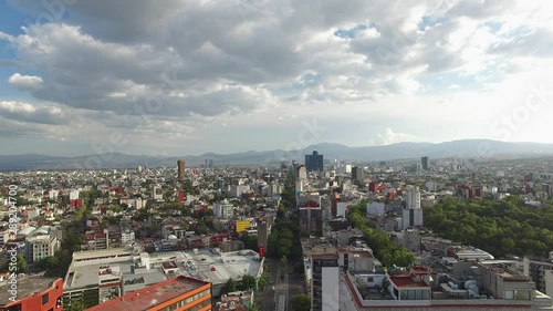
Drone view of the tallest skyscrapers in Mexico City
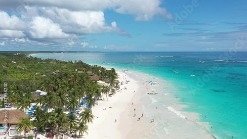
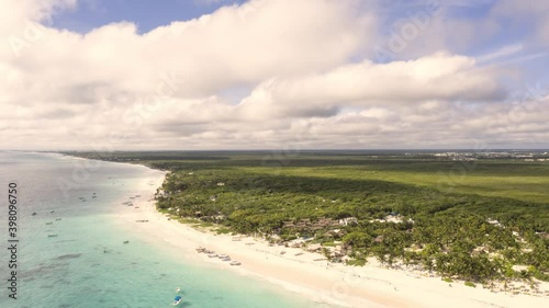
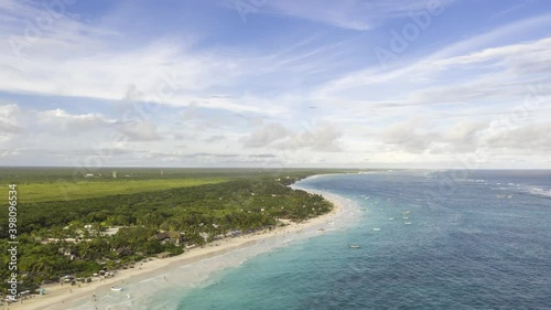
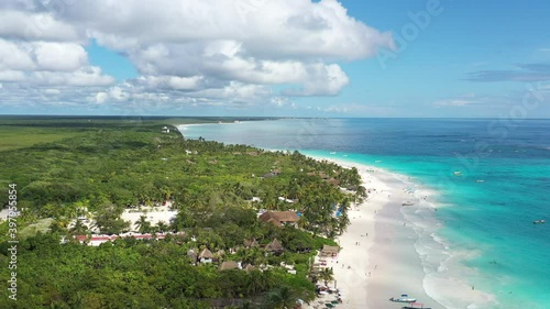
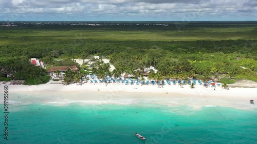
Aerial over Tulum Beach with boats on the shore, tourists walking on the beach and a blue sky as background.
Espectacular vista aérea sobre Playa Paraíso, con muchos turistas caminando sobre la playa y bañándose en el mar, en Tulum, México.
Vertical Video with aerial top view of a busy crosswalk intersection with people walking on both sides.
Vista aérea del skyline residencial sobre las colonias Piedad Narvarte y Roma Sur con el drone volando hacia el Viaducto Miguel Alemán
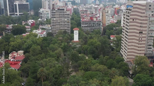
Vista aérea a la Torre del Reloj el simbolo de la Colonia Polanco ubicado en el Parque Lincoln de la alcaldía Miguel Hidalgo
Vista panorámica aérea al norte de la Ciudad de México durante el amanecer.
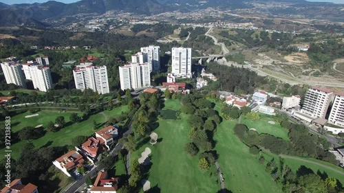
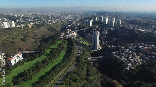
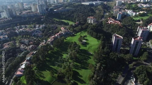
Vista aérea panorámica del Lomas Country Club, un club de golf ubicado en Naucalpan, Estado de México.
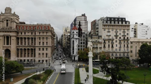
Aerial view of Palacio Barolo in Buenos Aires, Argentina. Drone slowly descending
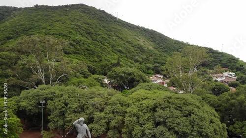
Aerial view of General Martín Miguel de Güemes monument in Salta, Argentina. Drone slowly descending.
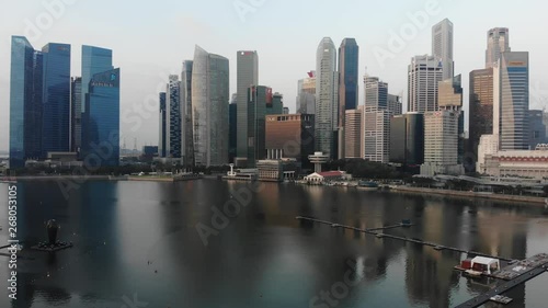
Aerial panoramic view of the financial district in Singapore with drone slowly descending over the bay
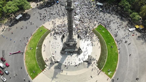
Vista aérea de una multitud de personas manifestandose sobre el Paseo de la Reforma en la Ciudad de México. El drone volando atras del Angel de la Independencia
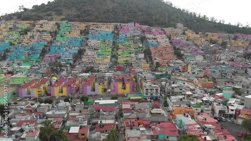
Aerial view of the colorful houses in Barrio La Concepción, southern Mexico City. Drone flying forward and ascending very slowly
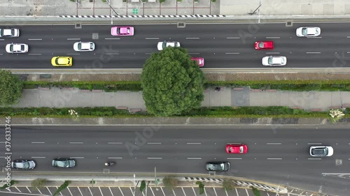
Aerial view of the traffic in Av. Juárez in México City during rush hour. Drone flying forward above the cars with the city skyline as background.
Aerial view of Biblioteca Nacional in Buenos Aires, Argentina. Drone flying sideways
Vista aérea de la Bandera Monumental de San Jerónimo, en la Ciudad de México, durante el atardecer con muchos autos circulando en Periférico
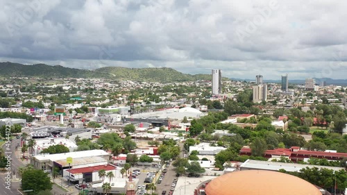
Aerial panoramic view of Hermosillo, Sonora in México. Drone flying backwards with a blue and cloudy sky as background.
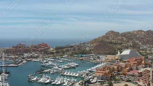
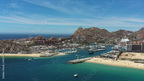
Aerial panoramic view of Cabo San Lucas, México, the drone slowly descending over the Marina with a blue and cloudy sky as background.
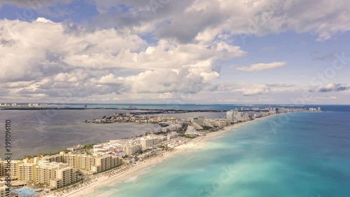
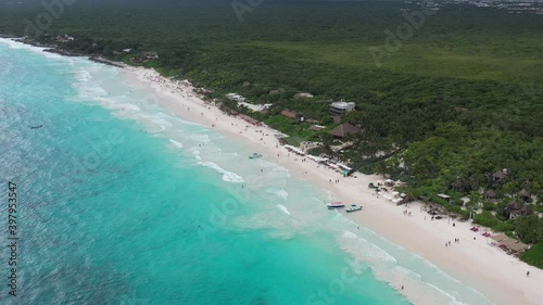
Detalle aéreo de la playa y zona hotelera de Cancún, en Quintana Roo, México con el tradicional mar color azul turquesa y un cielo azul como fondo.
Espectacular vista aérea del skyline de Polanco y Carso en la alcaldía Miguel Hidalgo de la Ciudad de México con un cielo azul como fondo.
Espectacular vista aérea del Nuevo Polanco y Carso en la alcaldía Miguel Hidalgo de la Ciudad de México. El drone sobre el Parque Lincoln.
Vista aérea revelando el skyline del barrio Morningside Heights, en Manhattan, Nueva York rematando con un cielo azul nublado.
Vista aérea cenital sobre el cruce de Av. F. C. de Cuernavaca y Ejercito Nacional con algunos peatones y autos circulando
Vista aérea panorámica del Lomas Country Club, un club de golf ubicado en Naucalpan, Estado de México.
Aérea sobre la pista de canotaje Virgilo Uribe con vista panorámica a los canales de Xochimilco durante el amanecer
Vista aérea cenital sobre el Ecoducto Río de la Piedad y el Viaducto Miguel Alemán Valdés
Vista aérea cenital sobre la autopista México - Toluca con los autos circulando en ambos sentidos y el drone moviéndose de izquierda a deredcha
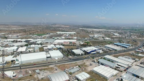
Vista aérea panorámica de la zona industrial de Querétaro. El drone volando hacia atrás con un cielo azul como fondo y cruzando la autopista
Aérea sobre el club de golf Lomas Country Club en Naucalpan, Estado de México
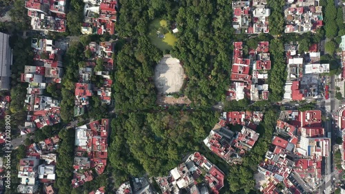
Vista aérea cenital a gran altura del Parque México y Av. Amsterdam en la colonia Hipódromo Condesa de la Ciudad de México
Panoramic view of Mexico City, CDMX, drone flying over Insurgentes avenue on a cloudy day with blue sky
Aerial top down view of the traffic in Av. Las Heras in Palermo Buenos Aires during sunset
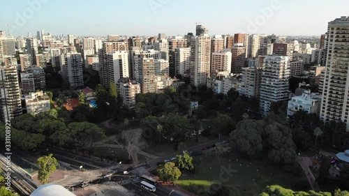
Aerial view of the skyline and buildings around Barracas de Belgrano park in Buenos Aires, Argentina. Drone flying forward during sunset
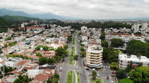
Aeria panoramic view of Salta, Argentina. Drone flying over Bicentenario de la Batalla de Salta street
Aerial panoramic view of Mexico City, drone slowly ascending and rotating in front of WTC Mexico with a blue sky as background
Aerial over Chapultepec Lake during sunrise
Aerial in colorful Ecatepec, Mexico. Drone flying over the houses
Aerial view of a colorful neighborhood in Ecatepec, Mexico. Drone slowly ascending
Aerial reveal type clip of El Manantial neighborhood in Mexico City with views of the houses and the mountains as background
Aerial view of the streets of Bruges, Belgium
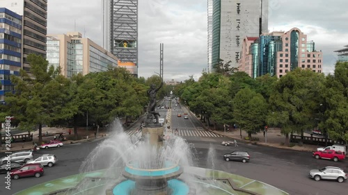
La Diana Cazadora in Paseo de la Reforma revealing Chapultepec Castle
Aerial panoramic view of the Skyline of Retiro Neighborhood in Buenos Aires, Argentina during the sunset. Drone flying sideways
Aerial panoramic view of the buildings around Plaza Lavalle in Buenos Aires, Argentina
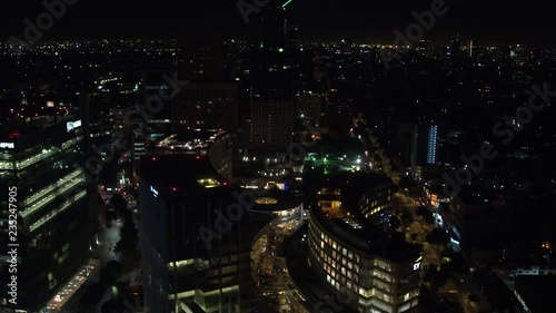
Aerial night panoramic view of Polanco district in Mexico City, drone asending and tilting down
Aerial night top view of Polanco district in Mexico City
Aerial panoramic view of the Oberbaum Bridge in Berlin, Germany with drone flying over the Spree River during the sunset
Aerial panoramic view of the Oberbaum Bridge in Berlin, Germany with drone flying over the Spree River during the sunset
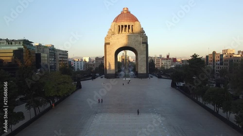
Aerial view of Monumento a la Revolucion in Mexico City
Aerial panoramic view of Hermosillo, Sonora. Drone flying sideways over Cerro de la Campana with a blue sky as background.
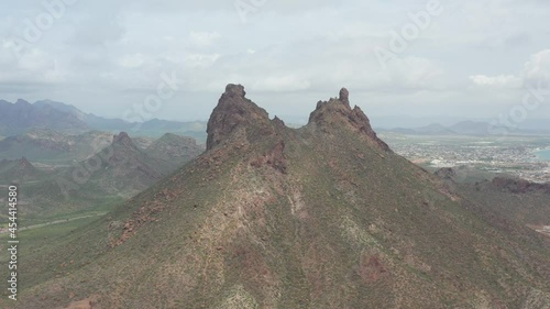
Aerial top down view over the communication towers at the top of Cerro de la Campana in Hermosillo, Sonora.
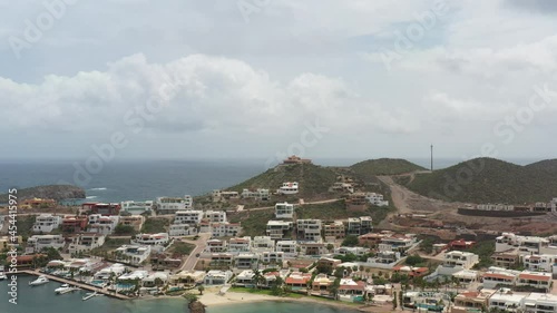
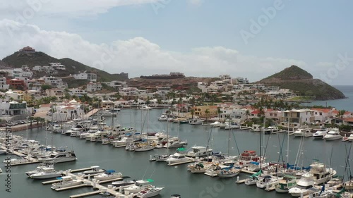
Aerial panoramic view of the luxury beach front residences in Marina Real, San Carlos, Mexico.
Aerial panoramic view of the luxury residences at Marina Real in San Carlos, Sonora. Drone flying backwards with a blue and cloudy sky as background.
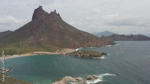
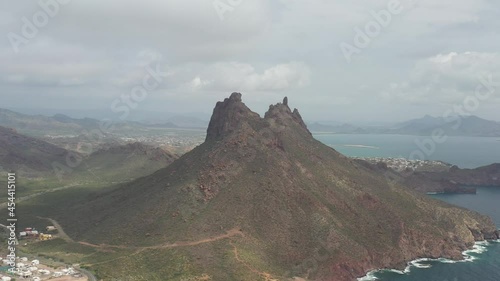
Aerial panoramic view of Cerro Tetakawi in San Carlos, Sonora, México. Drone rotating slowly with a cloudy sky and the city of Guaymas as background.
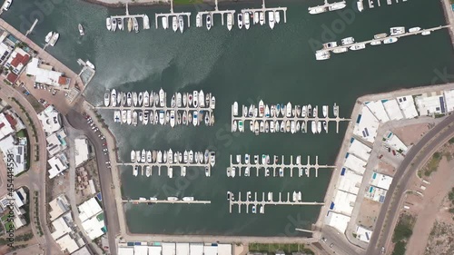
Aerial top down view over Marina Real in San Carlos, Sonora, Mexico. Drone slowly descending.
Aerial panoramic view of San Carlos bay in Sonora, Mexico. Cerro Tetakawi as background with the drone slowly ascending.
Aerial panoramic view of San Carlos bay in Sonora, Mexico. Cerro Tetakawi as background with the drone slowly ascending.
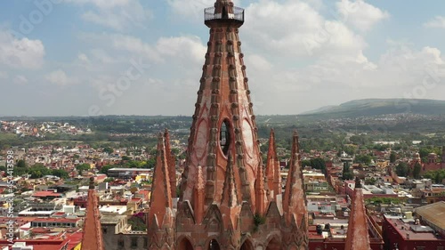
Aerial view in front of the gothic church of San Miguel Arcangel, drone flying backwards and slowly revealing the city of San MIguel de Allende.
Aerial panoramic view of Hermosillo, Sonora in México.
Aerial panoramic view of the city of Hermosillo, Sonora in Mexico.
Aerial panoramic view of Hermosillo Sonora, drone flying forward over Lomas de Pitic neighborhood with a cloudy sky as background.
Aerial top down view, drone slowly ascending, over the tombs of cemetery in Hermosillo, Sonora.
Aerial view of Marina Real in San Carlos, Sonora. Drone flying forward over the yachts and boats with a blue sky as background.
Aerial panoramic view of Cerro Tetakawi in San Carlos, Sonora, México. Drone flying backwards with a cloudy sky as background.
Aerial view of the gothic chuch of San Miguel Arcángel in San Miguel de Allende, Guanajuato, México. Drone ascending.
Aerial panoramic view of the luxury residences at Marina Real in San Carlos, Sonora. Drone flying sideways.
Aerial panoramic view of the tip of Peninsula de Baja California, in Cabo San Lucas, Mexico. Drone slowly descending with a blue sky as background.
Aerial view over El Medano beach in Cabo San Lucas, Mexico. Drone flying forward with tourists on the beach, a blue sky and the waves crushing over the sand.
Aerial top down view over La Marina in Cabo San Lucas
Aerial top down view over La Marina in Cabo San Lucas
Aerial panoramic view of the Marina in Cabo San Lucas, the drone flying in El Medano Beach with a blue sky as background.
El Medano beach in sunny Cabo San Lucas, México. Aerial view with the drone flying forward.
Aerial top down view over Playa de los Amantes in Cabo San Lucas, Mexico. Drone hovering
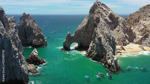
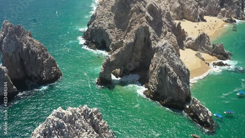
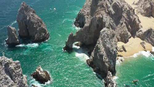
Aerial view of the Arch of Cabo San Lucas with some waves crashing in the rock, the drone slowly rotating.
Aerial view of the Arch of Cabo San Lucas with some waves crashing in the rock, the drone slowly rotating.
Aerial view over Playa de los Amantes in Cabo San Lucas, México
El Medano beach in sunny Cabo San Lucas, México. Aerial view with the drone flying forward.
Aerial panoramic view of the Marina in Cabo San Lucas, the drone flying in El Medano Beach with a blue sky as background.
Aerial view of El Pedregal in Cabo San Lucas, México.
Aaerial panoramic view of the Marina in Cabo San Lucas, México. Drone hovering over El Médano beach and slowly rotating.
Aerial view of the tip of the Peninsula of Baja California in Los Cabos, México. A blue sky as background with some yacths and ships sailing in the Pacific Ocean.
Aerial panoramic view of the iconic arch of Cabo San Lucas in Los Cabos, México. Drone flying backwards with a blue sky as background.
Aerial panoramic view of El Medano Beach in Cabo San Lucas, with views of the Marina and the city with a blue sky as background.
Aerial view of the Arch of Cabo San Lucas, at the tip of the Baja California Peninsula, in Los Cabos, México
Aerial view of the Arch of Cabo San Lucas with some waves crashing in the rock, the drone slowly rotating.
Aerial panoramic view of the iconic arch of Cabo San Lucas in Los Cabos, México. Drone flying forward with a blue sky as background.
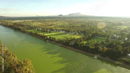
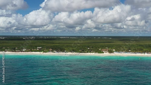
Espectacular hyperlapse aéreo con vista a las playas de la Riviera Maya en Tulum, Quintana Roo con un cielo nublado como fondo.
Hyperlapse aéreo sobre Playa Paraiso, una playa tropical de la Riviera Maya en Tulum, México.
Hyperlapse aéreo sobre Playa Paraiso en Tulum, México con un espectacular cielo azul y el característico mar azul turquesa del caribe mexicano como fondo.
Espectacular hyperlapse aéreo con vista al skyline de la zona hotelera de Cancun, la laguna de Nichupté y la zona residencial de La Isla, con un espectacular cielo nublado como fondo.
Vista aérea panorámica de Playa Paraíso en Tulum, México. El drone 120 metros dentro del mar y girando lentamente de izquierda a derecha con un cielo azul como fono.
Espectacular vista aérea de Playa Paraiso, en Tulum, México. El drone volando de forma lateral a 150 metros de la costa con un cielo azul y nublado como fondo.
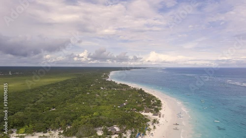
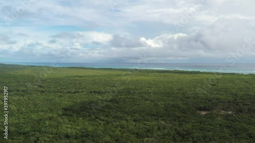
Vista aérea panorámica de la densa jungla tropical que rodea la playa en Tulum, México. Un cielo azul nublado y el mar azul turquesa como fondo.
Vista aérea panorámica de la densa jungla tropical que rodea la playa en Tulum, México. El drone volando de forma lateral.
Vista aérea panorámica de la densa jungla tropical que rodea la playa en Tulum, México. El drone volando de forma lateral con un mar azul turquesa.
Aérea descendiendo sobre la densa jungla tropical de Tulum para llegar a Playa Paraiso, el mar caribe y unas pangas en la playa.
Vista aérea de la densa jungla y selva en el caribe mexicano, el drone sobre el mar azul turquesa frente a Playa Paraíso en Tulum, Quintana Roo
La vasta y densa jungla tropical que rodea a la ciudad de Tulum en México, con un cielo azul y nublado como fondo. Toma aérea con el drone descendiendo rápidamente.