Login
Sign Up
Member Area
Login
Sign Up
English
Afrikaans formal
Afrikaans informal
Arabic
Azerbaijan
Brazilian
Bulgarian
Catalan
Chinese simplified
Chinese traditional
Croatian
Czech
Danish
Dutch
English
Estonian
Finnish
French
Georgian
German
Greek
Hebrew
Hungarian
Icelandic
Indonesian
Italian
Japanese
Latvian
Lithuanian
Malaysian
Norwegian
Persian
Polish
Portuguese
Romanian
Russian
Serbian
Slovakian
Slovenian
Spanish
Swedish
Thai
Turkish
Ukrainian
Vietnamese
Toggle navigation
VideotonStock
Your Shopping Cart is empty.
Files
Stock
Photo
Video
Special offer
Collections
Packages
Lightboxes
Licenses
Royalty free
Rights managed
Creative
Editorial
Items
Most downloaded
Featured
Most popular
New
Free
Categories
Browse categories
Site info
Site info
About
Support
Privacy Policy
Privacy Policy
FAQ
Contact Us
Contact Us
Terms and Conditions
Buyer Agreement
Seller Agreement
Customers
Users
Credits
Photographers
Boby Richards
0
Boby Richards
0
Videoton1
286
Search
Keywords:
Creator ID:
Type:
Photo
Illustration
Vector
Video
Template
3d
Categories:
Animals
Buildings and Architecture
Business
Drinks
The Environment
States of Mind
Food
Graphic Resources
Hobbies and Leisure
Industry
Landscapes
Lifestyle
People
Plants and Flowers
Culture and Religion
Science
Social Issues
Sports
Technology
Transport
Travel
News
Entertainment
Sport News
Languages:
Brazilan Portuguese - Brazil
English - Canada
French - Canada
Spanish - Mexico
English - United States
English - Belgium
French - Belgium
Dutch - Belgium
Czech - Czech Republic
English - Cyprus
Danish - Danmark
German - Germany
English - Estonia
Spanish - Spain
French - France
French - Marocco
English - Greece
English - Ireland
Italian - Italia
English - Latvia
English - Lithuania
German - Luxembourg
English - Luxembourg
French - Luxembourg
English - Hungary
English - Malta
Dutch - Nederlands
Bokmal Norwegian - Norway
German - Austria
Polish - Poland
Portuguese - Portugal
English - Romania
German - Switzerland
English - Slovenia
Slovakian - Slovakia
French - Switzerland
English - Finland
Swedish- Sweden
Italian - Switzerland
English - United Kingdom
English - Bulgaria
English - Australia
Japanese - Japan
Korean - South Korea
English - New Zealand
Russian - Russia
English - Ukrain
English - Thailand
Orientation:
All
Horizontal
Vertical
square
Color:
Model property release:
All
Yes
No
Duration Video:
All
Up to 10 seconds
Up to 20 seconds
Longer than 30 seconds
Results
(0)
Site
Getty/iStock
Bigstockphoto
Pixabay
Adobe Stock
Relevance
New
Most popular
Most downloaded
Undiscovered
12
24
36
48
96
Auto paging
Menu
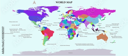
A world map that shows all existing countries with different colors for each country
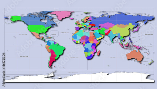
This map depicts the entire surface of the earth consisting of countries, surrounded by oceans. Countries are marked by their geographical areas with color gradations.
world map complete with political areas with different color gradations
Illustration of a globe that highlights the countries of the world clearly. Italy is positioned in the center of the image, showing other major countries
Illustration of a globe that highlights the countries of the world clearly. United States is positioned in the center of the image, showing other major countries
Illustration of a globe that highlights the countries of the world clearly. Germany is positioned in the center of the image, showing other major countries
Illustration of a globe that highlights the countries of the world clearly. South Korea is positioned in the center of the image, showing other major countries.
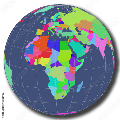
An illustration of a globe highlighting the African continent clearly. The African landmass is positioned at the center of the image, showcasing major countries
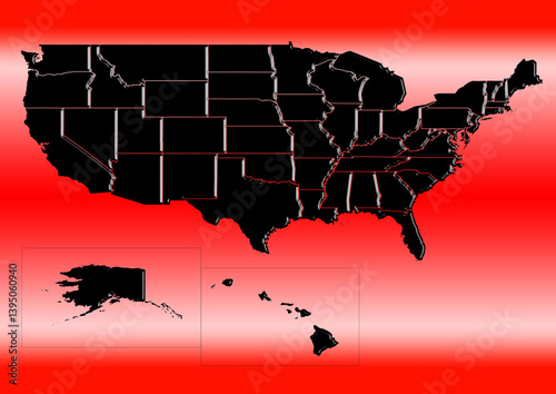
High-resolution illustration of the map of United State, showcasing the complete geographical shape of the country
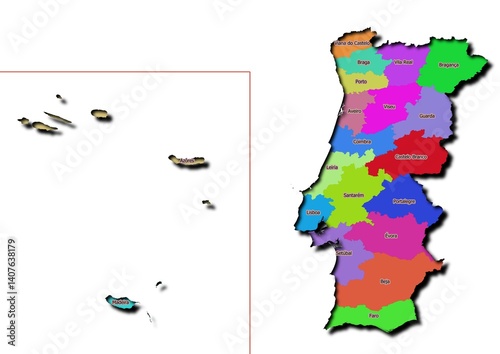
High-resolution illustration of the map of Portugal, showcasing the complete geographical shape of the country
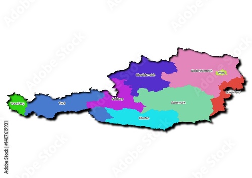
High-resolution illustration of the map of Austria, showcasing the complete geographical shape of the country
High-resolution illustration of the map of Nedherland, showcasing the complete geographical shape of the country
High-resolution illustration of the map of Qatar, showcasing the complete geographical shape of the country
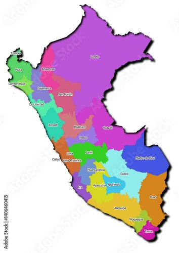
High-resolution illustration of the map of Peru, showcasing the complete geographical shape of the country
High-resolution illustration of the map of Turkey, showcasing the complete geographical shape of the country
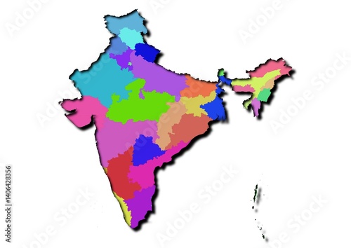
High-resolution illustration of the map of India, showcasing the complete geographical shape of the country
High-resolution illustration of the map of Norwegia, showcasing the complete geographical shape of the country
High-resolution illustration of the map of Luxembourg, showcasing the complete geographical shape of the country
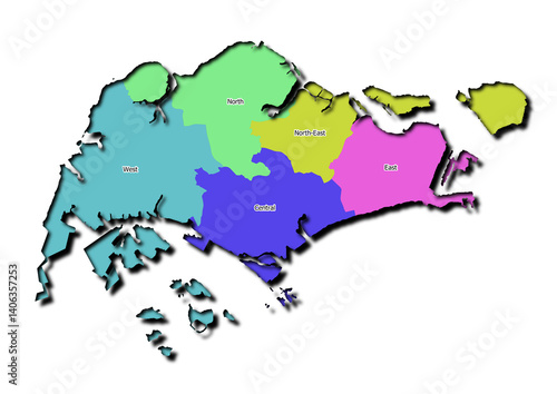
High-resolution illustration of the map of Singapore, showcasing the complete geographical shape of the country
High-resolution illustration of the map of Thailand, showcasing the complete geographical shape of the country
High-resolution illustration of the map of mexico, showcasing the complete geographical shape of the country
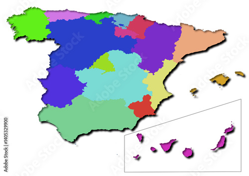
High-resolution illustration of the map of Spain, showcasing the complete geographical shape of the country
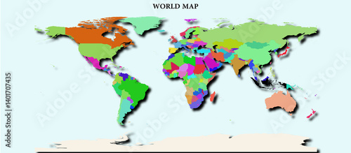
High-resolution illustration of the map of world, showcasing the complete geographical shape of the country
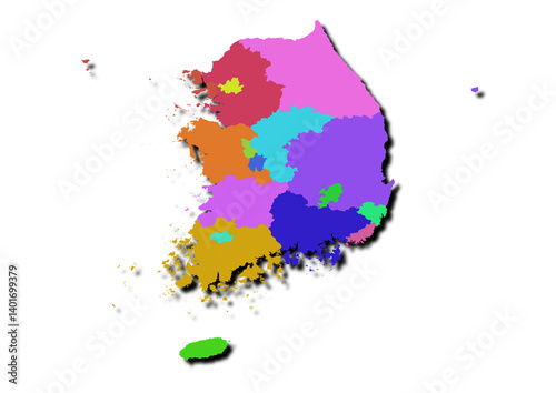
High-resolution illustration of the map of South Korea, showcasing the complete geographical shape of the country
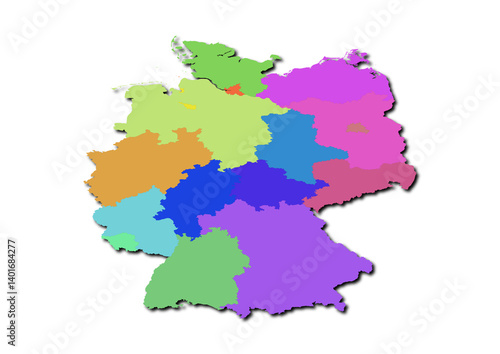
High-resolution illustration of the map of Germany, showcasing the complete geographical shape of the country
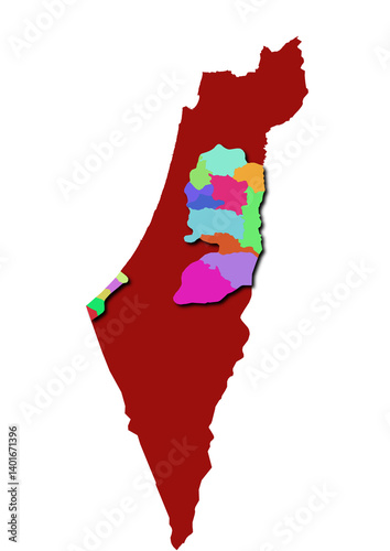
High-resolution illustration of the map of Palestine, showcasing the complete geographical shape of the country
High-resolution illustration of the map of Uni Emirat Arab, showcasing the complete geographical shape of the country
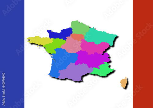
High-resolution illustration of the map of France, showcasing the complete geographical shape of the country
High-resolution illustration of the map of Japan, showcasing the complete geographical shape of the country
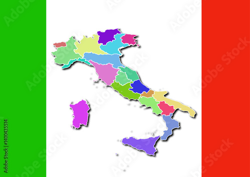
High-resolution illustration of the map of Italy, showcasing the complete geographical shape of the country
Modern and minimalist United States map illustration. Suitable for education, business, infographics, or presentations
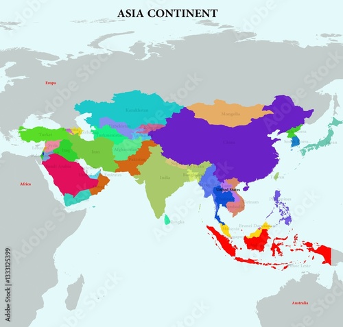
The depiction of countries in the world on a map in each continent.
The depiction of countries in the world on a map in each continent.
The depiction of countries in the world on a map in each continent.
The depiction of countries in the world on a map in each continent.
The depiction of countries in the world on a map in each continent.