Login
Sign Up
Member Area
Login
Sign Up
English
Afrikaans formal
Afrikaans informal
Arabic
Azerbaijan
Brazilian
Bulgarian
Catalan
Chinese simplified
Chinese traditional
Croatian
Czech
Danish
Dutch
English
Estonian
Finnish
French
Georgian
German
Greek
Hebrew
Hungarian
Icelandic
Indonesian
Italian
Japanese
Latvian
Lithuanian
Malaysian
Norwegian
Persian
Polish
Portuguese
Romanian
Russian
Serbian
Slovakian
Slovenian
Spanish
Swedish
Thai
Turkish
Ukrainian
Vietnamese
Toggle navigation
VideotonStock
Your Shopping Cart is empty.
Files
Stock
Photo
Video
Special offer
Collections
Packages
Lightboxes
Licenses
Royalty free
Rights managed
Creative
Editorial
Items
Most downloaded
Featured
Most popular
New
Free
Categories
Browse categories
Site info
Site info
About
Support
Privacy Policy
Privacy Policy
FAQ
Contact Us
Contact Us
Terms and Conditions
Buyer Agreement
Seller Agreement
Customers
Users
Credits
Photographers
Boby Richards
0
Boby Richards
0
Videoton1
286
Search
Keywords:
Creator ID:
Type:
Photo
Illustration
Vector
Video
Template
3d
Categories:
Animals
Buildings and Architecture
Business
Drinks
The Environment
States of Mind
Food
Graphic Resources
Hobbies and Leisure
Industry
Landscapes
Lifestyle
People
Plants and Flowers
Culture and Religion
Science
Social Issues
Sports
Technology
Transport
Travel
News
Entertainment
Sport News
Languages:
Brazilan Portuguese - Brazil
English - Canada
French - Canada
Spanish - Mexico
English - United States
English - Belgium
French - Belgium
Dutch - Belgium
Czech - Czech Republic
English - Cyprus
Danish - Danmark
German - Germany
English - Estonia
Spanish - Spain
French - France
French - Marocco
English - Greece
English - Ireland
Italian - Italia
English - Latvia
English - Lithuania
German - Luxembourg
English - Luxembourg
French - Luxembourg
English - Hungary
English - Malta
Dutch - Nederlands
Bokmal Norwegian - Norway
German - Austria
Polish - Poland
Portuguese - Portugal
English - Romania
German - Switzerland
English - Slovenia
Slovakian - Slovakia
French - Switzerland
English - Finland
Swedish- Sweden
Italian - Switzerland
English - United Kingdom
English - Bulgaria
English - Australia
Japanese - Japan
Korean - South Korea
English - New Zealand
Russian - Russia
English - Ukrain
English - Thailand
Orientation:
All
Horizontal
Vertical
square
Color:
Model property release:
All
Yes
No
Duration Video:
All
Up to 10 seconds
Up to 20 seconds
Longer than 30 seconds
Results
(0)
Site
Getty/iStock
Bigstockphoto
Pixabay
Adobe Stock
Relevance
New
Most popular
Most downloaded
Undiscovered
12
24
36
48
96
Auto paging
Menu
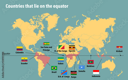
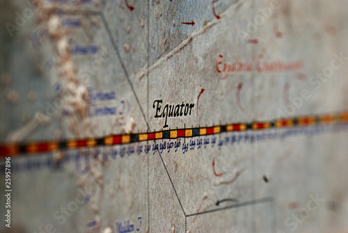
Map of all the countries that lie on the equator
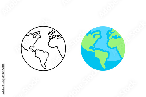
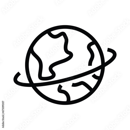
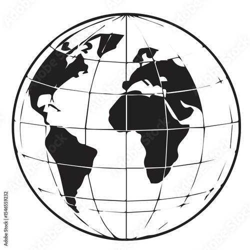
Globe earth world map continents geography planet illustration vector
Types of Earth's climate system called the El Nino and La Nina that can impact to ocean temperatures in the Equatorial Pacific
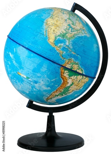
Earth ball school education
A close-up of a traditional Panama hat being handcrafted by local artisans
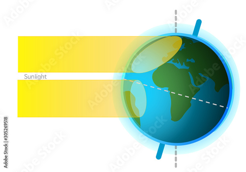
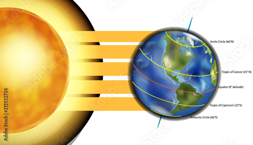
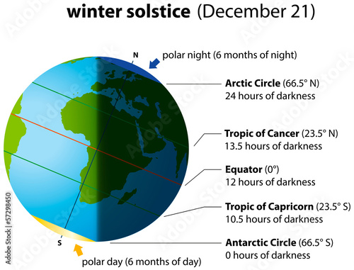
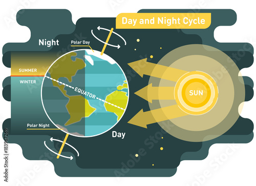
Sunlight, rays on surface of globe. Formation of seasons. Reasons. With the axis tilt and annual movement, seasons occur. Light from upright and veal. Vector
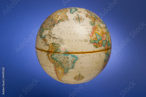
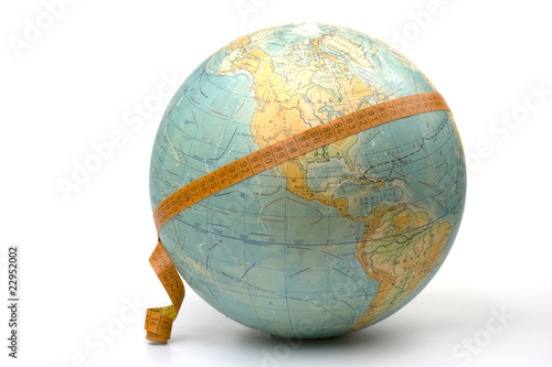
Globe.
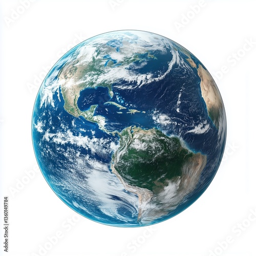
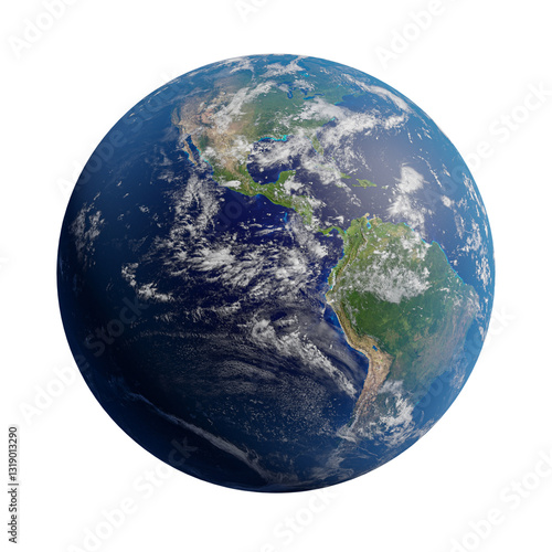
Detailed View of Planet Earth with Emphasis on the Americas
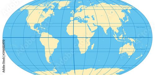
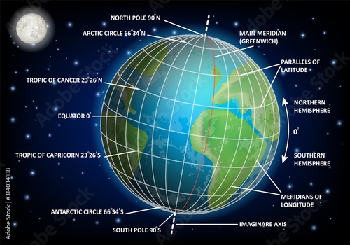
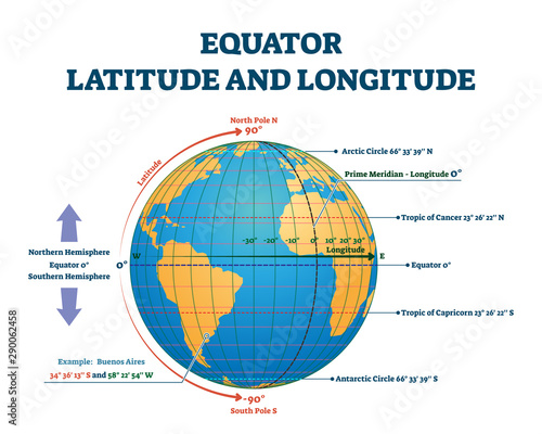
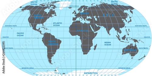
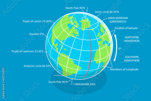
World map with most important circles of latitudes and longitudes, showing Equator, Greenwich meridian, Arctic and Antarctic Circle, Tropic of Cancer and Capricorn. English. Illustration. Vector.
A drawing of a globe showing continents such as africa and south america on a white background
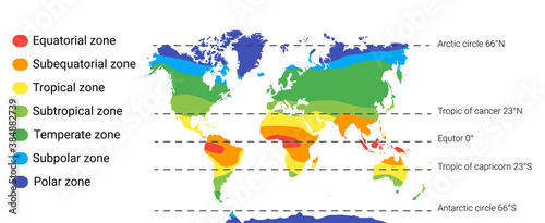
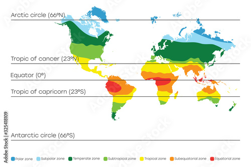
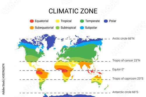
climate zones map. Vector with equatorial, tropical, polar, temperate and sub- zones
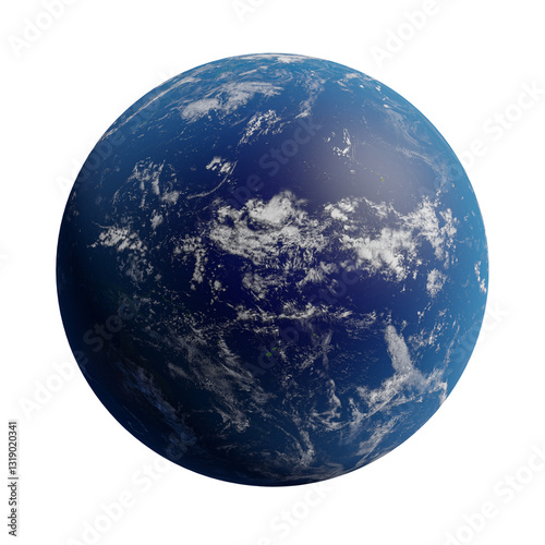
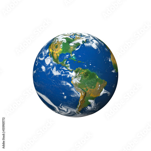
Earth globe with detailed continents and oceans, realistic rendering,isolated on white background.
Half-frozen earth globe divided into icy and warm halves against black space
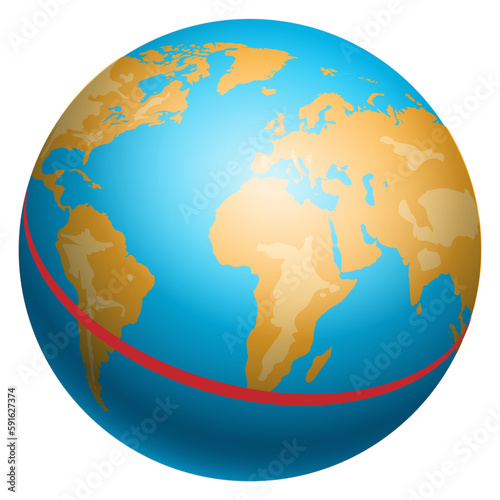
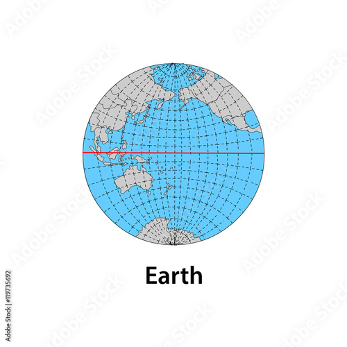
Equator illustration. Red line on globe. Planet Earth
Latitude and longitude diagram, vector educational poster
World Map Banner
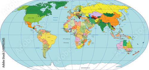
Map of world
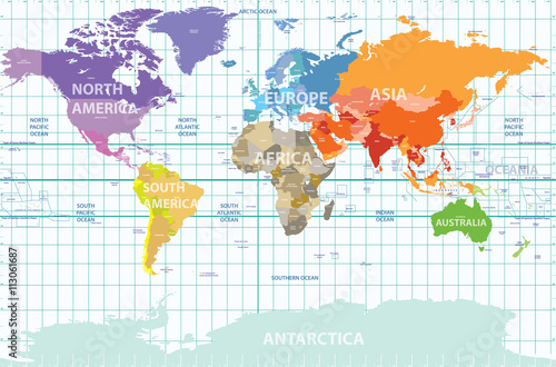
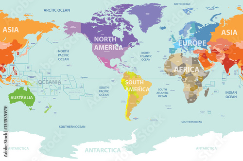
political map of the world with all continents separated by color, labeled countries and oceans, and with enumerated longitudes and latitudes on background
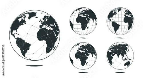
Four views of Earth, showing continents, oceans, and clouds
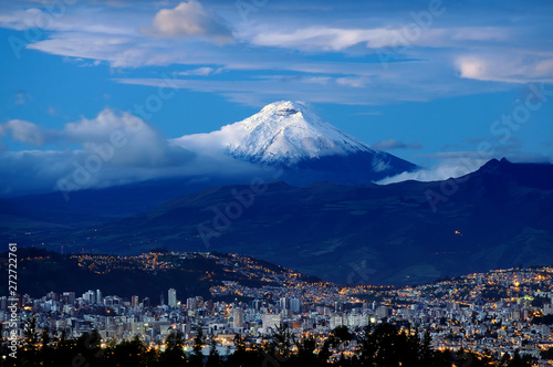
El Volcán Cotopaxi custodia la ciudad de Quito, Ecuador.
Diagram of five major circles of latitude on the Earth. Vector illustration
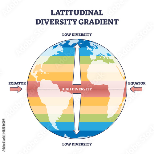
Latitudinal diversity gradient as biodiversity zones on earth outline diagram. Labeled educational scheme and parallel equator lines with various flora and fauna vegetation density vector illustration
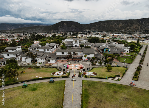
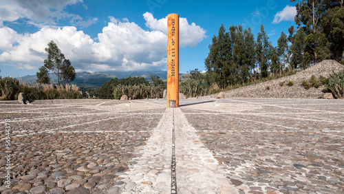
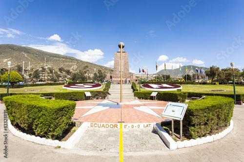
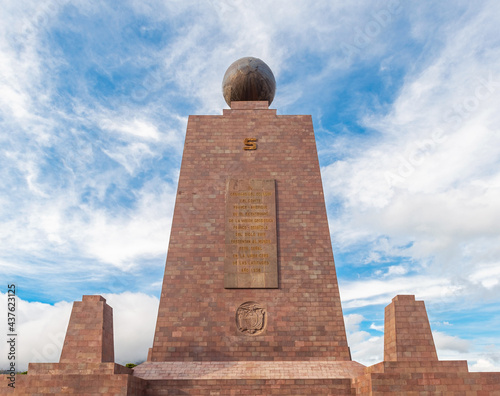
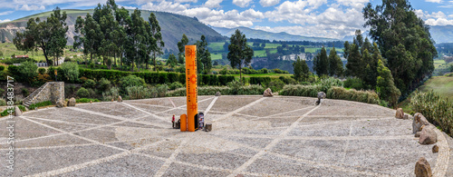
Middle of the World monument, quito, Ecuador
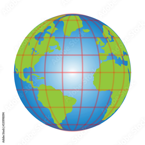
Globe vector illustration: world geography, earth map, travel, education, cartography, school globe image
World Climate Map with Temperature Zones
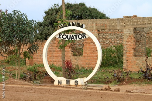
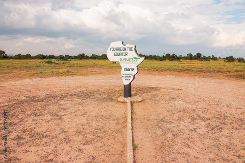
sign of equator Line in Uganda
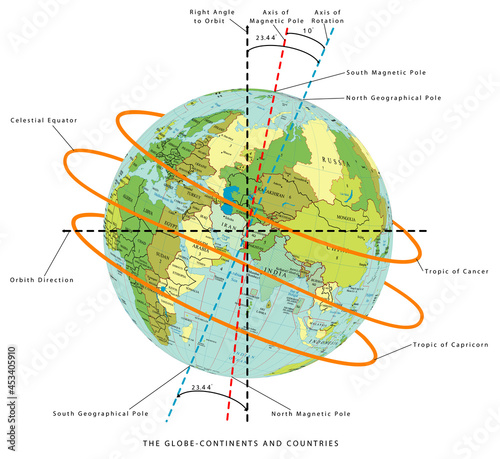
The Globe - World Map with continents and countries. Illustration of the earth - geographic pole, magnetic pole & axial Tilt of the Earth. Earth Temperature, Earth rotation on a white background.
earth
Equinox 3D Concept, when the Sun is exactly above the Equator and day and night are of equal length
View of Pululahua Dormant Volcano North of Quito, Pichincha Province, Ecuador
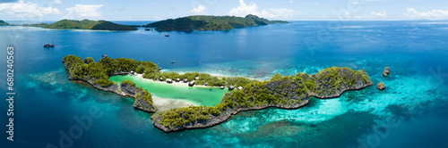
Explore the breathtaking beauty of a tropical island paradise with crystal clear waters and lush green palms near the equator
Earth icon marked with line style and flat blue and green color style is suitable for environmental themes, Earth Day promotions, global concepts, educational materials.
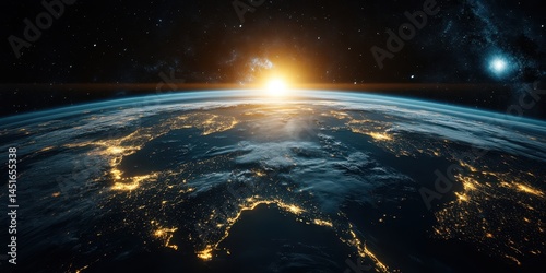
a close-up of the sun peeking over the horizon, casting its golden rays across a blue globe, created with generative ai
An exquisite sunrise illuminates the calm seas surrounding the Togian Island of Central Sulawesi, Indonesia. This beautiful area, just south of the equator, harbors extensive marine biodiversity.
erdball3
Realistic earth planet isolated on transparent background, PNG
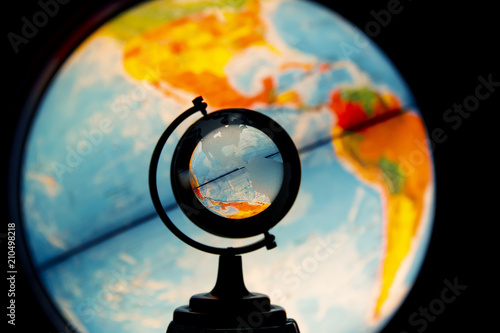
Luminous desktop globe, view oh North and South Americas through small transparent glass globe
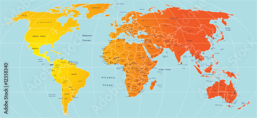
world map colored by continents and centered by America
Aerial View of the Equator Line on World Map - PNG Cutout
Exploring our planet with a classic globe embracing global understanding on transparent background
The equator running through Quito, Ecuador, South America
holiday
Climate type vector illustration. Labeled classification educational scheme
Winter Solstice
a globe of the earth against a blue background
Equator Line Monument, marks the point through which the equator
Circle monument in Uganda that sign the equator line
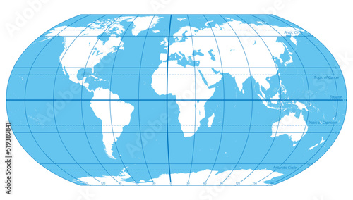
World map with climate zones, equator and tropic lines, arctic and antarctic circle. Vector illustration.
Global Earth Perspective and World Continent Views Earth Illustrations Globe Geography Map
A classic earth globe on a wooden base with detailed geographic features and a dark blue ocean, designed for an educational setting.
Detailed terrestrial globe centered on Africa, showcasing continents and oceans
Equator sign at Ol Pejeta Conservancy, Nanyuki, Kenya
Globe.
Earth from Space Stunning View with Clouds and Oceans
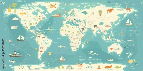
A colorful map of the world with various animals and boats. The map is a representation of the world and its diverse features
A detailed physical map of the world provides a high-resolution flattened satellite view of Earth's geography and topography.
Realistic earth planet isolated on transparent background, PNG
latitude and longitude diagram of earth
Detailed earth globe image showing americas continents on transparent background
Idyllic Rufas Island, near Penemu in Raja Ampat, is surrounded by healthy corals and open ocean. This island, as well as those in the region, support some of the highest marine biodiversity on Earth.
Map of world
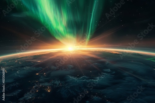
Cinematic capturing the breathtaking sight of a massive aurora borealis enveloping the Earth, extending down to the equator, with the sun peeking behind the planet's rim, casting North
24 hours day and night cycle diagram, graphic vector illustration with sun and planet earth
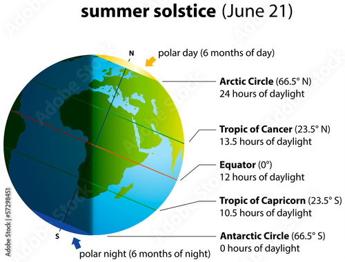
Summer Solstice
Earth globe with lush green equatorial forest
Antique style globe with detailed continents on wooden base
Vintage globe with wooden stand showing continents and oceans, ideal for educational, decorative, and geographic themes.
Study of gravitational force grid illustrating laws of motion and action-reaction dynamics on a globe
Abstract Spherical Globe World Map Modern Style Logo Template Design
Tropical beach palm trees ocean paradise vacation
two chairs on a stretch of beach
No fat!
Close-up of an antique-style world globe with geographical details, on a patterned marble desk and ornate background
outline vector icons of global sun exposure: sunlight map, Earth tilt, equator sun path, seasonal daylight, sun above continents, heat zones, hemisphere icon, sunrise chart. ine style icons in a
Graphic World Map: Eye-Level View
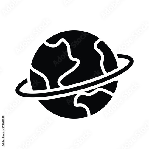
Planet earth equator vector icon
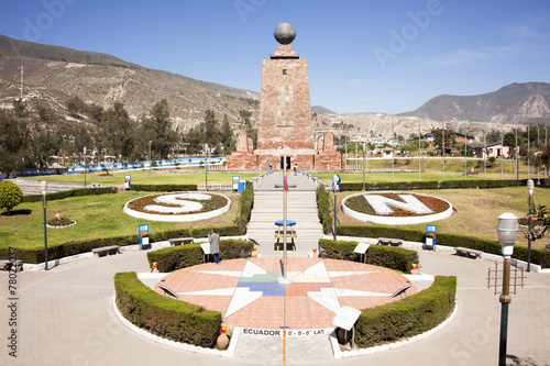
Middle of the World Monument
A globe being torn apart at its equator, with the upper half glowing blue and the lower half burning red, symbolizing a fractured world order.
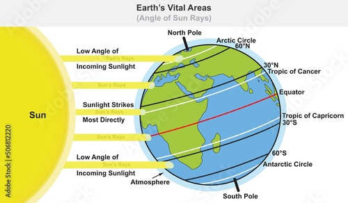
Earth planet vital areas infographic diagram angle of sun ray sunlight radiation solar wind concept science education cartoon vector sphere drawing chart illustration scheme globe map
The equator line building monument in Mitad del Mundo (Middle of the World), Quito, Ecuador.
A bright pumpkin glows as golden leaves drift down in soft lighting.
A black and white vector globe showing continents and grid lines, representing Earth, geography, or global connections. Depicts Africa and the Americas prominently.
Equator latitude or longitude vector illustration. Equator line explanation
The World, important circles of latitudes and longitudes, blue colored political map. Equator, Greenwich meridian, Arctic and Antarctic Circle, Tropic of Cancer and Capricorn. Illustration. Vector.
Equator
Vector map of the world. Oceans and continents on a flat projection.
World map mosaic marks the exact location of the parallels zero and Equator, Rolas, Sao Tome and Principe
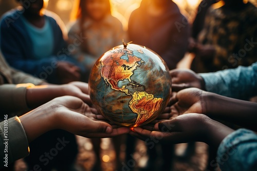
Hands cradling a vintage world globe in a warm, communal setting
World map, oval projection, grid lines
a close-up of the sun peeking over the horizon, casting its golden rays across a blue globe, created with generative ai
climate zones map. Vector with equatorial, tropical, polar, temperate and sub- zones
The equator line
Middle of the World Monument, Ciudad Mitad del Mundo, Ecuador. 0 latitude.
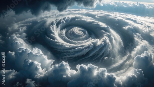
Aerial perspective of a powerful storm above the ocean.
Bird's-eye view of a fierce hurricane over the sea
Star chart depicting celestial navigation.
Planet earth equator vector icon
Globe Icon
3D Isometric Flat Vector Conceptual Illustration of Latitude And Longitude Diagram, Geographic Coordinate System
Equator sign at Ol Pejeta Conservancy, Nanyuki, Kenya