Login
Sign Up
Member Area
Login
Sign Up
English
Afrikaans formal
Afrikaans informal
Arabic
Azerbaijan
Brazilian
Bulgarian
Catalan
Chinese simplified
Chinese traditional
Croatian
Czech
Danish
Dutch
English
Estonian
Finnish
French
Georgian
German
Greek
Hebrew
Hungarian
Icelandic
Indonesian
Italian
Japanese
Latvian
Lithuanian
Malaysian
Norwegian
Persian
Polish
Portuguese
Romanian
Russian
Serbian
Slovakian
Slovenian
Spanish
Swedish
Thai
Turkish
Ukrainian
Vietnamese
Toggle navigation
VideotonStock
Your Shopping Cart is empty.
Files
Stock
Photo
Video
Special offer
Collections
Packages
Lightboxes
Licenses
Royalty free
Rights managed
Creative
Editorial
Items
Most downloaded
Featured
Most popular
New
Free
Categories
Browse categories
Site info
Site info
About
Support
Privacy Policy
Privacy Policy
FAQ
Contact Us
Contact Us
Terms and Conditions
Buyer Agreement
Seller Agreement
Customers
Users
Credits
Photographers
Boby Richards
0
Boby Richards
0
Videoton1
286
Search
Keywords:
Creator ID:
Type:
Photo
Illustration
Vector
Video
Template
3d
Categories:
Animals
Buildings and Architecture
Business
Drinks
The Environment
States of Mind
Food
Graphic Resources
Hobbies and Leisure
Industry
Landscapes
Lifestyle
People
Plants and Flowers
Culture and Religion
Science
Social Issues
Sports
Technology
Transport
Travel
News
Entertainment
Sport News
Languages:
Brazilan Portuguese - Brazil
English - Canada
French - Canada
Spanish - Mexico
English - United States
English - Belgium
French - Belgium
Dutch - Belgium
Czech - Czech Republic
English - Cyprus
Danish - Danmark
German - Germany
English - Estonia
Spanish - Spain
French - France
French - Marocco
English - Greece
English - Ireland
Italian - Italia
English - Latvia
English - Lithuania
German - Luxembourg
English - Luxembourg
French - Luxembourg
English - Hungary
English - Malta
Dutch - Nederlands
Bokmal Norwegian - Norway
German - Austria
Polish - Poland
Portuguese - Portugal
English - Romania
German - Switzerland
English - Slovenia
Slovakian - Slovakia
French - Switzerland
English - Finland
Swedish- Sweden
Italian - Switzerland
English - United Kingdom
English - Bulgaria
English - Australia
Japanese - Japan
Korean - South Korea
English - New Zealand
Russian - Russia
English - Ukrain
English - Thailand
Orientation:
All
Horizontal
Vertical
square
Color:
Model property release:
All
Yes
No
Duration Video:
All
Up to 10 seconds
Up to 20 seconds
Longer than 30 seconds
Results
(0)
Site
Getty/iStock
Bigstockphoto
Pixabay
Adobe Stock
Relevance
New
Most popular
Most downloaded
Undiscovered
12
24
36
48
96
Auto paging
Menu
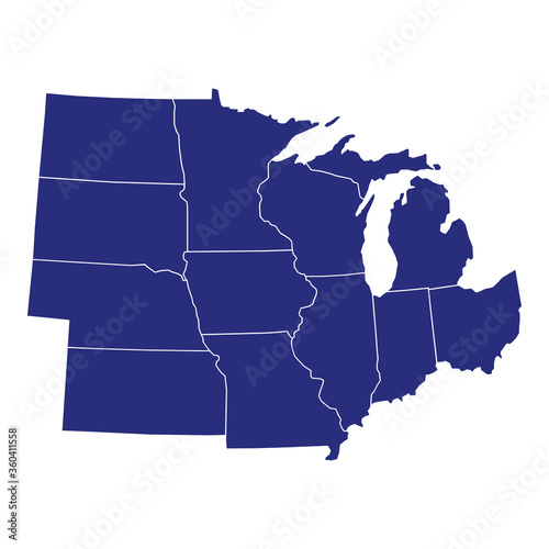
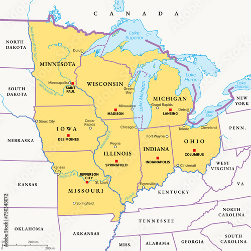
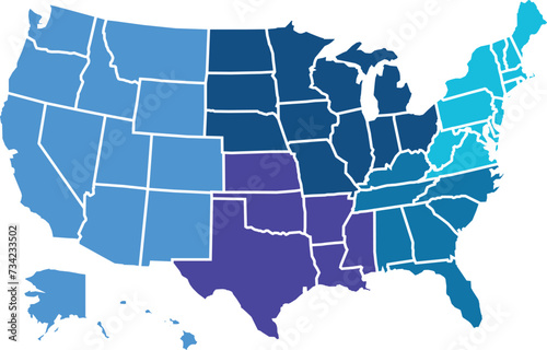
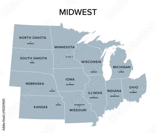
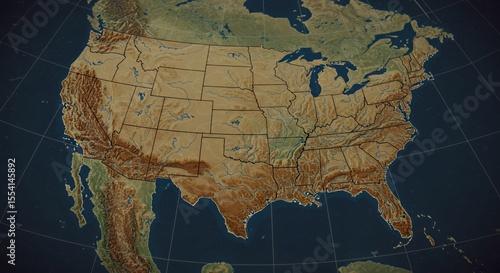
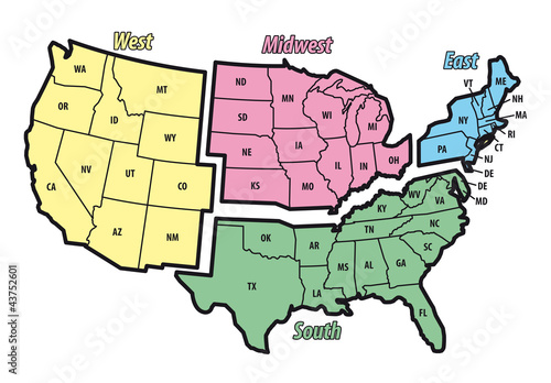
High Quality map of Midwest region of United States of America with borders of the states
American flag waving on rural farm at sunset
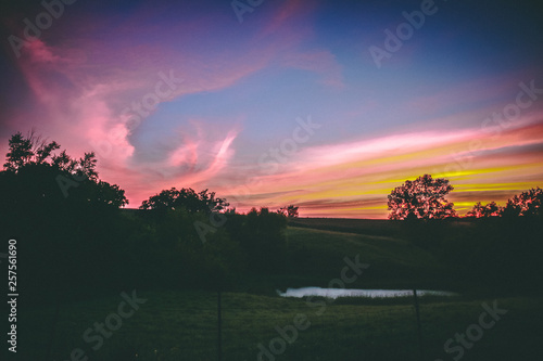
Sandhills Sunset
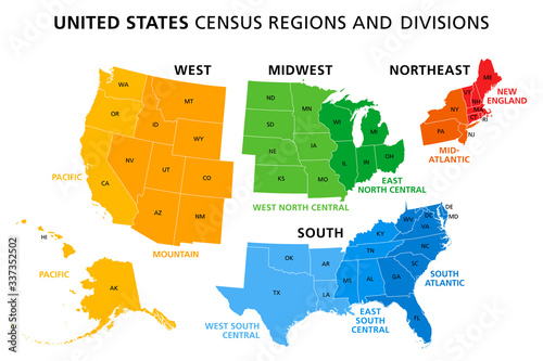
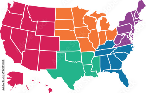
Map of United States split into Census regions and divisions. Region definition, widely used for data collection and analysis. Most commonly used classification system. English. Illustration. Vector
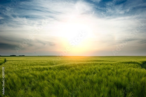
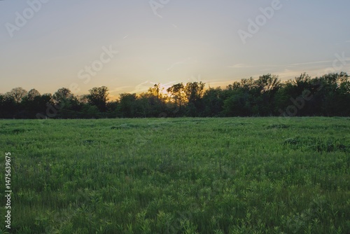
Kansas field of grass and sky
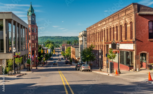
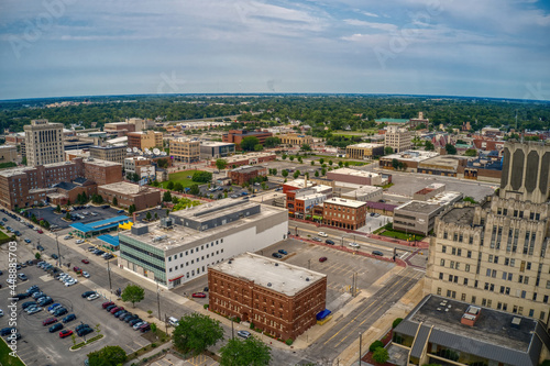
Madison City street view in Wisconsin of USA
Good Morning Sunshine
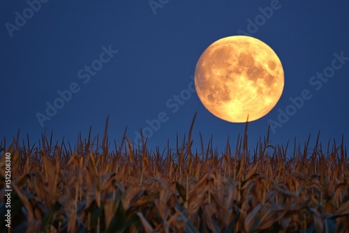
Harvest moon rises elegantly over a golden cornfield under a deep blue sky as twilight envelops the rural landscape
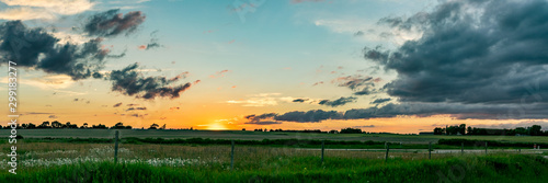
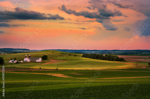
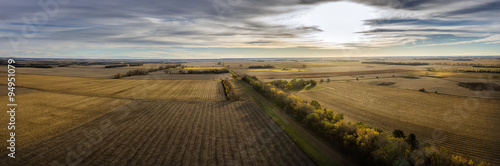
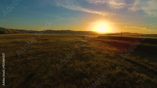
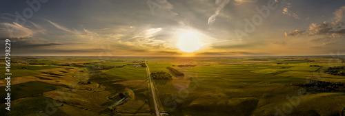
Midwest Sunset Panoramic
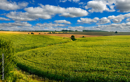
Corn field lines and beautiful landscapes
Historic buildings along Vine Street in Over-The-Rhine, Cincinnati, Ohio.
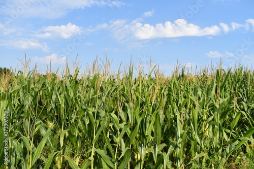
Sunlit corn field under clear blue morning sky
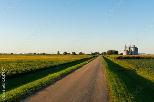
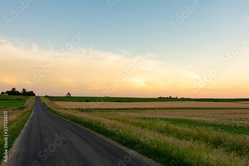
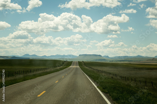
Open country road
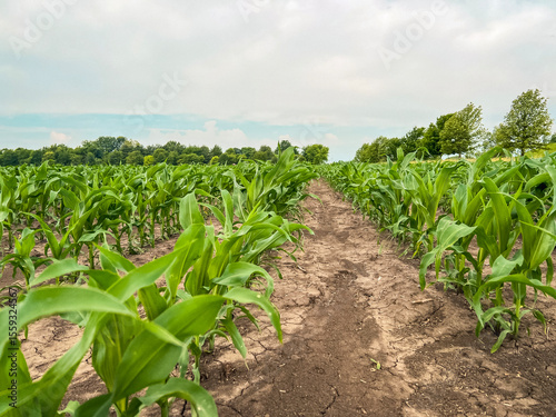
Rows of young corn crop plants in an agricultural field. Rural setting. Captured in early June in the Midwest USA. Soft morning sky.
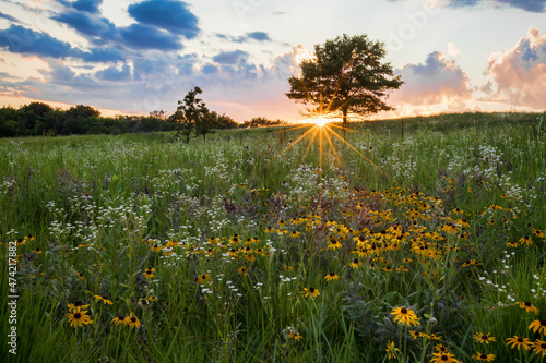
Spectatcular sunburst at sunset over a prairie field of wildflowers, Shoefactory Prairie Nature Preserve, ELgin, IL.
Mid-Western Sunset
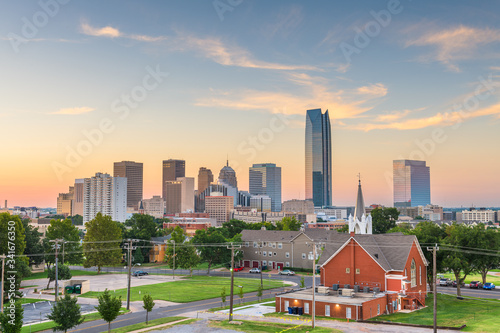
Oklahoma City, Oklahoma, USA Skyline
A road with a dark sky and thunderstorm background. Scary weather concept
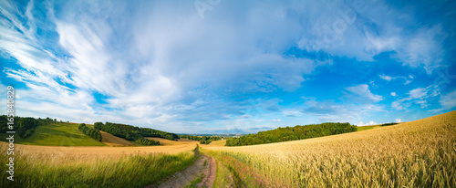
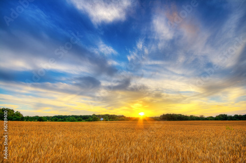
Panorama of wheat field in the morning in Kansas
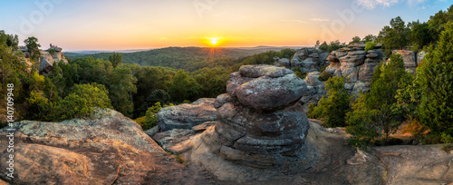
Rock formations and summer sunset, Garden of the God's, Southern Illinois
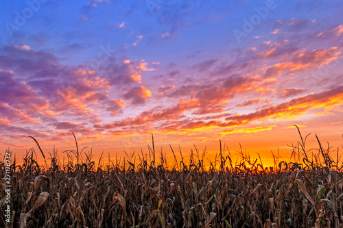
Vibrant Autumn Harvest - Corn stalks are silhouetted by a beautiful, vibrant sunset in the American Midwest.
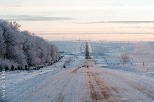
A snow covered rural road in the midwest
MIDWEST - Glowing Neon Sign on stonework wall - 3D rendered royalty free stock illustration. Can be used for online banner ads and direct mailers..
united states | midwest state digital badges | vector art
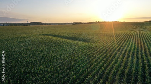
Sunrise over Corn Field (Drone)
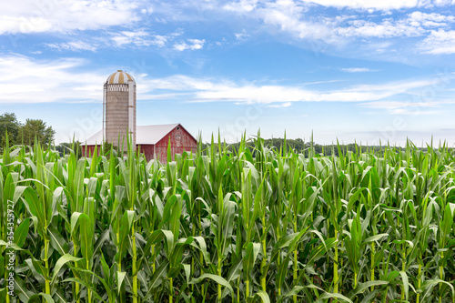
Classic Red Barn in a Corn Field
US map with hollow outline
Autumn Crop Land
Midwest Region of the United States, political map. Midwestern United States or American Midwest, a geographic region, south of the Great Lakes, bordered by Mid-Atlantic, the South and Great Plains.
Grass - hedgehogs
Theodore Roosevelt National Park North Unit
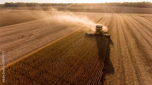
Farmer harvesting soybeans in Midwest
An old red barn standing tall on a Kansas farm with cattle nearby
Open country road
Golden Cornfield Sunrise Over Rural Farmhouse
a winter hiking trail walking path in the snow beautiful nature backdrop with trees and dried golden brush
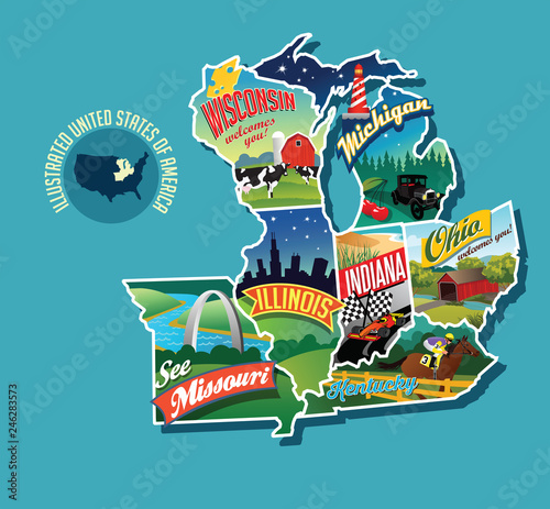
Illustrated pictorial map of Midwest United States. Includes Wisconsin, Michigan, Missouri, Illinois, Indiana, Kentucky and Ohio. Vector Illustration.
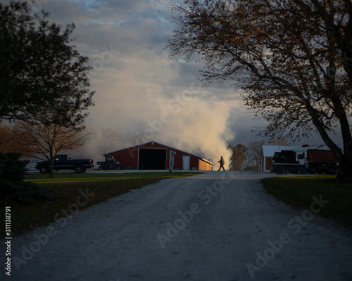
Smoke rises from burning leaves on a farm in the midwest
Oklahoma City, Oklahoma, USA Skyline
grass midwest tallgrass prairie illustration nature kansas, landscape sky, background hills grass midwest tallgrass prairie
Golden California Field Aerial Flyover Grassland Valley
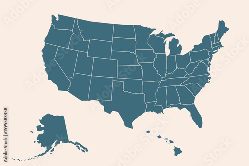
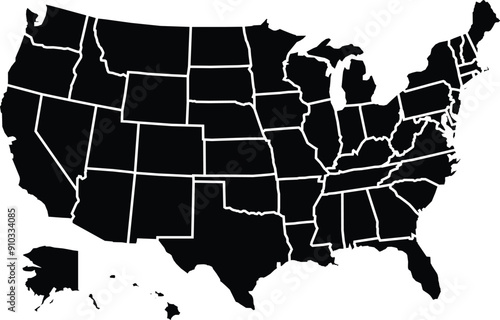
Map of the United States of America in vector format
Beautiful snowy winter rural landscape. Scenic view with covered by fresh snow backyard of private house in the setting sun light. Wisconsin nature background, Wausau area, Midwest USA.
Caucasian farmers working in crop field
midwest pasture at sunset
sunset over the open road.
Cornfield stretching to the horizon during sunset in the American Midwest farm country.
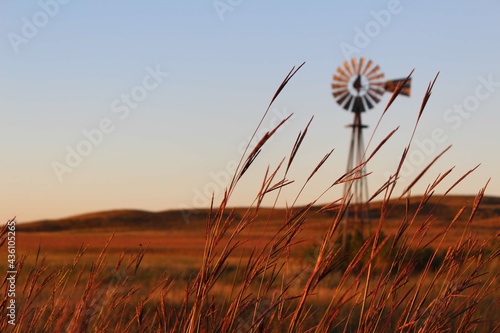
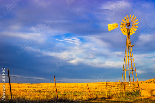
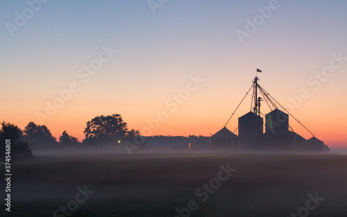
Saline County, KS USA - Aermotor Windmill in the Prairie at Sunset
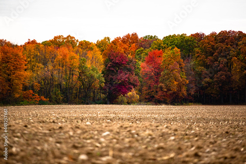
Beautiful autumn red, yellow and green fall colored trees at the edge of a harvest corn field_07
Sunset Drive on a Midwest Country Road
Midwest, census region of the United States of America, gray political map of census region 2, consisting of 12 single states. Map with geographical borders and capitals. Isolated illustration.
A Road at Autumn in Door County of Wisconsin
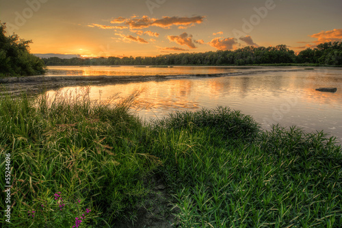
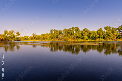
Peaceful Lake on a Summer Evening in the Midwest
A sunset over a wheat field
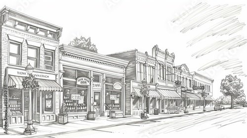
Charming midwest main street historic storefronts and downtown architecture sketch illustration
Unveiling America's Topography: A Detailed Relief Map of the Continental United States
Clouds and Sun over Midwestern Highway
Sunset behind a field of wind turbines
A pickup truck passes on a road near a pretty farm in this all American country rural midwest scene.
Field of Corn in Midwest
Corn Field
City of Marquette in Northern Michigan sits on Hilltop
High Quality map of Midwest region of United States of America with borders
Map of the United States of America in vector format
Empty Country Road Lined With Trees Under Sunny Sky
midwest sunset
Aerial view of crop circles and squares over midwest states on flight over Colorado, Kansas, Missouri, Illinois, Indiana, Ohio and West Virginia during autumn. Grand sweeping views of agriculture land
A gray ranch style model Hedges around modern house
Young crop rows pattern large farm field. Midwest agriculture, farming, landscape, repeating rows. Cultivated farmland with neat rows, spring time growth. Crop farming background.
Fall bridge in the midwest
River Rapids Sunset
Lincoln Park, Chicago, Illinois Skyline
Panoramic landscape of shoreline at Lake Superior Saginaw, Michigan
US east midwest south west
Craftsman style house, navy blue exterior, white trim
United States of America map outlining each state, originally from scalable vector graphics
Farmer in plaid shirt and straw hat walking between rows of corn field during harvest season in autumn rural landscape
sundown on the meadow
Aerial View of Saginaw, Michigan during Summer
Dramatic dunescape overlooking tranquil Lake Michigan Epic view of the lake and vast sand , travel photography, panoramic view, natural beauty
Wheat sunset
Supercell storm cloud forming over a wheat field in the american plains
A midwest farm silhouetted at dawn
Map of the United States America Separated by State
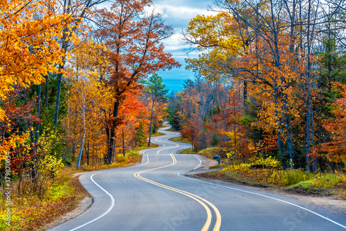
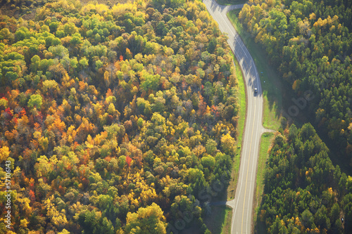
Aerial view of road curving through woods in fall color
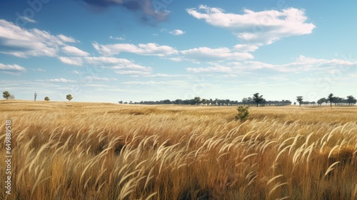
Sunset Tall Grass. Kansas Summer Landscape with Field of Meadow Grass and Blue Sky
Lush Tree-Lined Street in a Peaceful Suburban Neighborhood
Vibrant mid-western sunset through dramatic storm clouds.
Morning calm on Minnesota Lake reflection
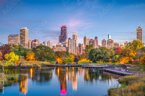
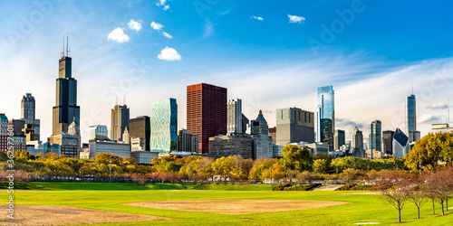
Skyline of Chicago at Grant Park in Illinois - United States
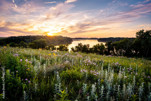
Wildflowers over the Lake at sunset
Minneapolis, Minnesota, USA skyline with the Stone Arch Bridge on the Mississippi River at dusk.
Rapid River Water flowing in Michigan Forest Scenic
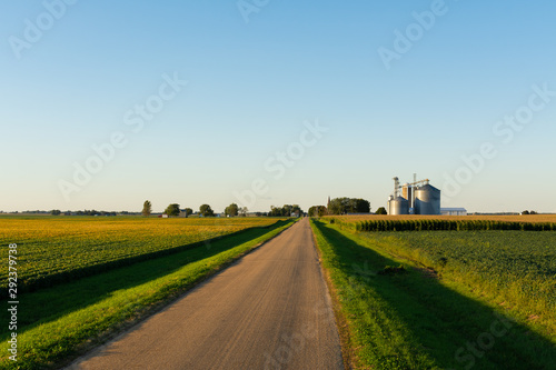
Country road through farmland, Midwest
charming midwest main street historic storefronts and downtown architecture sketch illustration
US regions of East North Central. East North Central states devide by each state in grey color
A large tornado, green sky. Generative AI
farmer combining bean field in rural midwest United States
Indiana red barn in rural farm country with corn crop
Circa 1986 - Minneapolis, Minnesota: The famous July 18 1986 Fridley tornado touches down, as seen from Brooklyn Park. Vintage scanned photo may have imperfections