Login
Sign Up
Member Area
Login
Sign Up
English
Afrikaans formal
Afrikaans informal
Arabic
Azerbaijan
Brazilian
Bulgarian
Catalan
Chinese simplified
Chinese traditional
Croatian
Czech
Danish
Dutch
English
Estonian
Finnish
French
Georgian
German
Greek
Hebrew
Hungarian
Icelandic
Indonesian
Italian
Japanese
Latvian
Lithuanian
Malaysian
Norwegian
Persian
Polish
Portuguese
Romanian
Russian
Serbian
Slovakian
Slovenian
Spanish
Swedish
Thai
Turkish
Ukrainian
Vietnamese
Toggle navigation
VideotonStock
Your Shopping Cart is empty.
Files
Stock
Photo
Video
Special offer
Collections
Packages
Lightboxes
Licenses
Royalty free
Rights managed
Creative
Editorial
Items
Most downloaded
Featured
Most popular
New
Free
Categories
Browse categories
Site info
Site info
About
Support
Privacy Policy
Privacy Policy
FAQ
Contact Us
Contact Us
Terms and Conditions
Buyer Agreement
Seller Agreement
Customers
Users
Credits
Photographers
Boby Richards
0
Boby Richards
0
Videoton1
286
Search
Keywords:
Creator ID:
Type:
Photo
Illustration
Vector
Video
Template
3d
Categories:
Animals
Buildings and Architecture
Business
Drinks
The Environment
States of Mind
Food
Graphic Resources
Hobbies and Leisure
Industry
Landscapes
Lifestyle
People
Plants and Flowers
Culture and Religion
Science
Social Issues
Sports
Technology
Transport
Travel
News
Entertainment
Sport News
Languages:
Brazilan Portuguese - Brazil
English - Canada
French - Canada
Spanish - Mexico
English - United States
English - Belgium
French - Belgium
Dutch - Belgium
Czech - Czech Republic
English - Cyprus
Danish - Danmark
German - Germany
English - Estonia
Spanish - Spain
French - France
French - Marocco
English - Greece
English - Ireland
Italian - Italia
English - Latvia
English - Lithuania
German - Luxembourg
English - Luxembourg
French - Luxembourg
English - Hungary
English - Malta
Dutch - Nederlands
Bokmal Norwegian - Norway
German - Austria
Polish - Poland
Portuguese - Portugal
English - Romania
German - Switzerland
English - Slovenia
Slovakian - Slovakia
French - Switzerland
English - Finland
Swedish- Sweden
Italian - Switzerland
English - United Kingdom
English - Bulgaria
English - Australia
Japanese - Japan
Korean - South Korea
English - New Zealand
Russian - Russia
English - Ukrain
English - Thailand
Orientation:
All
Horizontal
Vertical
square
Color:
Model property release:
All
Yes
No
Duration Video:
All
Up to 10 seconds
Up to 20 seconds
Longer than 30 seconds
Results
(0)
Site
Getty/iStock
Bigstockphoto
Pixabay
Adobe Stock
Relevance
New
Most popular
Most downloaded
Undiscovered
12
24
36
48
96
Auto paging
Menu
A river in northeast China that is discharging floodwater
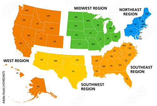
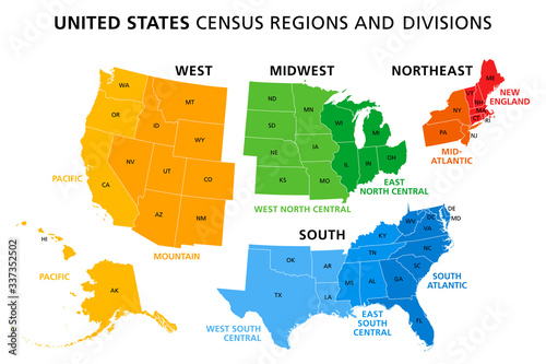
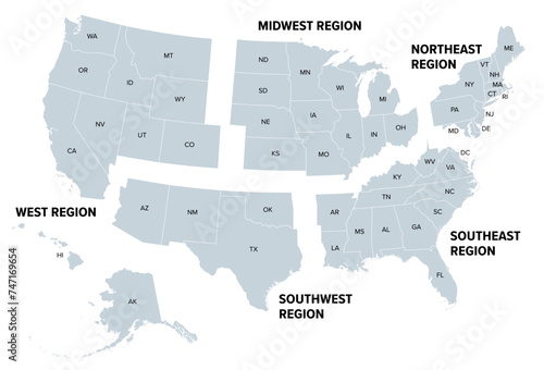
United States, geographic regions, colored political map. Five regions, according to their geographic position on the continent. Common but unofficial way of referring to regions of the United States.
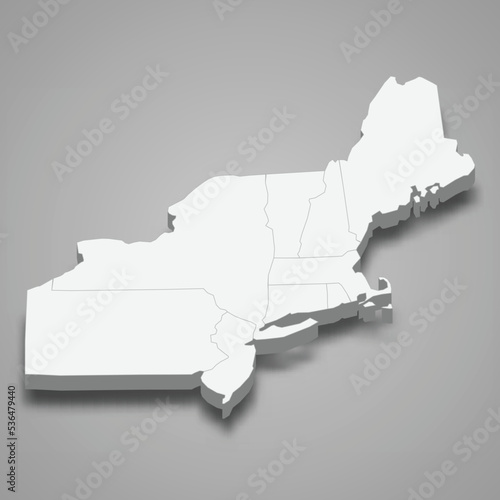
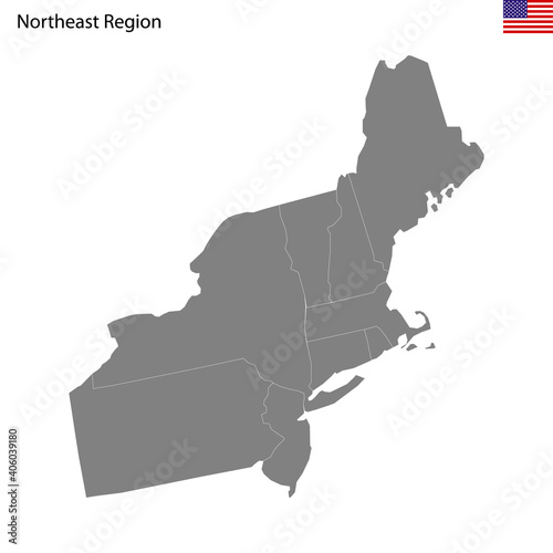
3d isometric map Northeast Region of United States
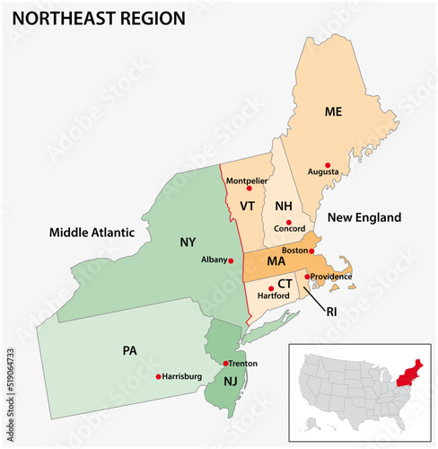
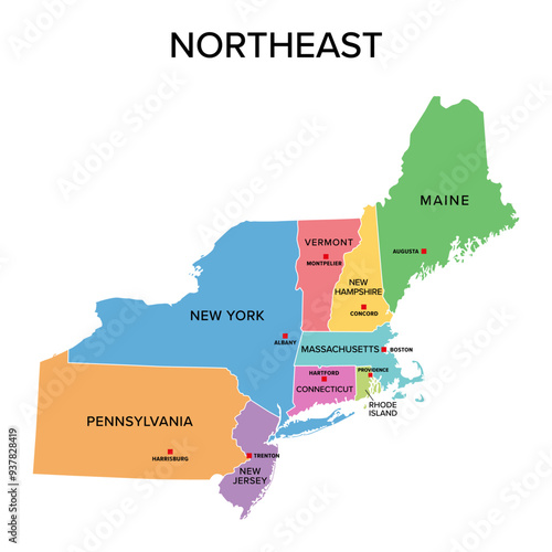
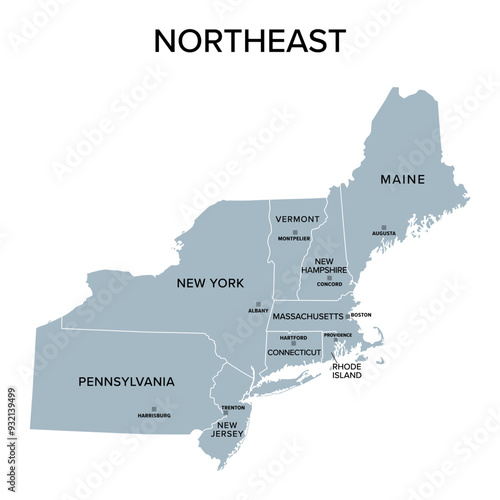
Administrative vector map of the US Census Region Northeast
Cangaceiro hat. Black and white vector isolated illustration. Northeast of Brazil. Brazilian cordel
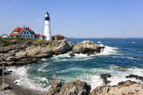
Cape Elizabeth, Maine, USA: The Portland Head Light (1791), on a head of land at the entrance to the primary shipping channel of Portland Harbor, is the oldest lighthouse in Maine.
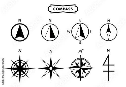
Compass northeast. Compass with wind rose, the arrow points to the northeast. Compass on a blue background. Compass illustrations can be used as background
Portrait of Brazilian Northeastern cowboy wearing his typical leather hat.
Aerial northeast earth village in summer
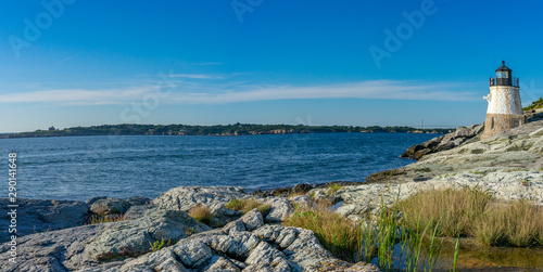
Panorama of Castle Hill Lighthouse at Newport, Rhode Island
Climbers approach the summit of Mt Washington, New Hampshire.
Street and row houses in Center City, Philadelphia, Pennsylvania.
850_5500
Philadelphia, Pennsylvania, USA
Aerial lowering over houses Hamsterley Village in countryside, County Durham, UK
An Atlantic Puffin (Fratercula arctica), carrying sand eels, Staple Island, Farne Islands, Northumberland, northeast England, United Kingdom
Burlington, Vermont, USA autumn town skyline.
Musk ox, Ovibos moschatus, in the mountainside tundra of Geologfjord, in Northeast Greenland National Park. A herbivore that feeds on the grass, moss and lichens of their habitat.
Vintage Typography Poster Rhode Island Wood Sign Aged Travel Illustration Retro Design
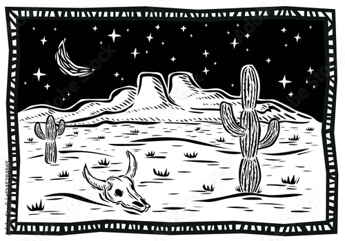
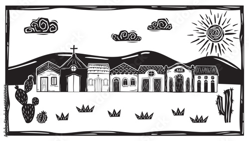
Typical desert landscape of America. Cactus, succulents, mountains, rocks, moon and stars. Vector illustration in woodcut or linocut style..eps
Majestic Waterfall Cascading Over Cliff in Lush Green Forest
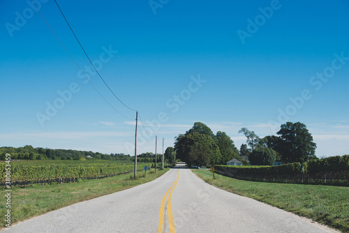
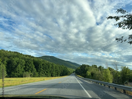
Country road
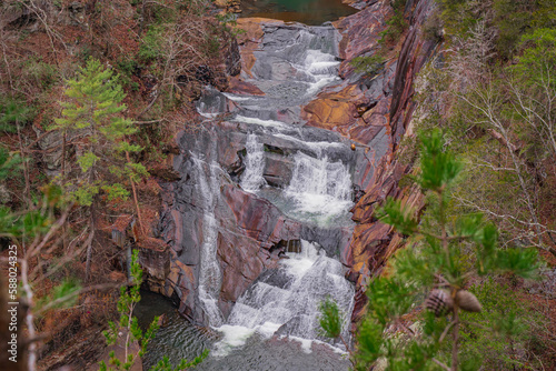
Outlooks around Tallulah Falls are in northeast of Atlanta, Habersham and Rabun County, Georgia. They are a series of six waterfalls cascading through Tallulah Gorge, an ancient 1,000-foot chasm carve
Majestic white clapboard colonial mansion with dormers, gable roofs amid green plants in suburban Shaker Heights Ohio. Early 20th century luxury home with classic American architectural style,
A river in northeast China that is discharging floodwater
Map of United States split into Census regions and divisions. Region definition, widely used for data collection and analysis. Most commonly used classification system. English. Illustration. Vector
Lighthouse in Portland, Maine
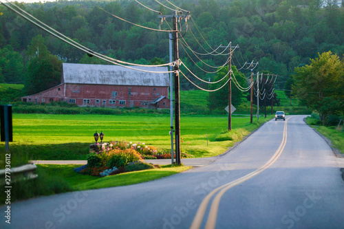
Cars coming down rural road with power lines, Stowe Vermont, USA
Wedding. Brazilian northeast cordel woodcut illustration
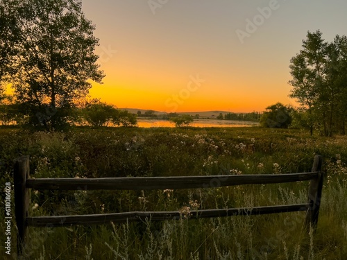
Scenic Wooden Table Against Jaw-Dropping Sunset & Mountain View in Northeast
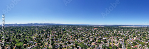
Panoramic aerial drone view of Northeast Portland, Oregon, showcasing residential homes, tree-lined streets, urban landscape, and cityscape with Mount Hood and St. Helens visible in the background
Portrait of Brazilian Northeastern cowboy wearing his typical leather hat.
Satellite View Of Nighttime Lights In Eastern Hemisphere
Background of beautiful religious tourist attractions, the ancient church Wat Phra That Nong Bua has a Naga statue, a replica pagoda with a long history, tourists always come to see the beauty in Ubon
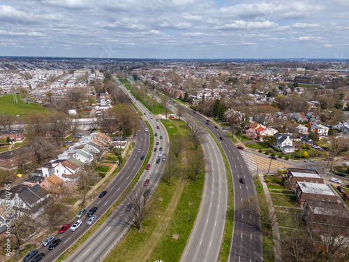
Roosevelt Boulevard, Northeast Philadelphia PA
Pittsburgh, Pennsylvania, USA River and Skyline
方位記号 セット 黒
A colorful display of traditional Brazilian Junina Festival treats with a focus on delicious sweets.
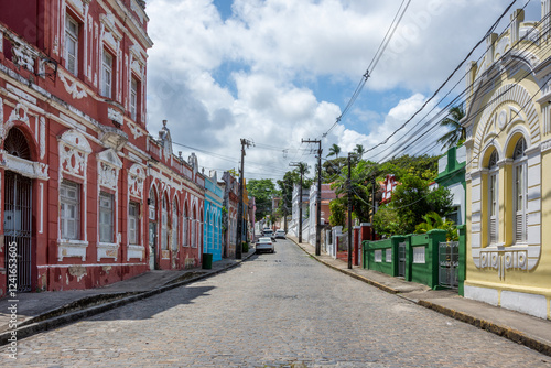
View of some colonial houses in Olinda - Pernambuco, Brazil
Back roads through rural Vermont, USA in autumn time
Village of simple houses and little church, sunny sky with clouds in the interior of Brazil. Vector woodcut, Cordel from the Brazilian Northeast
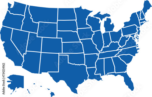
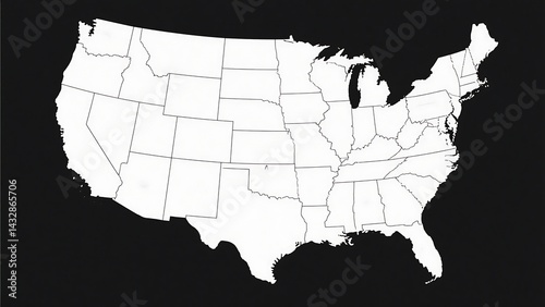
Map of the United States of America in vector format
US map with hollow outline
Outlooks around Tallulah Falls are in northeast of Atlanta, Habersham and Rabun County, Georgia. They are a series of six waterfalls cascading through Tallulah Gorge, an ancient 1,000-foot chasm carve
A river in northeast China that is discharging floodwater
Northeast, U.S. census region, multi colored political map. Census region 1 of the United States, consisting of 9 single states. Colored silhouettes of single states with borders and their capitals.
Beautiful sunset over Burlington Lake in northeast Wyoming on a summer evening
United States at Night Satellite View
Cashew nuts in woodcut style. Brazilian northeast cordel. Vector decorative illustration
Downtown New York City skyline USA
Aerial drone view of Northeast Portland, Oregon, showcasing residential homes, tree-lined streets, urban landscape, and cityscape with Mount Hood and Mount St. Helens visible in the background
Typical leather hat used by cowboys in northeastern Brazil
Providence downtown skyline and buildings at sunset over Providence River Walk, Rhode Island
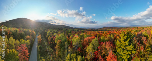
Beautiful autumn forest with yellow and red trees, aerial top view
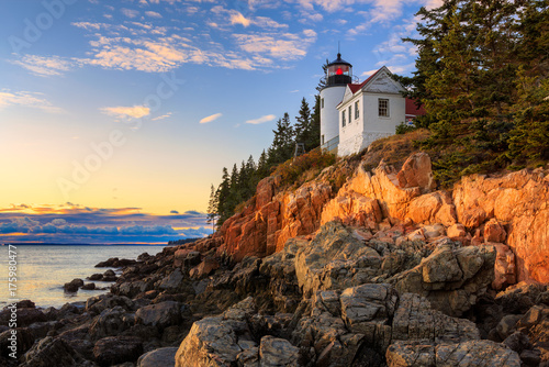
Sunset over Bass Head Light in Acadia National Park, Maine
Pittsburgh, Pennsylvania, USA
Map of the United States perfect for educational materials, travel brochures, patriotic designs, geography infographics, and business presentations.
Pork liver meat spicy salad Thai northeast style local food, Thailand
Tri State Area Outline North East US States Tri State
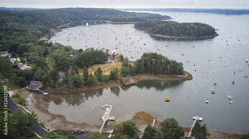
Aerial drone view of Buck's Harbor Deer Isle, Maine
Vector of a caracara hawk flying with the sun in the background. Design template for icons, logos, cards, prints. Vector illustration.eps
Low Light Photography of the Eastern Seaboard Map Highlighting Coastal Cities and Landmarks in Atmospheric Nightscape View with Glowing Lights and Rich Textures
Washington Crossing, Titusville, NJ: Johnson Ferry House (c. 1740), at the site of George Washington's crossing of the Delaware River, December 1776.
Scenic view of an open highway and rolling hills in Vermont
A river in northeast China that is discharging floodwater
Northeast, census region of the United States of America, gray political map of census region 1, consisting of 9 single states. Map with geographical borders and capitals. Isolated illustration.
Brazilian northeast dessert known as roll cake isolated on white background.
Hummingbird in flight
Brazilian northeast cordel style. Woman feeding birds from her hands. Woodcut style
Northeast Brazil Rural Landscape: Asphalt Road Cutting Through Sertao
Autumn in Vermont, with its scenic byways and back roads winding through the countryside.
Portrait of Brazilian Northeastern cowboy wearing his typical leather hat.
N East Vector Icon
Static establishing of quiet winter day with snow falling at airport, normal operations on tarmac
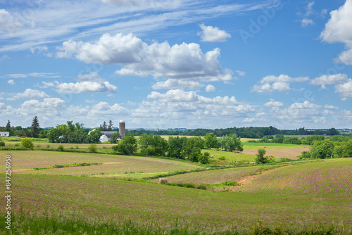
Iowa farm and farmland on a beautiful day in late spring
High Quality map of Northeast region of United States of America with borders
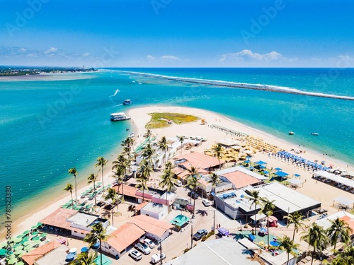
Aerial view of Gunga Beach, Alagoas
Small, colourful tour boats and a lookout tower in Ban Diam, on the shore of the Red Lotus Lake (Nong Han Kumphawap), province of Udon Thani, northeast Thailand
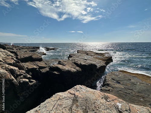
rocks and sea view
Omaha, Nebraska, USA Downtown Skyline
Hummingbird (colibri) couple hand-drawn in the woodcut style of the northeastern cordel. Vector illustration.eps
bridge over the golden lake in the city of Poti
Drawing of a cangaceiro hat, a folkloric leather hat typical from northeast of Brazil, in comics style. Vector illustration.
Dirt road leading to a mountain through fall leaves
A river in northeast China that is discharging floodwater
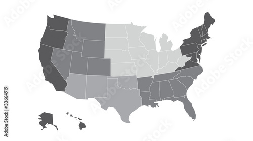
United States, geographic regions, gray political map. Five regions, according to their geographic position on the continent. Common but unofficial way of referring to regions of the United States.
Asclepias exaltata | Poke Milkweed | Native North American Woodland Wildflower
Lake at Davidsonville State Park, Arkansas
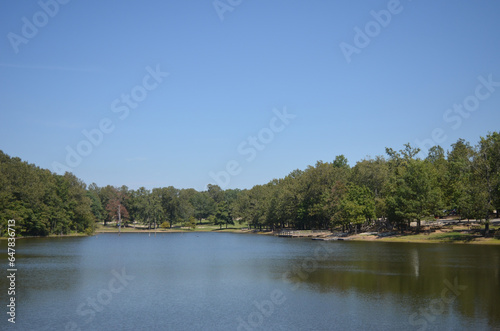
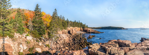
Colorful fall leaves decorate the rocky Atlantic coast of Acadia National Park on Mt. Desert Island in Down East Maine in the New England region of the United States.
コンパス方位磁針のベクターシンボル素材集
Christmas markets in San Candido. Magical Val Pusteria under the snow.
Portrait of Brazilian Northeastern cowboy wearing his typical leather hat.
Aerial view of Martha's Vineyard coastline.
Mesmerizing sunset view over Lake Wallenpaupack in Northeast Pennsylvania captured in summer
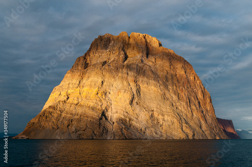
Ella Island at sunset, King Oscar Fjord, Greenland
Compass arrow, navigation icon, symbol
US regional map grayscale
.Route of emotions in the northeast of Brazil
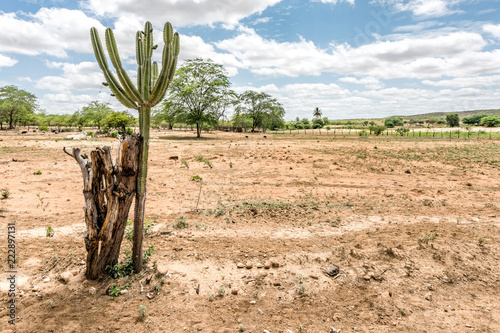
São Domingos do Cariri, Paraiba, Brazil - February, 2018: Landscape of Caatinga Biome cactus
Brazilian northeast cordel style. Man and bird. Woodcut illustration