Login
Sign Up
Member Area
Login
Sign Up
English
Afrikaans formal
Afrikaans informal
Arabic
Azerbaijan
Brazilian
Bulgarian
Catalan
Chinese simplified
Chinese traditional
Croatian
Czech
Danish
Dutch
English
Estonian
Finnish
French
Georgian
German
Greek
Hebrew
Hungarian
Icelandic
Indonesian
Italian
Japanese
Latvian
Lithuanian
Malaysian
Norwegian
Persian
Polish
Portuguese
Romanian
Russian
Serbian
Slovakian
Slovenian
Spanish
Swedish
Thai
Turkish
Ukrainian
Vietnamese
Toggle navigation
VideotonStock
Your Shopping Cart is empty.
Files
Stock
Photo
Video
Special offer
Collections
Packages
Lightboxes
Licenses
Royalty free
Rights managed
Creative
Editorial
Items
Most downloaded
Featured
Most popular
New
Free
Categories
Browse categories
Site info
Site info
About
Support
Privacy Policy
Privacy Policy
FAQ
Contact Us
Contact Us
Terms and Conditions
Buyer Agreement
Seller Agreement
Customers
Users
Credits
Photographers
Boby Richards
0
Boby Richards
0
Videoton1
286
Search
Keywords:
Creator ID:
Type:
Photo
Illustration
Vector
Video
Template
3d
Categories:
Animals
Buildings and Architecture
Business
Drinks
The Environment
States of Mind
Food
Graphic Resources
Hobbies and Leisure
Industry
Landscapes
Lifestyle
People
Plants and Flowers
Culture and Religion
Science
Social Issues
Sports
Technology
Transport
Travel
News
Entertainment
Sport News
Languages:
Brazilan Portuguese - Brazil
English - Canada
French - Canada
Spanish - Mexico
English - United States
English - Belgium
French - Belgium
Dutch - Belgium
Czech - Czech Republic
English - Cyprus
Danish - Danmark
German - Germany
English - Estonia
Spanish - Spain
French - France
French - Marocco
English - Greece
English - Ireland
Italian - Italia
English - Latvia
English - Lithuania
German - Luxembourg
English - Luxembourg
French - Luxembourg
English - Hungary
English - Malta
Dutch - Nederlands
Bokmal Norwegian - Norway
German - Austria
Polish - Poland
Portuguese - Portugal
English - Romania
German - Switzerland
English - Slovenia
Slovakian - Slovakia
French - Switzerland
English - Finland
Swedish- Sweden
Italian - Switzerland
English - United Kingdom
English - Bulgaria
English - Australia
Japanese - Japan
Korean - South Korea
English - New Zealand
Russian - Russia
English - Ukrain
English - Thailand
Orientation:
All
Horizontal
Vertical
square
Color:
Model property release:
All
Yes
No
Duration Video:
All
Up to 10 seconds
Up to 20 seconds
Longer than 30 seconds
Results
(0)
Site
Getty/iStock
Bigstockphoto
Pixabay
Adobe Stock
Relevance
New
Most popular
Most downloaded
Undiscovered
12
24
36
48
96
Auto paging
Menu
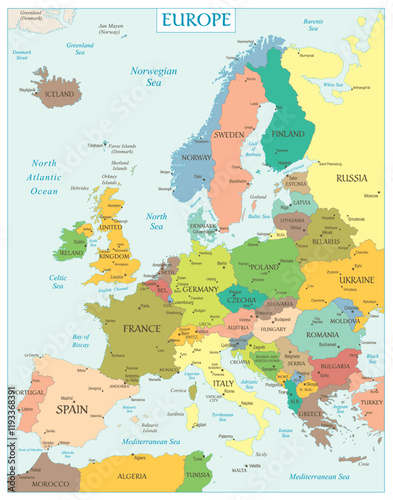
Political and administrative vector map of northern europe with state borders
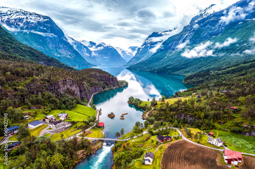
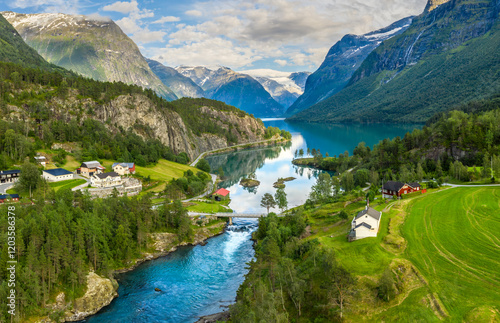
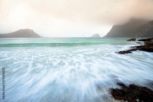
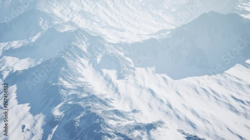
Beautiful Nature Norway aerial photography.
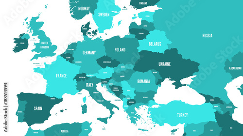
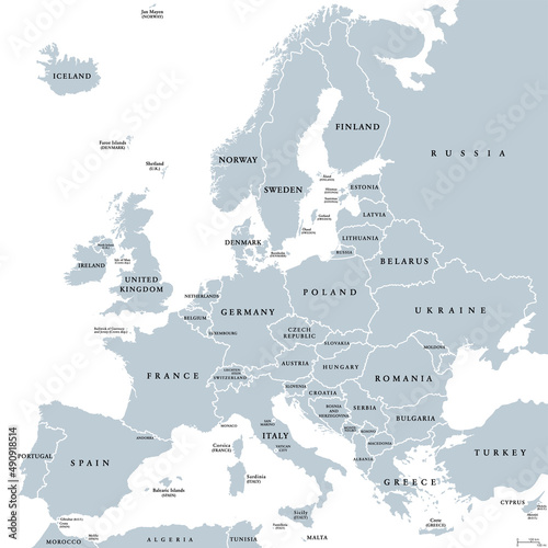
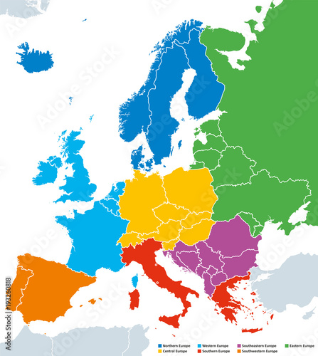
Regions of Europe, political map, with single countries and English labeling. Northern, Western, Southeastern, Eastern, Central, Southern, Southwestern Europe in different colors. Illustration. Vector
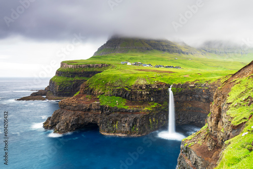
The iconic waterfall of Mulafossur, Gasadalur, Vagar, Faroe islands, Denmark, Northern Europe
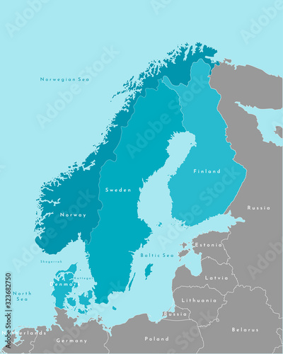
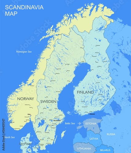
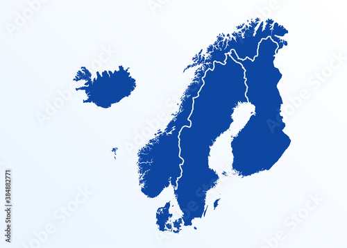
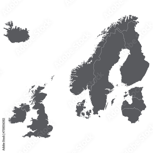
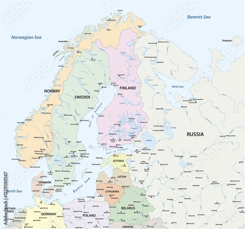
scandinavia map. Norway, Sweden, Finland, Denmark, Iceland and Faroe Islands. Nordic countries map. Vector background for infographics
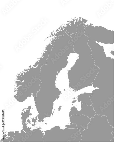
Vector isolated illustration. Simplified political map of scandinavian and northern europe countries in blue colors (Sweden, Finland, Norway, Denmark) and nearest areas in grey. Borders of the states.
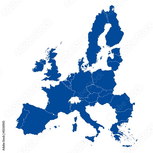
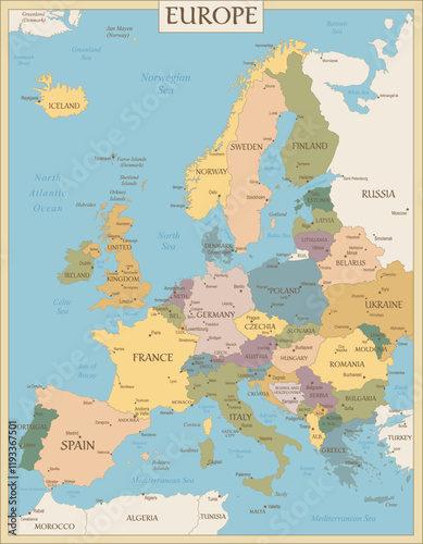
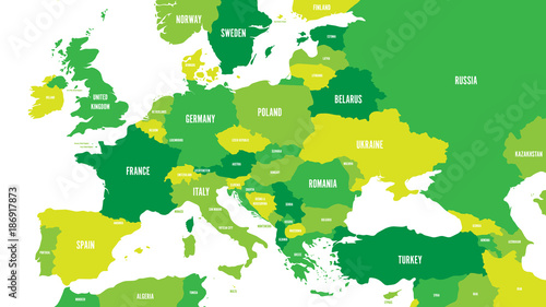
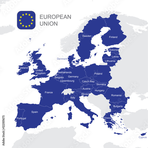
Map of European Union
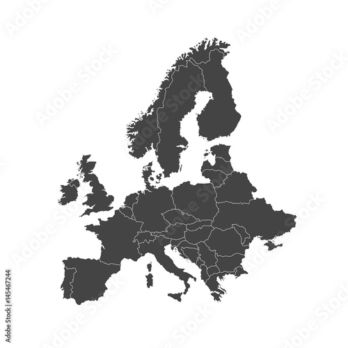
Europe Map Illustration
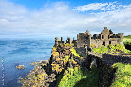
Ruins of the medieval Dunluce Castle on green cliffs overlooking the North Atlantic ocean. Causeway Coast, Northern Ireland.
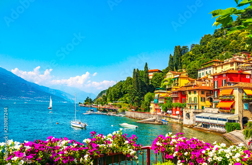
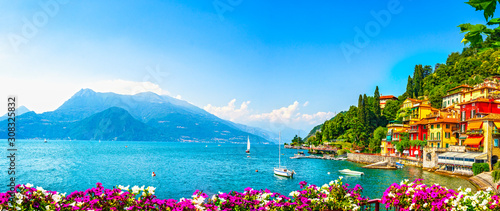
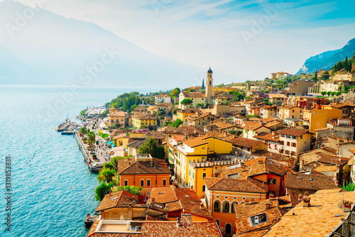
Varenna town, Como Lake district landscape. Italy, Europe.
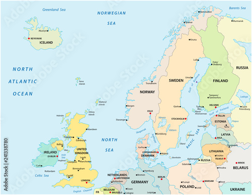
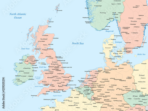
Political map showing the United Kingdom, Ireland, and parts of northern and central Europe, including country borders, major cities, and surrounding bodies of water like the North Sea and Irish Sea.
Political map of Europe and Caucasian region in shades of green on white background. Simple flat vector illustration.
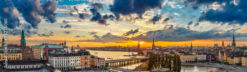
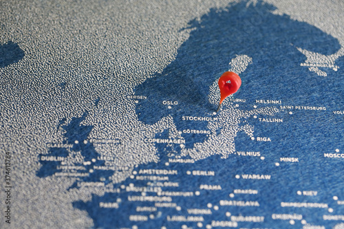
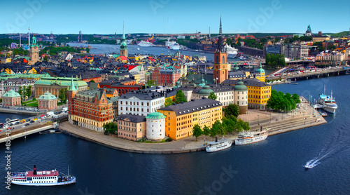
Scenic summer night panorama of Stockholm, Sweden
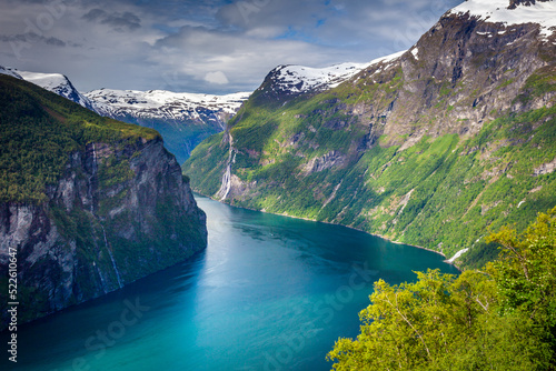
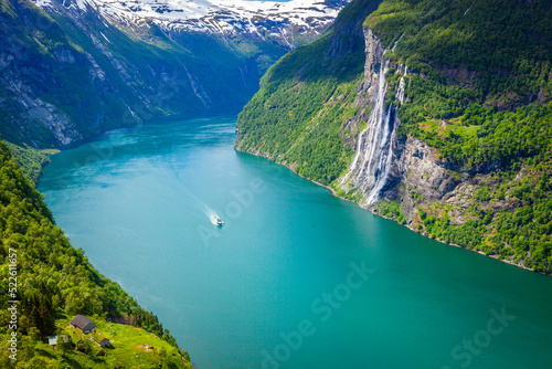
Gierangerfjord and Seven Sisters Waterfalls, Norway, Northern Europe
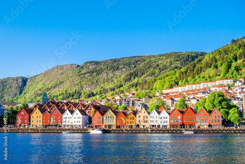
Bergen, Norway
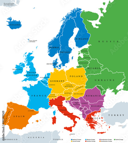
Regions of Europe, political map, with single countries and labeling.
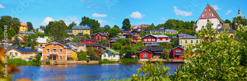
panorma of historical town of Porvoo in Finland
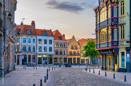
Vieux Lille old town quarter with empty narrow cobblestone street, paving stone square with old colorful buildings in historical city centre, French Flanders, Hauts-de-France Region, Northern France
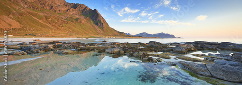
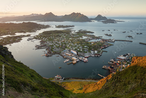
Norway/Nordland, Lofoten Islands
Detailed Scandinavia map Vector political Scandinavia countries map
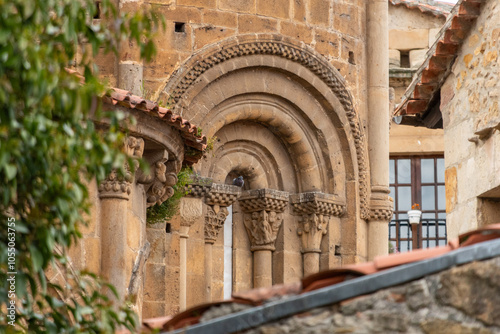
Architectural details of the romanesque Collegiate Church of Santillana or Colegiata de Santa Juliana in the medieval little town Santillana del Mar, Cantabria region in Northern Spain
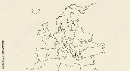
Outline of a detailed map of Europe showing countries and geographical features in a minimalist style Generative AI
Historical part of Bergamo city, view from Bergamo Alta with narrow streets, tourists destination
Beautiful Nature Norway aerial photography.
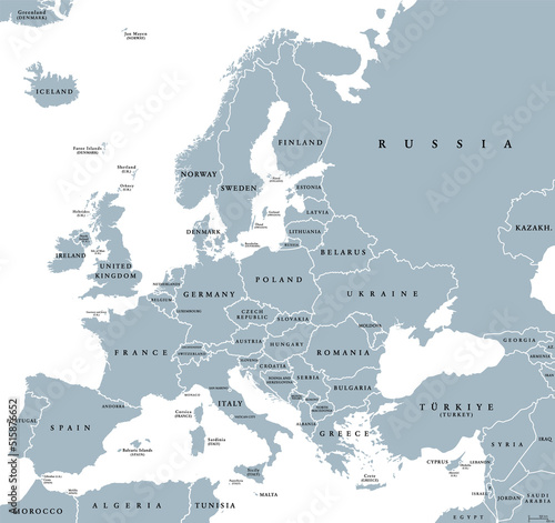
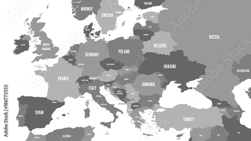
Europe, gray political map. Continent and part of Eurasia, located in the Northern Hemisphere, with about 50 sovereign states. Map with borders and English country names. Gray illustration over white.
scandinavia map. Norway, Sweden, Finland, Denmark, Iceland and Faroe Islands. Nordic countries map. Vector background for infographics
Vector isolated illustration of simplified political map of some scandinavian countries (Sweden, Finland, Norway, Denmark) and nearest areas. Borders of the states. Grey silhouettes. White outline
the pin and handmade map in northern europe
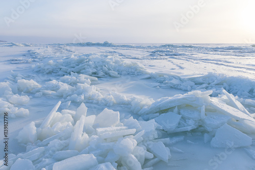
Coastal winter landscape photography with frozen Baltic Sea
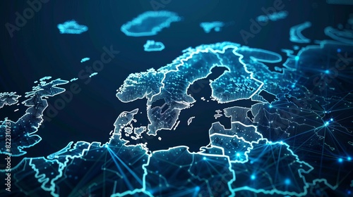
abstract digital map of scandinavia northern europe global network concept illustration
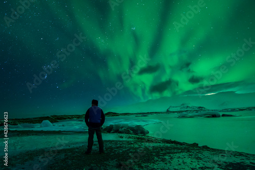
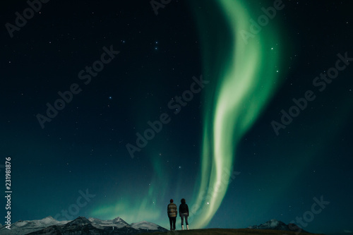
a man from the back watching the northern lights. Aurora borealis.
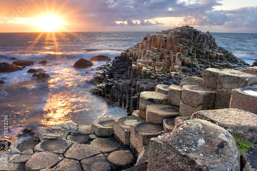
Sunset at Giant s causeway
Amazing waterfall in winter under northern lights
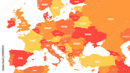
Political map of Europe and Caucasian region in shades of orange on white background. Simple flat vector illustration.
Couple watching northern lights in Iceland
Above Geiranger fjord, ship and village, Norway, Northern Europe
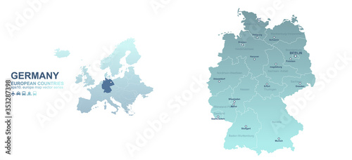
germany map. european country vector map series.
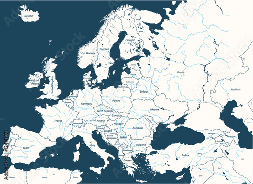
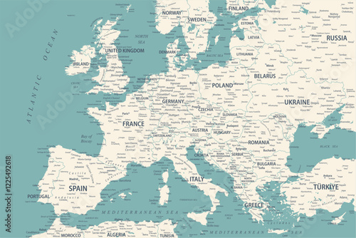
Europe high detailed vector political map with rivers. All elements separated in detachable and labeled layers
Village of Ballstad, Lofoten Islands, Norway
abstract digital map of scandinavia northern europe global network connectivity concept illustration
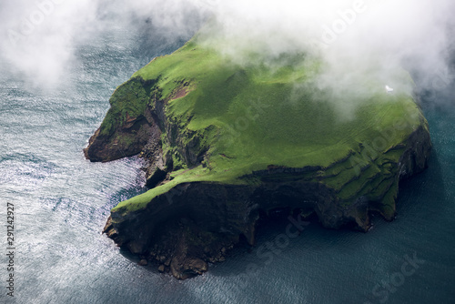
Aerial view of beautiful small island in Iceland
Europe Map Retro Vintage Ancient - stock vector colored illustration with layers
European Union map
Haukland Strand, Lofoten
A glass igloo hotel in Finland under the northern lights, where travelers watch the aurora borealis from the comfort of their beds surrounded by snowy landscapes.
Remote settlement on an island in the Western Fjords; Tromso, Troms, Norway
view of the Henningsvear, Lofoten
Panoramic landscape along coast, Vatnsnes Peninsula, Westfjords, Iceland.
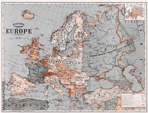
Bacon's standard map of Europe vintage vector, remix from original artwork.
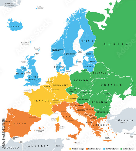
Europe subregions, political map. Geoscheme, that subdivides the European continent into Eastern, Northern, Southern, and Western Europe, for statistical purposes, and represented in different colors.
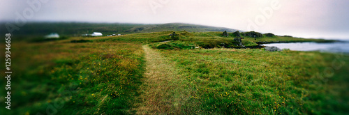
Beautiful view on nordic Scandinavian landscape
arctic mountains in northern Norway at winter
abstract digital scandinavia map northern europe global network connectivity concept futuristic data transfer illustration
Tromso Cathedral illuminated at night, Tromso, Norway
Reine bay, Lofoten Island, Norway
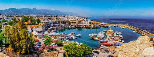
Kyrenia marina in Cyprus
abstract digital map of scandinavia northern europe global network concept illustration
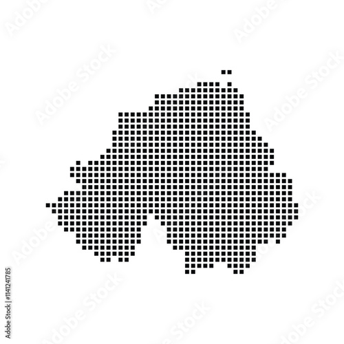
northern ireland map icon
nordic christmas town
Political map of Europe and Caucasian region in shades of green on white background. Simple flat vector illustration.
Simple line drawing of the UK and Ireland.
Ferry ship crossing Geirangerfjord and Seven Sisters Waterfalls, Norway
Gulpiyuri beach in Asturias, northern Spain.
Christmas Generative Ai
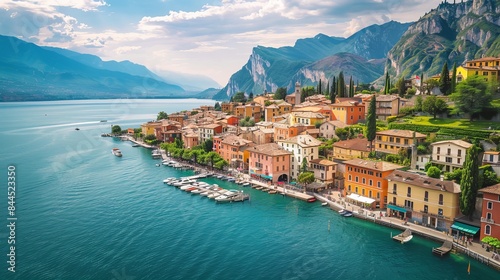
Riva del Garda is a picturesque town in the Italian province of Trentino. It's located on the northern shores of Lake Garda, one of the largest lakes in Italy.
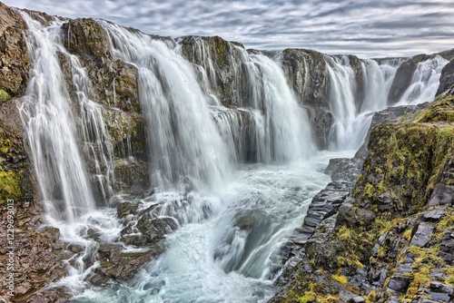
Waterfall at Seljalandsfoss, Sudurland, South Iceland, Iceland, Europe
Europe Map Colored - stock vector illustration
The European Union map
Varenna town, Como Lake district landscape. Italy, Europe.
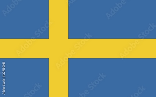
Flag of Sweden, Vector illustration
A Classic Traditional Sweet from Northern Europe
Europe with a part of the Middle East, gray political map. Western part of the continent Eurasia, located in the Northern Hemisphere. Countries with international borders and English labeling. Vector
abstract digital map of scandinavia concept of northern europe global network and connectivity data transfer and cyber technology information exchange and telecommunication.illustration,stock photo
scandinavian woman making snow angels. image from above. Soft smile. Happy. yellow winter coat
abstract digital scandinavia map northern europe global network connectivity concept futuristic data transfer illustration
Kolufossar waterfall, Laugarbakki, Hvammstanga, Iceland, Europe
Northern Europe country Map. Map of Northern Europe in grey color.
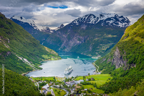
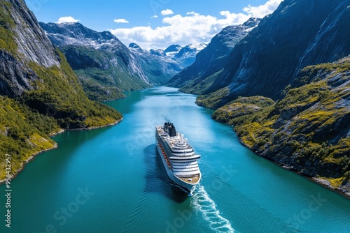
A large cruise ship glides through the breathtaking, narrow fjord, surrounded by towering mountains, sparkling blue waters, and clear skies, evoking a sense of adventure.
Earth Northern Europe Aerial View.
Political map of Europe and Caucasian region in shades of gray on white background. Simple flat vector illustration.
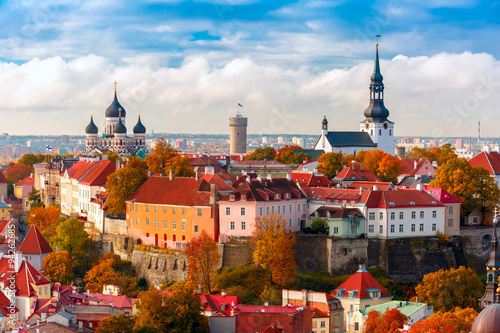
Aerial view old town, Tallinn, Estonia
Colorful northern lights over lake and snowy mountains. Fantasy panoramic winter landscape background with Aurora Borealis with starry in the night sky
Royalty Free
Sami Man in Traditional Clothing in a Winter Forest
Colored terrain map of the northern hemisphere in an Azimuthal Equidistant projection (north pole view)
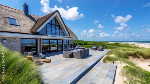
luxury beach cottage background in northern europe style isolated on nature
Vector map of Northern Europe with the most important cities and bodies of water
Europe Map Retro Vintage Ancient - stock vector blue green faded colored illustration with layers
europe counties vintage icon map. Vintage europe counties map with regions isolated on white background.
Panorama of Stockholm, Sweden
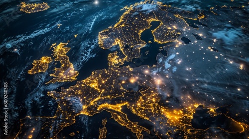
Satellite view of Europe at night showing city lights highlighting the denseness of population and the spread of urban areas across the continent.
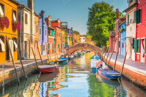
Colorful Burano island in the Venetian Lagoon, northern Italy
Regions of Europe, political map, with single countries. Northern, Western, Southeastern, Eastern, Central, Southern and Southwestern Europe in different colors. English labeling. Illustration. Vector
Woman traveling outdoor in Norway autumn season adventure trip active lifestyle sunset mountains and fjord landscape Kvaloya island
abstract digital scandinavia map northern europe global network connectivity concept futuristic data transfer illustration
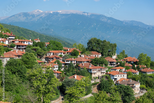
Springtime landscape showing the stone houses of traditional architecture in the village of Palaios Panteleiomonas in northern Greece
Limone sul Garda
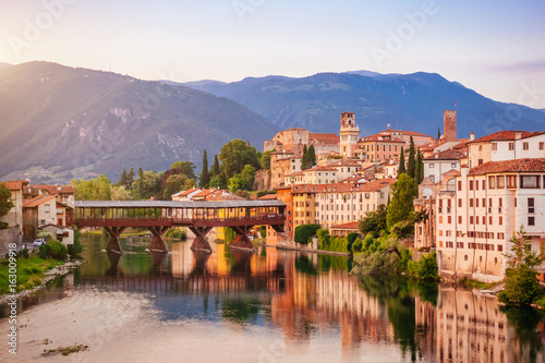
Bassano del Grappa Ponte Vecchio in Veneto Region Northern Italy
Spectacular panorama of Gjovik, Norway: A harmonious mélange of cultural heritage and modernity
Old Tallinn evening panoram