• Login
  • Sign Up
Member Area
  • Login
  • Sign Up
 English
    • Afrikaans formal
    • Afrikaans informal
    • Arabic
    • Azerbaijan
    • Brazilian
    • Bulgarian
    • Catalan
    • Chinese simplified
    • Chinese traditional
    • Croatian
    • Czech
    • Danish
    • Dutch
    • English
    • Estonian
    • Finnish
    • French
    • Georgian
    • German
    • Greek
    • Hebrew
    • Hungarian
    • Icelandic
    • Indonesian
    • Italian
    • Japanese
    • Latvian
    • Lithuanian
    • Malaysian
    • Norwegian
    • Persian
    • Polish
    • Portuguese
    • Romanian
    • Russian
    • Serbian
    • Slovakian
    • Slovenian
    • Spanish
    • Swedish
    • Thai
    • Turkish
    • Ukrainian
    • Vietnamese
VideotonStock

Cart (0)

Your Shopping Cart is empty.
  • Files

    Stock

    • Photo
    • Video

    Special offer

    • Collections
    • Packages
    • Lightboxes

    Licenses

    • Royalty free
    • Rights managed
    • Creative
    • Editorial

    Items

    • Most downloaded
    • Featured
    • Most popular
    • New
    • Free
  • Categories

    Browse categories

  • Site info

    Site info

    • About
    • Support
    • Privacy Policy
    • Privacy Policy
    • FAQ
    • Contact Us
    • Contact Us
    • Terms and Conditions
    • Buyer Agreement
    • Seller Agreement

    Customers

    • Users
    • Credits

    Photographers

    • Boby Richards   0
    • Boby Richards   0
    • Videoton1   286

Cart (0)

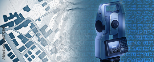
Imaginary cadastral map of territory with buildings and roads drawn with a CAD (Computer-Aided-Design) computer software in dwg format file and 3D rendering of a geodesic device, called Total Station

    {PATH}


Download sample
File Details
Published: 2021-10-04 12:25:25.860325 Category: Industry Type: Photo Model release: No
Share
Contributor: Francesco Scatena
ID : 460797509

TitleFilesize
Photo7872x3168


Buy on VideotonStock

Keywords
computer graphic, cad, file, relief, surveying, survey, measuring, measure, cadastre, map, city map, plan, planning, land, land register, surveyor, measurement, device, geodesy, instrument, geodesic, topographic, topography, instrument, concept, global positioning system, global, equipment, work tool, cartographic, cartographer, cartography


Related items

#460797509

#460797509

#263376158

#263376158

#1236694764

#1236694764

#825369689

#825369689

#728846609

#728846609

#1045935587

#1045935587

#514251682

#514251682

#368140517

#368140517

#1154561017

#1154561017

#696700276

#696700276

#272912138

#272912138

#1243803003

#1243803003

#805468543

#805468543

#188347322

#188347322

#1148335630

#1148335630

#1375537221

#1375537221

#1227515833

#1227515833

#1486292499

#1486292499

#51772219

#51772219

#1211066721

#1211066721

#372014002

#372014002

#257457568

#257457568

#1366964951

#1366964951

#361133525

#361133525

#340339556

#340339556

#577314177

#577314177

#257847773

#257847773

#1145322047

#1145322047

#265738079

#265738079

#1225489821

#1225489821

#258843925

#258843925

#1152850473

#1152850473

  • Home
  • About
  • Support
  • Privacy Policy
  • News

Copyright © 2022 Videoton Media Stock

100%